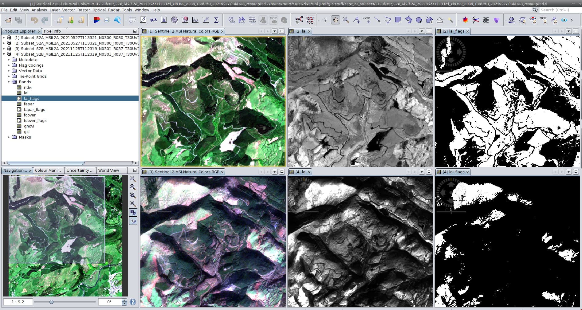
I am trying to determine LAI values for a specific area of Wales and have run into an interesting problem. the attached screenshot shows two of my reprocessed and subset images, taken in May and November '21 respectively.
to the naked eye, the May image would seem to be the better quality (understandable as the sun will be higher in the sky) but the LAI values (calculated with the biophysical 10m processor) for the areas which I know to be forest know are all flagged as ‘1’ - LAI input out of range, as can be seen ion the right hand image
This occurs in many of the ‘good’ images I have of my AOI.
Is there a reason why a ‘lower’ quality image produces a ‘better’ set of LAi values?
@FlorianD can you help here?