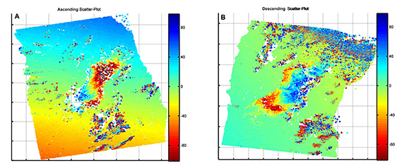
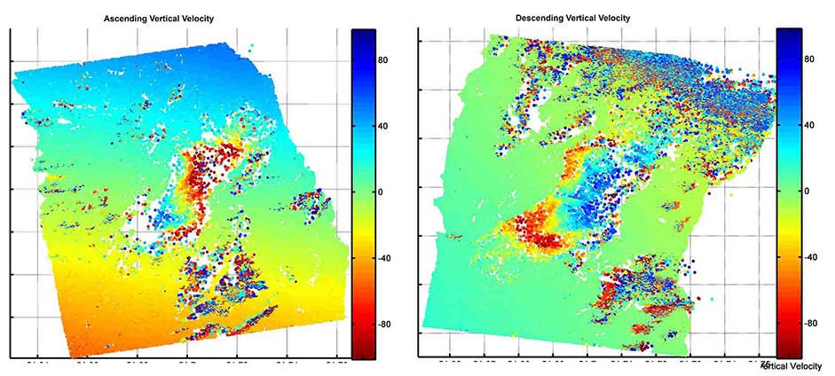
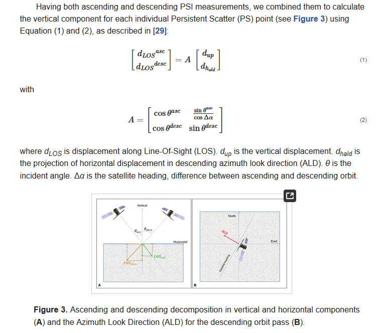
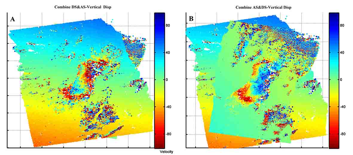
I think it would be helpful for us to undestand how you generated these maps. Different velocity patterns for ascending/descending results are possible if the displacement was measured along the line of sight. So how did you convert the displacement to absolute vertical velocities?
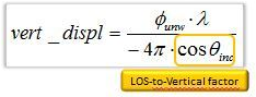
now I understand, thank you. Which equation did you use to calculate the vertical velocity
There are many error sources which could be responsible, atmospheric disturbances in one of the images, unwrapping errors, changed environmental conditions.
Are the image pairs from the same time?
I the results bin ascending and descending orbits during the same period show different up/down in LOS means that the main phenomenon is not subsiding or uplifting but lateral displacement.