The values of soil moisture look normal (nothing extreme).
It is very hard to tell what has gone wrong in your final image
I would suggest:
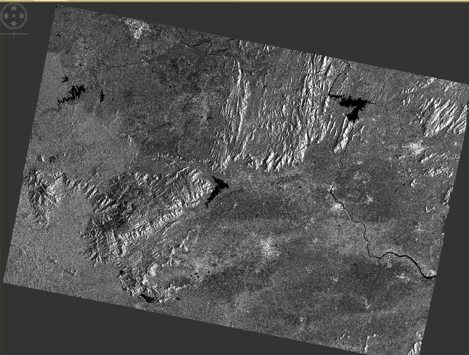
Make sure the SAR image you downloaded is of a good quality around your AOI
Make sure you have pre-processed the SAR image appropriately and the final pre-processed image looks good with no artifacts
Make sure you used an appropriate equation to derive soil moisture (they usually use a model ‘inversion’). It’s just a linear model between backscatter intensity data and soil moisture (m^3) data
sir, I had downloaded IW , GRD data For the preprocessing work i had done
1. Radiometric Calibration
2. Speckle Filtering
3. Terrain Correction
4. Convert linear to/from db
(Sir, Is the preprocessing is correct or not?)
After that i applied the WCM algorithm.
the pre-processing steps you performed for Sentinel-1 data looks fine.
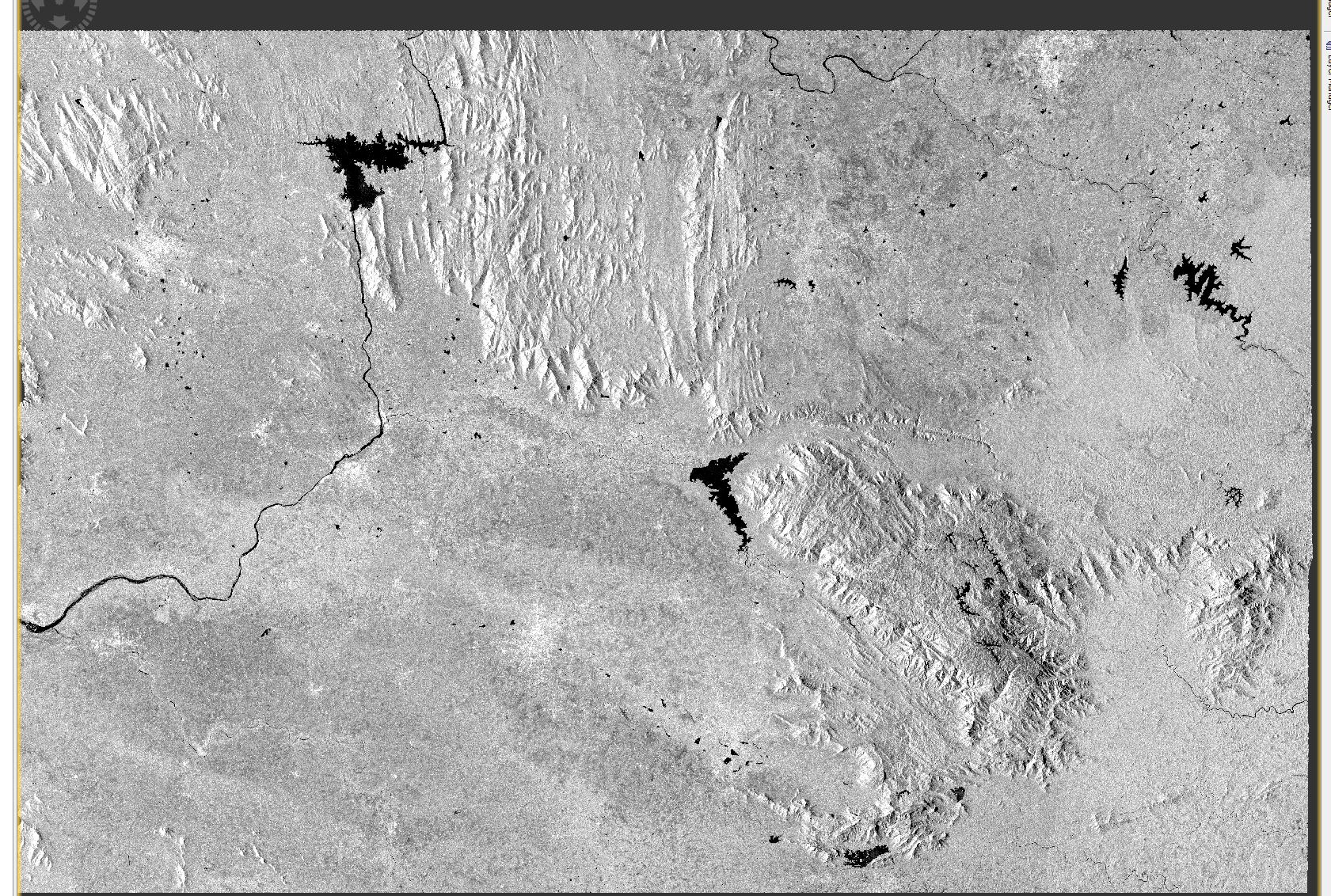
Compare the resulted pre-processed SAR image with the image that shows soil moisture
Did you get this contrast (shown in soil moisture data you posted) in your processed image?
If not, then something went wrong when applying WCM
Every time you get some results after applying each equation, display the SAR image and look for inconsistencies.
Sir, While observing both the pre-processed and soil moisture data i had observed the inversion of colour contrast(black part in the pre-processed data is inverted as white part in the soil moisture data).
Sir, I had made the total algorithm in a single band math expression
(((Sigma0_VV_db - (3.55 * lai * cos(incident_angle)) * (1- exp(-2 * 0.0011 * lai / cos(incident_angle)))) / (exp(-2 * 0.0011 * lai / cos(incident_angle))))- (-15.25)) / 0.146
As long as you observed this black line in your pre-processed data, apply each processing step individually. In that way, you will identify in the end which step in your pre-processing analysis causes the issue
I would not recommend you applying all three equations for WCM into a single. In that case, if something goes wrong, you cannot identify the error. Apply each equation onto your data seeprately and investigate the results. This is a good way to detect errors
Hi,
I had processed the WCM properly ,But the resultant output(Surface Soil Moisture) displayed like a mirror image of the scene as before pre-processing.
The pre-processed image looks good. Did you terrain correct the image to WGS-84 or in a different coordinate system? It looks like you did
So, applying the WCM in the georeferenced SAR image shown on the top, we do not expect any sort of coordinate transformation. I do not know whether you have done any other processing on the SAR data.
It does not make sense for the SAR image to be re-projected when applying the WCM.
Are you sure you did not apply further processing?
Sir, i found out where i made wrong, I added the downloaded source band for the collocation thats why the resultant output image got mirrored. After that i corrected it and collocate only the LAI and the pre-processed(Terrain corrected) image band.
Thank you sir…
Hi sir,
I’m beginner in Surface Soil Moisture related research and Rstudio. And I have no idea of Water Cloud Model(WCM). I had download all package and loaded in Rstudio. Can you tell me how I should use my own data in that model?
There have been discussions of the WCM in this forum. Have you searched for “Water Cloud Model” here? Please read the discussions and ask more specific questions if there are things you don’t understand.
I have finished the preprocessing steps for SAR in SNAP. At the same time, I got VWC(Vegetation water content) data. How should I apply them to WCM model?
There are four functions in WCM 0.2.2, they are lai_inversion_lut lut_wcm sm_inversion_lut wcm_sim. When I open in Rstudio, where should I input my experimental data?
Hi,
Through my study, I have a general understanding of the model, but I still have some questions. The questions are as follows:
Is the “lai_inversion_lut” function to calculate the LAI from the satellite imagery? If I get the LAI by calculation in SNAP, can I bring it directly into the wcm_sim function?
I want to get the backscattering coefficient of soil through WCM model, so which of the four functions can I get this image through?