I have noticed a number of images over the same area have some artifacts or interference outside of the bounds of the data - and their presence is causing errors in my automated routine.
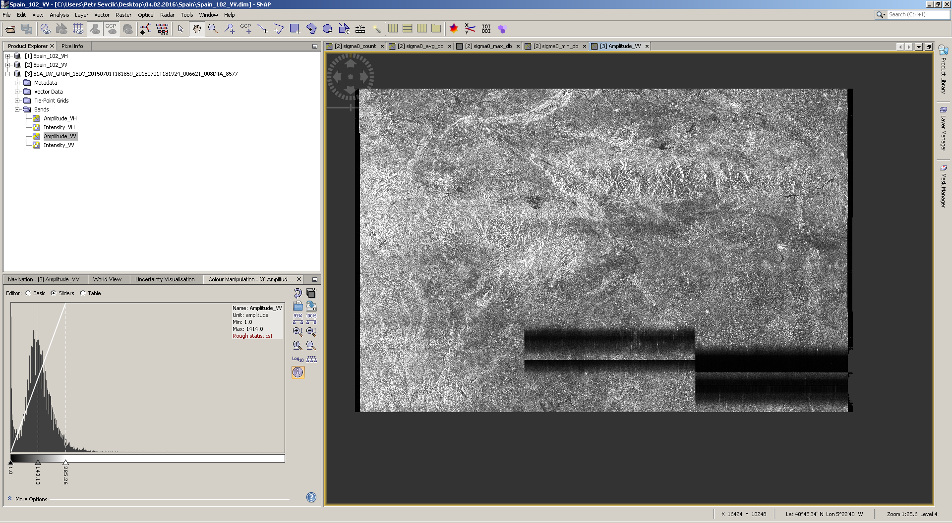
In SNAP it looks like this (after calibration and terrain correction):
I did see that but it seems slightly different in this case - the interference (or whatever it is) being outside the data detected for the area by the sensor.
The practical problem being it becomes part of the larger image once terrain corrected…
3 images I’ve seen so far. I’ve just repeated the process using a different DEM and it is still there…
After checking out the DEM as well it is obvious the pixel size of the noise is a lot smaller than the grid of the DEMs I am using - so that rules that out at least.
The best solution should be the filter as suggested.
Otherwise then remove the problematic data afterwards as if you are scripting the procedure it is troublesome to prove every input on false values…the best way is to conduct some overview…like output average values of your data and identify the anomalies based on this information.
One more thing…if this is the output then the file is probably considerably larger than other outputs, so you could try to solve it just by setting up a file size threshold .
@Suprd is that image one of the first to be collected then? All the ones I am looking at are from less than a month ago.
I ran the processing in SNAP (calibrate + TC), saving as a geotiff every time and the artifacts where still there…however exactly the same steps but sticking to BEAM-DIMAP and they are gone!
Suggests something to do with the geotiff export but I can’t figure out why it’s only on images in this particular area - if it was purely a geotiff problem I would expect all the dozens of other images I have made this way would be affected, but they are fine.
I’m just running the processing again using snappy in case there is some difference between snap and snappy.
Thanks @css - you are right that they are not radar related - through process of elimination the artifacts first appear after an export to geotiff-bigtiff, no matter what other processing steps I have in the chain (the first screenshot was of a geotiff created as part of a automated routine).
This is true both when using snap or snappy.
I can’t work out why though - or why it looks like it does, maybe some sort of EOF error and some metadata is being read as pixels and therefore appending on the bottom? Just a wild guess!
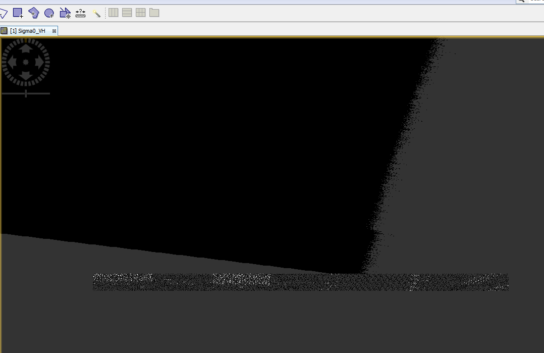
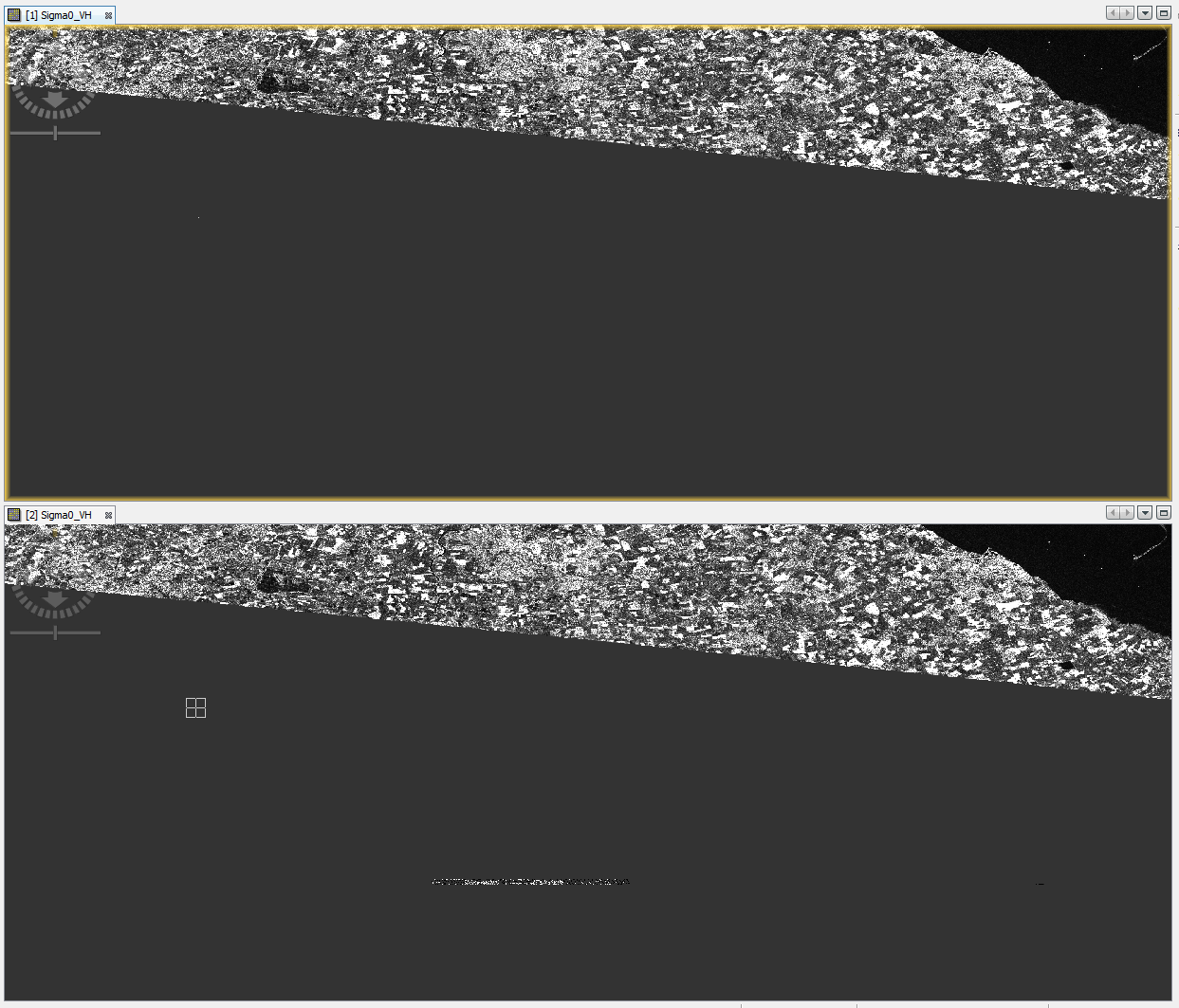
Below is screenshot of a BEAM-DIMAP image above, and that image exported as geotiff below - the artifacts have appeared.
Not sure where to go other than avoid geotiff - not ideal as I read/manipulate the geotiff with rasterio
I think rasterio can read multiple data formats. So you could try NetCdf or Envi format. Maybe the Envi files in the data directory of the BEAM-DIMAP product.
The artifacts are strange. Beside the artifacts, the image looks also more noise.
Seems the cause has been discovered, could be just bug at exporting to GeoTiff or something else, and yes GeoTiff is probably only good for exporting /converting the final product from ENVI (BEAM-DIMAP).
But if you can work with ENVI in rasterio everything should be fine now.