Optical sensors provide data in an array where the rows are “scan lines”. Standard processing workflows do geolocation and calibration, then atmospheric correction and generation of “level-2” geophysical products. If you are monitoring a point location you can extract level-2 values for that location (or a small neighbourhood of the location) using SNAP’s Pixel Extraction. There are tools to automate this if you have many images to process (e.g., monitoring over time).
Yes, the data is unprojected. The image geometry is more or less as it has been measured by the sensor.
If you are working on a pixel basis there is now need to reproject the data. This is more important if you are looking at regions.
When you select nearest-neighbour resampling for the reprojection the values are not changed.
Thank you Marco (@marpet) and George (@gnwiii) , now it is much more clear to me.
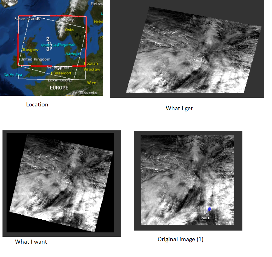
A follow up question is how to properly reproject to UTM. I may start a new thread if it seems more appropriate. To begin with, I found a lot of questions about OLCI reprojection and problems with per-pixel geocoding mode, but I did not find my case there.
The case is that the image gets truncated after reprojection to UTM 31N zone.
I presume the image gets truncated.
I was able to reproject, copying crs from the product I had (“What I want”, which is UTM 31N as well), but the desired product will not be with me all the time. Setting the desired file resolution, width and height did not help.
Is it a known issue of truncating?
Shall I parametrize the Reprojection operator differently? (Graph processing command does not change with crs specified as EPSG 32631 or copied from the product).