Could I do atmospheric correction before S1 TOPS Coregistration? How can I see the quality of the DEM whether it’s trustful or not? Could you give me more details? Thank you very much.
SNAP doesn’t support atmospheric correction.
Noise cannot be removed, only coarsely approximated subtracted from the phase. This is only possible with large stacks of images, for example by estimating the atmospheric phase screen (APS, short explanation here). This technique is not really suitable for common interferometry, but rather for persistent scatterer techniquest to derive surface deformations.
Values of high coherence tell you where your data is suitable. Please have a look at this post: Some explanations about concepts of fringes of interferogram and coherence - #2 by ABraun
Besides that, ESA provides nice explanations on interferometry: ESA - InSAR Principles: Guidelines for SAR Interferometry Processing and Interpretation<br>(ESA TM-19)
Here you will find three documents:
Part A is for readers with a good knowledge of optical and microwave remote sensing, to acquaint them with interferometric SAR image processing and interpretation.
Part B provides a practical approach and the technical background for beginners with InSAR processing.
Part C contains a more mathematical approach, for a deeper understanding of the interferometric process. It includes themes such as super resolution and ERS/Envisat interferometry.
S1A_IW_SLC__1SDV_20171217T100443_20171217T100510_019741_02190D_231D.zip
S1A_IW_SLC__1SDV_20171229T100443_20171229T100510_019916_021E78_13C8.zip
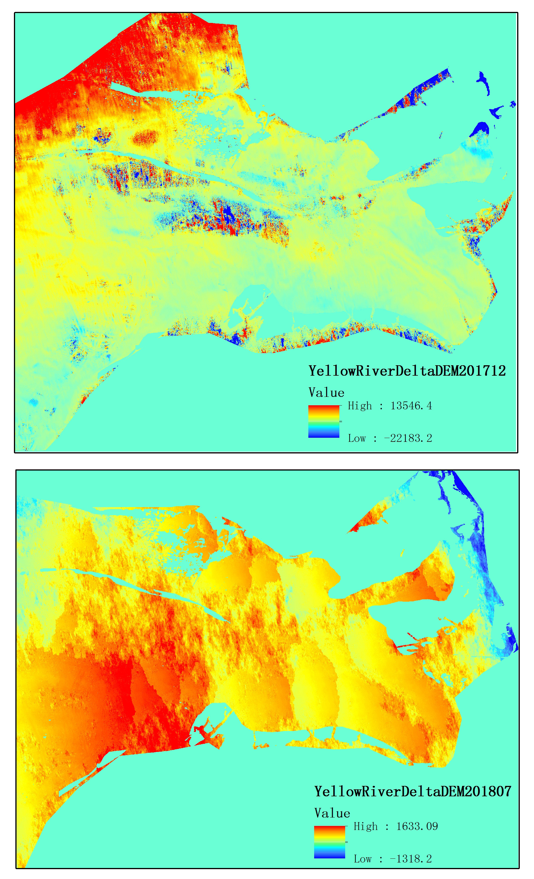
these two made the DEM201712
S1A_IW_SLC__1SDV_20180709T100447_20180709T100514_022716_02762B_5BB2.zip
S1A_IW_SLC__1SDV_20180721T100448_20180721T100515_022891_027B8F_7120.zip
these two made the DEM201807
They both use the same reference DEM
Why the result value ranges gap so large?
What’s the DEM elevation unit? meter?
The unit is meter, yes. It is adjusted to the DEM used in the phase to elevation step.
There are many reasons why InSAR results are mostly not usable. The most important are temporal decorrelation, atmospheric effects and unwrapping errors. Here is a nice compilation of what can go wrong: https://eo-college.org/resources/insar_errors/
an example how atmospheric effects are reduced in time-series data of Sentinel-1 is given here:
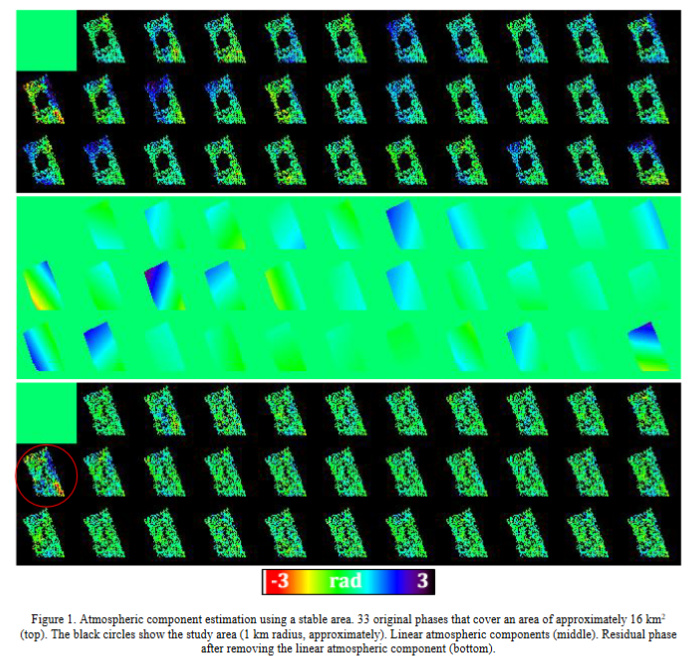
source and full text: https://www.int-arch-photogramm-remote-sens-spatial-inf-sci.net/XLII-2-W7/597/2017/isprs-archives-XLII-2-W7-597-2017.pdf