Hi all,
I was using the Graph Builder and noticed several curiosities regarding the subset operator.
-
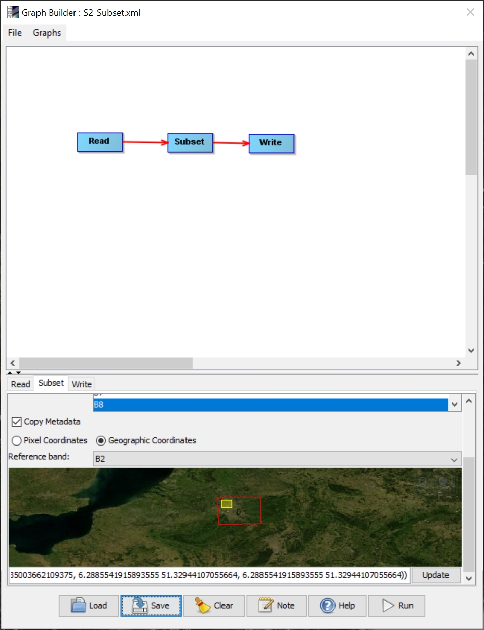
When drawing a bounding box within the map preview to define an area of interest for the subset, the WKT polygon inside the input field only updates if Imove one of the nodes inside the graph section.
-
The WKT polygon contains the last lon/lat coordinate pair twice. See image below.
If I save the graph as XML, it contains the same WKT polygon with duplicated last coordinate pair:
 <node id="Subset">
    <operator>Subset</operator>
    <sources>
      <sourceProduct refid="Read"/>
    </sources>
    <parameters class="com.bc.ceres.binding.dom.XppDomElement">
      <sourceBands>B2,B3,B8</sourceBands>
      <region>0,0,0,0</region>
      <referenceBand>B2</referenceBand>
      <geoRegion>POLYGON ((6.2885541915893555 51.32944107055664, 6.6484246253967285 51.32944107055664, 6.6484246253967285 51.035003662109375, 6.2885541915893555 51.035003662109375, 6.2885541915893555 51.32944107055664, 6.2885541915893555 51.32944107055664))</geoRegion>
      <subSamplingX>1</subSamplingX>
      <subSamplingY>1</subSamplingY>
      <fullSwath>false</fullSwath>
      <tiePointGridNames/>
      <copyMetadata>true</copyMetadata>
    </parameters>
  </node>
-
If I edit the XML file and delete one of the duplicated coordinate pairs and then load the file within the Graph Builder, the WKT polygon contains the duplicated coordinate pairs, again.
-
The referenceBand parameter won’t be considered when loading the XML file within the Graph Builder. In the above example, I selected band “B2” but the UI lists band “B1”.
Since I didn’t find any similiar issue within this forum, I wondered, if these are known issues to you.