Is it possible to use google earth and add it as wms? If yes which is the url for WMS to use ?
I don’t think so. SNAP is not a GIS software.
However, you can export your products to be readable by QGIS where you can use map background via the OpenLayers plugin.
1 Like
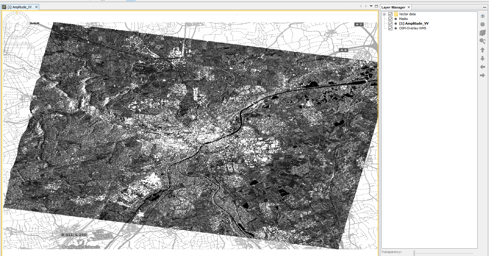
@qglaude You underestimate SNAP 
If you have opened and displayed a geocoded (WGS84) raster you can select “add layer” in the mapping tools:
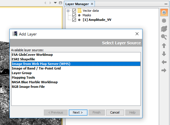
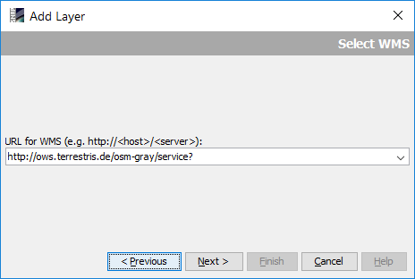
Add a service URL of a WMS, for example the OWS terrestris OpenStreetMap
http://ows.terrestris.de/osm-gray/service?
Select a layer in the following dialogue:
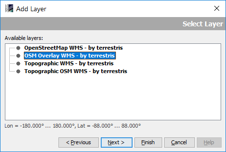
Click “Next” and “Finish” - there you have it:
3 Likes
Yes, we can display map from Web Mapping Services.
But displaying Google Earth as WMS within SNAP is not possible.
But what you can do is to export a displayed image as KMZ file and show it on the Google Earth globe.
1 Like
I learn new things everyday  Thanks !