@qglaude You underestimate SNAP 
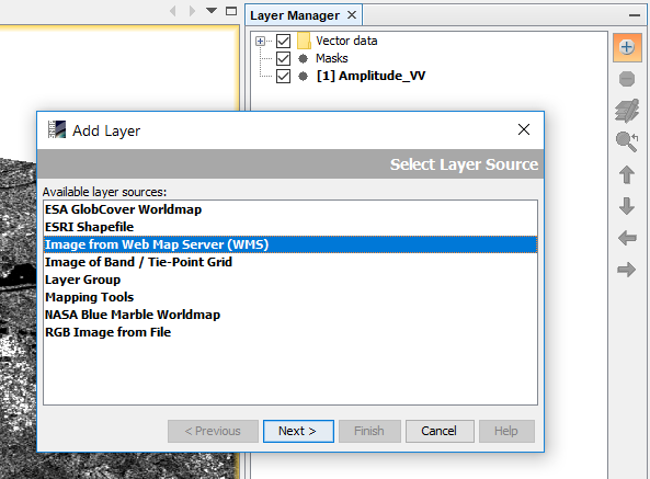
If you have opened and displayed a geocoded (WGS84) raster you can select “add layer” in the mapping tools:
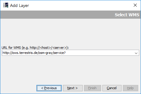
Add a service URL of a WMS, for example the OWS terrestris OpenStreetMap
http://ows.terrestris.de/osm-gray/service?
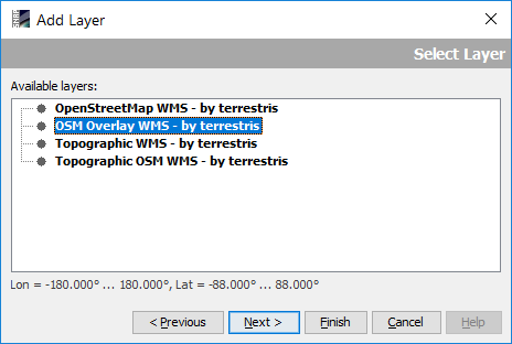
Select a layer in the following dialogue:
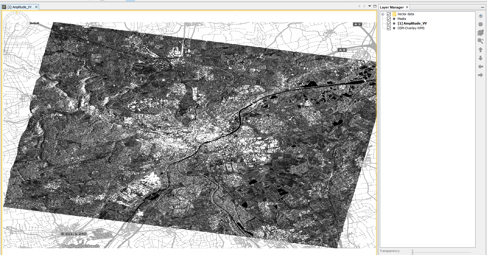
Click “Next” and “Finish” - there you have it: