Yes! I set the parameters suggested for the landslides based on Hoser, 2018 reported at the page you linked (https://gitlab.com/Rexthor/gis-blog/-/blob/master/StaMPS/2-4_StaMPS-steps.md - page bottom) 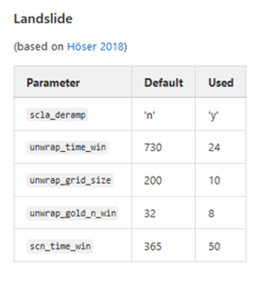
In particular, I used the command in matlab >>setparm(‘parm_name’, newvalue) for each parameter except “scla_deramp” before step 1. then I run steps 1 to 5 together (>>stamps(1,5)) and steps 6 to 8 together setting the “scal_deramp” to ‘y’ using >>stamps(6,8,‘y’).
I would like also to aplly the parameters suggested by Lazecky, 2011 to see the differences.
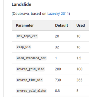
It will be also interesesting to modfiy each parameter individually to see how they influence the final product.
Here the “before” and “after”:
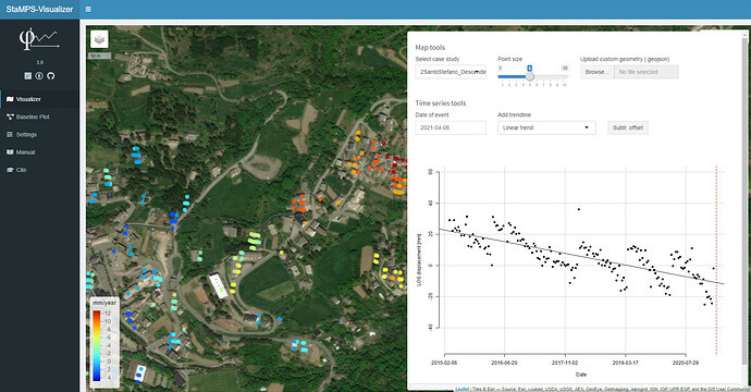
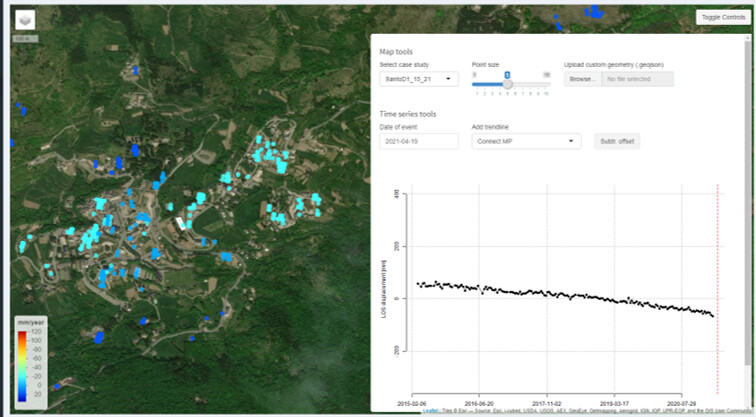
As you can see the jumps are gone and the velocity in mm/y is one order of magnitude greater!