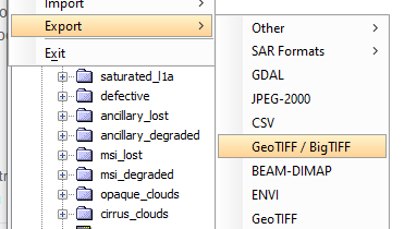
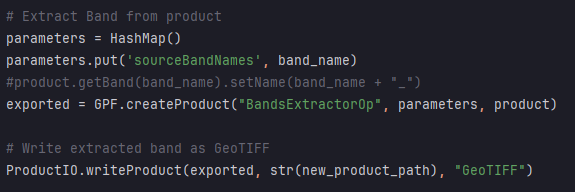
When I export a band from a DIM file as a GeoTiff it exports as ~500mb. If I export it as GeoTIFF/BigTIFF it comes out as ~ 50mb. The size difference is due to the NaN values which 90% of the satellite scene.

How do I get the same export as the GeoTIFF/BigTIFF when I’m using snappy?

Use as format name GeoTIFF-BigTIFF instead of GeoTIFF
In the snap examples is a little snippets script located which shows how to get the available format names:
snap-examples/snap-engine-python-scripts/src/main/python/snippets.py at master · senbox-org/snap-examples (github.com)
ProductIOPlugInManager = esa_snappy.jpy.get_type('org.esa.snap.core.dataio.ProductIOPlugInManager')

reader_spi_it = ProductIOPlugInManager.getInstance().getAllReaderPlugIns()
while reader_spi_it.hasNext():
    reader_spi = reader_spi_it.next()
    print("reader_spi: " + ', '.join(reader_spi.getFormatNames()) + " (" + reader_spi.getClass().getName() + ")")
1 Like

