Hi,
I tried to mosaick some Sentinel-3 level1 tiles to one image, but get wrong result. troubleshoot traces into one tile that causes the issue.
The steps of the image been processed are: download the raw S3 L1 file tile --> unzip --> open in SNAP --> subset AOI --> “FLH/mci processor” --> mosaic (single tile) , and show the wrong result below:
1.input tile for mosaic (with a lake boundary correctly drapped on):

2.result after mosaic (notice the missing part in the middle of the lake):

it is weird because I only use ONE tile for mosaic, and I expect the result should be the same as input.
the following are some auxiliary info that may be helpful to understand the issue:
-
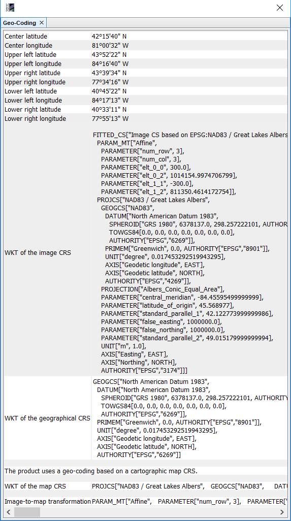
the geo-code info of the input tile:
-
the params used for mosaic:

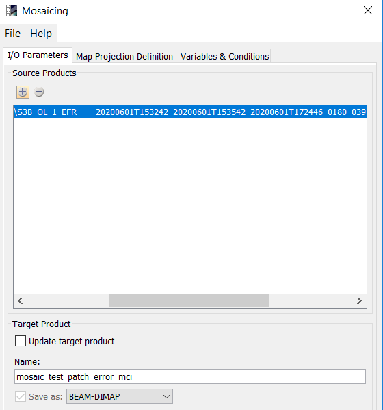

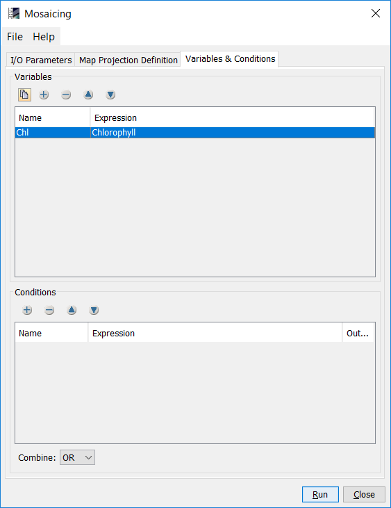
<parameters>
    <variables>
        <variable>
            <name>Chl</name>
            <expression>Chlorophyll</expression>
        </variable>
    </variables>
    <combine>OR</combine>
    <crs>PROJCS["NAD83 / Great Lakes Albers",
      GEOGCS["NAD83",
        DATUM["North American Datum 1983",
          SPHEROID["GRS 1980", 6378137.0, 298.257222101, AUTHORITY["EPSG","7019"]],
          TOWGS84[0.0, 0.0, 0.0, 0.0, 0.0, 0.0, 0.0],
          AUTHORITY["EPSG","6269"]],
        PRIMEM["Greenwich", 0.0, AUTHORITY["EPSG","8901"]],
        UNIT["degree", 0.017453292519943295],
        AXIS["Geodetic longitude", EAST],
        AXIS["Geodetic latitude", NORTH],
        AUTHORITY["EPSG","4269"]],
      PROJECTION["Albers_Conic_Equal_Area", AUTHORITY["EPSG","9822"]],
      PARAMETER["central_meridian", -84.45595499999999],
      PARAMETER["latitude_of_origin", 45.568977],
      PARAMETER["standard_parallel_1", 42.122773999999986],
      PARAMETER["false_easting", 1000000.0],
      PARAMETER["false_northing", 1000000.0],
      PARAMETER["standard_parallel_2", 49.015179999999994],
      UNIT["m", 1.0],
      AXIS["Easting", EAST],
      AXIS["Northing", NORTH],
      AUTHORITY["EPSG","3174"]]</crs>
    <orthorectify>false</orthorectify>
    <elevationModelName>SRTM 1Sec HGT</elevationModelName>
    <resampling>Nearest</resampling>
    <westBound>-84.2</westBound>
    <northBound>43.68</northBound>
    <eastBound>-77.8</eastBound>
    <southBound>40.75</southBound>
    <pixelSizeX>300.0</pixelSizeX>
    <pixelSizeY>300.0</pixelSizeY>
</parameters>
change output image projection does not change this wrong result.
- output image geo-code
I upload the tile raw file here: https://drive.google.com/file/d/1efvKIuyqZeOXqgs7Z0EvicVyfY82QhNl/view?usp=sharing
Any help or comments are appreciated!
Chui Zeng