Dear sir
Im using alos palsar dem image for mapping the elevated area along the coastal stretch but elevations are given in negative values … how to correct it to get the correct elevation details.
can you please give a visual example?
The DEMs in the ALOS RTC products are generated from ALOS, their original source depends on the location:
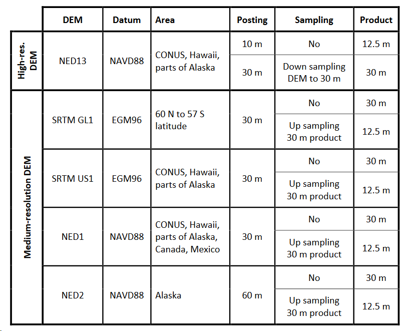
Source: https://media.asf.alaska.edu/uploads/RTC/rtc_product_guide_v1.2.pdf
Sir i downloded from ASF , I have attached the image for your reference . Im working in envi software
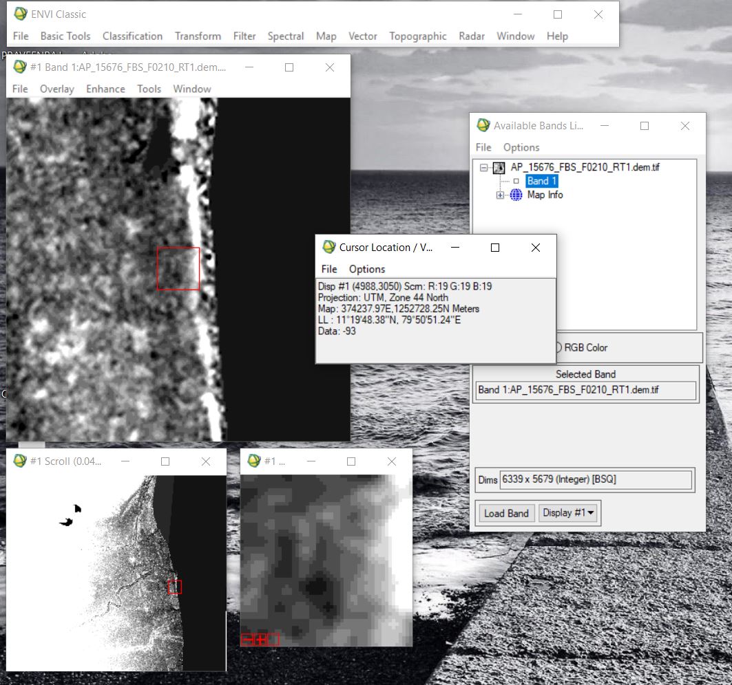
According to your screenshot, your image is located in India.
This means, for orthorectification of the SAR data SRTM GL1 was used.
It is documented here, including information on the quality of the DEM: https://lpdaac.usgs.gov/dataset_discovery/measures/measures_products_table/srtmgl1_v003
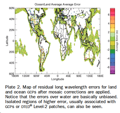
Additionally, possible error sources of this elevation data are discussed in this paper:
https://www.ingentaconnect.com/content/asprs/pers/2006/00000072/00000003/art00002%3Bjsessionid=2sv9xwar8gic6.x-ic-live-02#
Have a look at page 250 where coastal regions are explicitly mentioned and how errors could affect the data.
Sir, Thank you for your quick reply. Let me to go through these documents.
Mr. ABraun.
I am thankful for providing this document.
If I may inquire, the Only DEM that covers anywhere in the Middle East is SRTM GL1.

Source: https://media.asf.alaska.edu/uploads/RTC/rtc_product_guide_v1.2.pdf
However, I have found a High resolution terrain corrected NED for NE Egypt with a resampled 12.5 resolution. Does this mean this data may provide inaccurate elevation values for this area since NED13 data are based on the North American datum?
Also, is it possible for the 30 m DEM be used for shaded relief to enable lineament extractions?
If this is the one provided by ASF, the pixel spacing is 12.5 m but the actual resolution was 30 m. As you say, DEMs with higher resolution are only available in North America.
So you can directly use SRTM 30m data in its original form.
The Copernicus 30m DEM reveals some more details in some regions.
Is it possible to combine/mosaic more than one DEM without having discontinuities in the overlapped regions? My plan is to create a topographic contour map from the DEM but the area covered by a single DEM from ASF is quite small compared to my study area.
If so, can SNAP create such a mosaic?
Yes, you can load all DEMs into SNAP and use the mosaic operator. But if you need contour lines anyway, you can do both in QGIS