Hello,
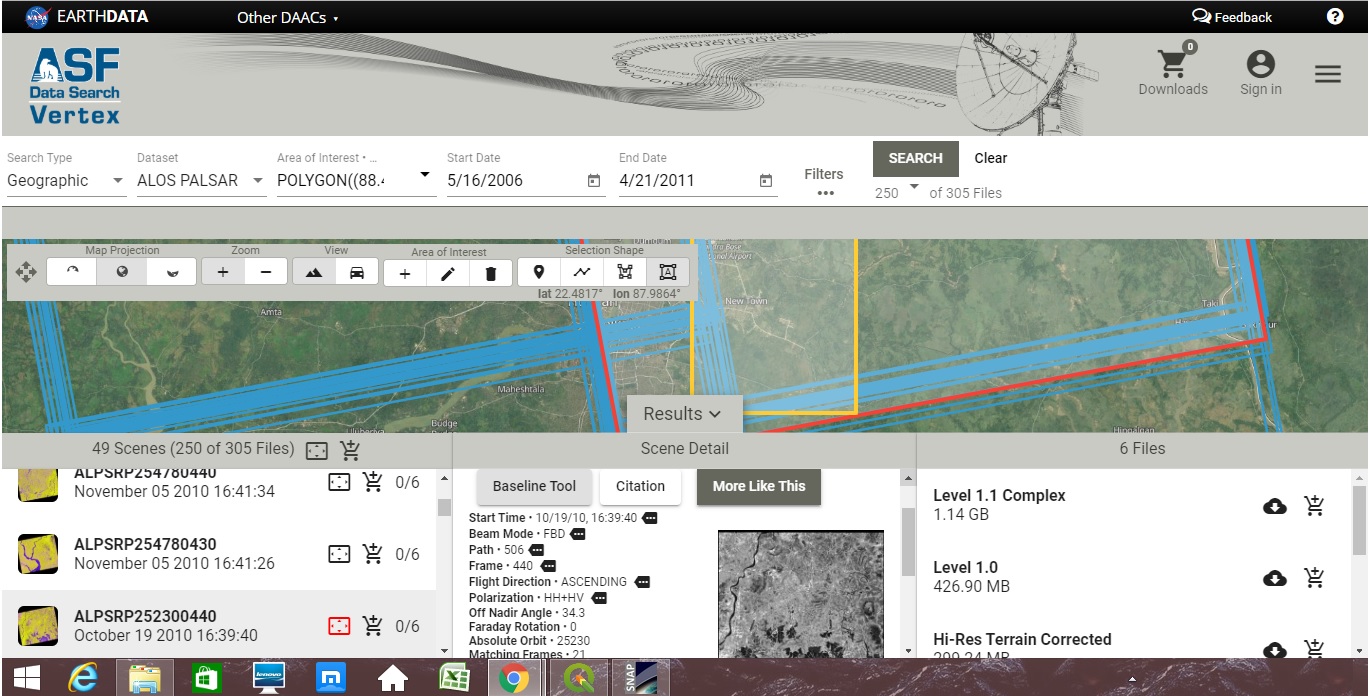
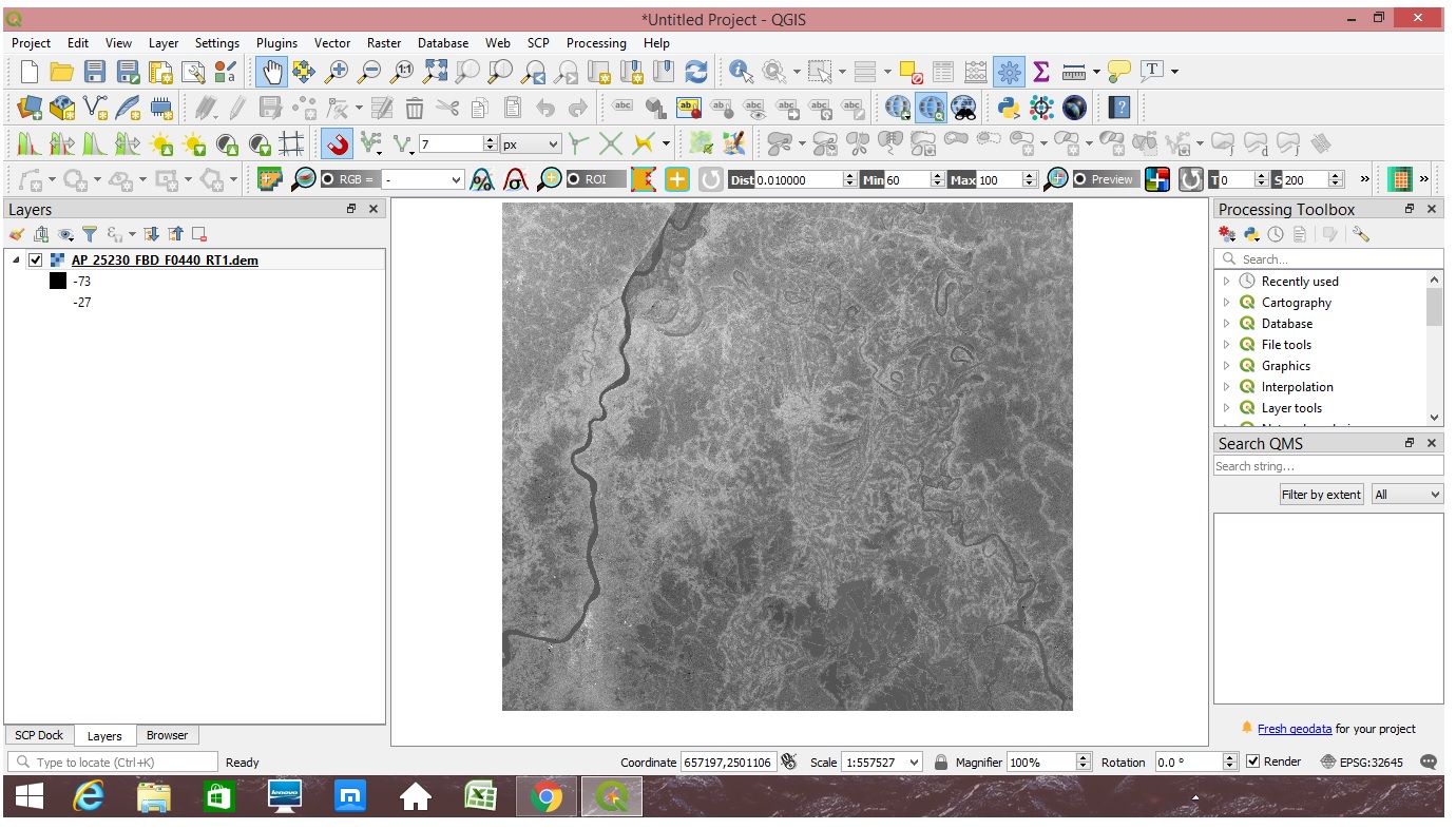
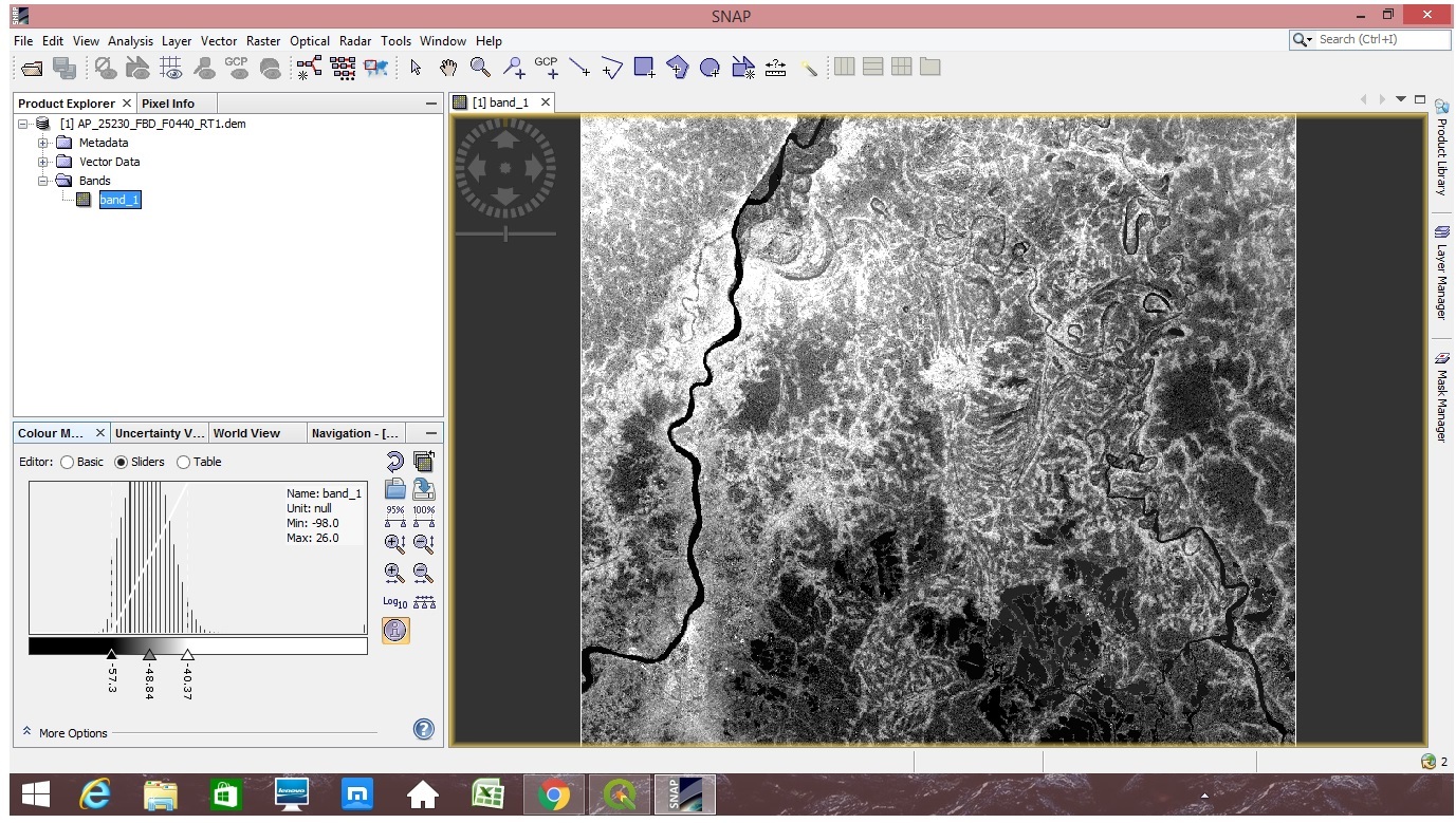
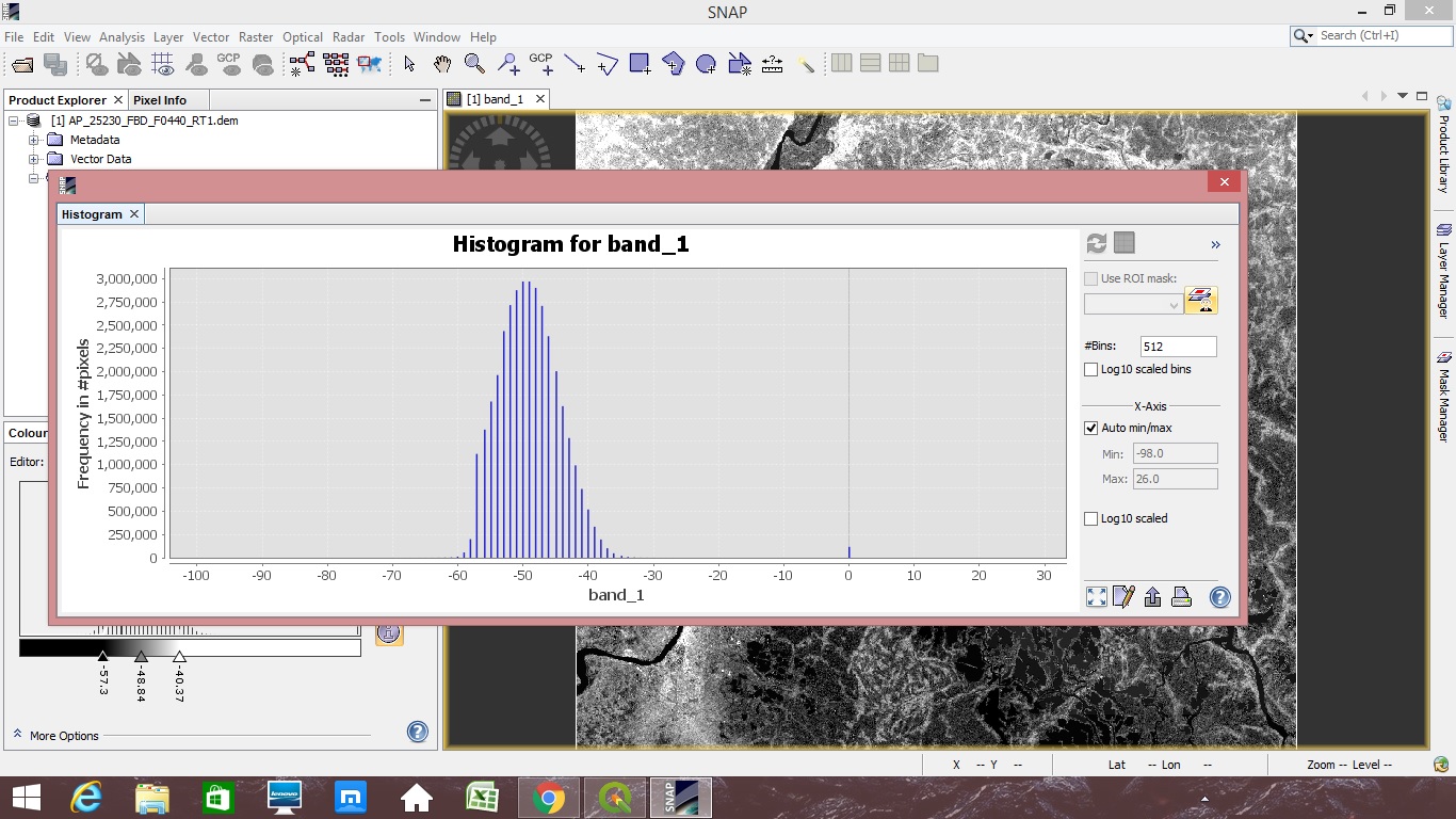
I am trying to extract elevation data from Alos PALSAR Hi-Res Terrain corrected FBD imagery. The area in which I am working is a wetland-reclaimed site. While trying to work with it in Qgis i found that all the elevation values are negative. I understand that there has been a similar topic (Alos PALSAR DEM hi-res Terrain corrected FBS). I have read the linked article but I am a bit confused about which correction techniques may be used in my case. I am attaching a screenshot so that it is easier to understand.
the values don’t make much sense, you are right, even if they were calibrated radar backscatter in db…
But you are aware that these elvations were not really extracted from ALOS data but just the secondary elevation source used for its radiometric and geometric correction?
I am aware of that. That is why I was thinking whether I should use the 1.0 level data and carry out dem extraction process in SNAP. I have tried to work with SRTM imageries but since they have a 30 m resolution they are not that appropriate as this area does not have such elevations at all. So alos imageries having a 12.5 m resolution seemed better.
Could you please give me an idea as to which imagery I might use for this area?
If you want to perform interferometry with SNAP, you need ALOS Level 1.1 data which contains phase information.
But unfortunately, the temporal baseline between two ALOS acquisitions (minumum 46 days) is often too long and the phase information is decorrelated. Furthermore, issues regarding the correct use of ALOS orbit information have been reported, so chances to get a DEM of good quality are comparably low. It depends on the amount of vegetation in your area and also requires favourable atmospheric conditions, as well as suitable perpendicular baselines (150-300 meters at best).
In any case, you should use single-polarized data which has higher resolution than dual-polarized data.
Thank you for your reply. I understand the predicament. But there is just one question, while computing the slope of the depressed regions plausible values have been generated from this same image. So can this be used?
I cannot answer this, sorry. I would never grant for correct measuremens from InSAR, even if the coherence was perfect. There are so many other error sources (atmospheric, unwrapping,…) so even if they are plausible, it is hard to determine their exact quality.
Thank you for your reply. I understand now. I will try to find out an alternative process which might suit my purpose. I thank you for taking the trouble to answer all my questions.