Hi,
I am continuing from the previous issue, since apparently the problem is in the back-geocoding step and not in ESD. ESD: Error: Generated network of images does not contain any pair. Max temporal baseline provided: 2147483647 - #5 by mengdahl
The previously described error disappeared after setting the DEM = CDEM in the back-geocoding step. However, this solved the problem only apparently.
The new issue is that the slave output data is always zero .
The process graph using back-geocoding with CDEM + ESD is this preprocess/TOPSAR_Coreg_ESD_FINLAND.xml at master · SARScripts/preprocess · GitHub
I have also tried to remove ESD, but the problem remains. (see xml here preprocess/TOPSAR_Coreg_FINLAND.xml at master · SARScripts/preprocess · GitHub )
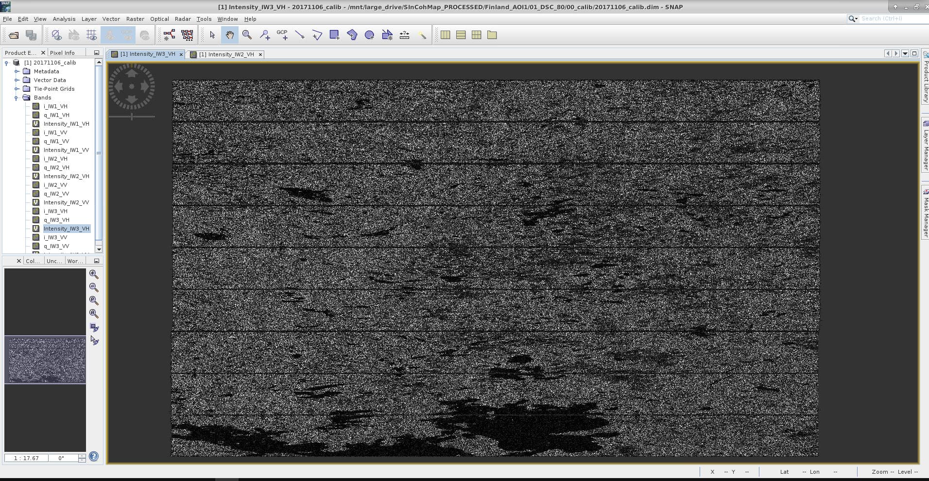
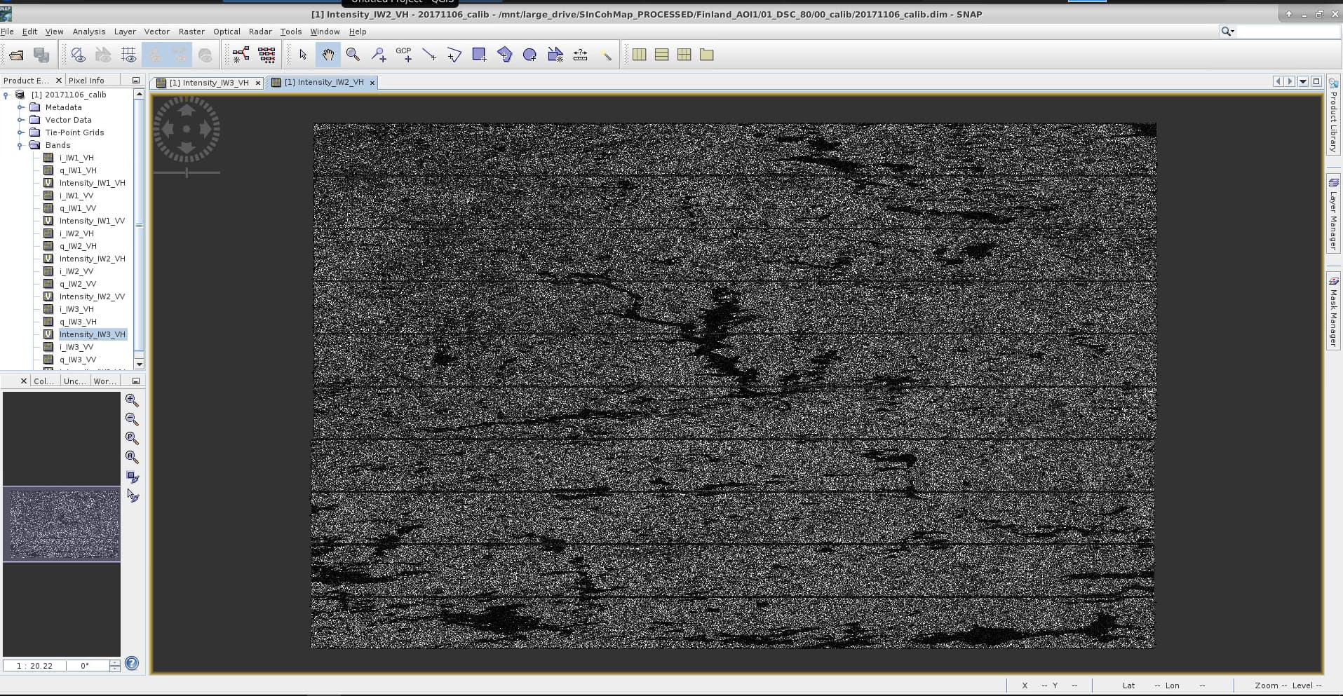
I attach two screenshots of the intensity visualized after the calibration step, which seems fine. The AOI intersect with IW2 and IW3 only.
I am not getting any relevant error from SNAP when running the provided graphs.
The DEM should not be an issue. In fact a low accuracy DEM at 1km resolution should be sufficient.
@ABraun @jun_lu would you have ideas?
jun_lu
January 25, 2022, 3:17pm
4
Could you please provide the names of the two products and the parameters that you used for all the operators? That will help us debug the problem. Thank you
@jun_lu I re-installed SNAP and all the updates.
Using Copernicus 30m Global DEM in back-geocoding now works as expected, it does no more return errors.
Using CDEM produces zeros only for the slave outputs
Output using Copernicus 30m Global DEM:
gdalinfo i_IW2_VV_slv1_11May2018.img -stats
Driver: ENVI/ENVI .hdr Labelled
Files: i_IW2_VV_slv1_11May2018.img
       i_IW2_VV_slv1_11May2018.hdr
Size is 24871, 7575
Metadata:
  Band_1=i_IW2_VV_slv1_11May2018
Image Structure Metadata:
  INTERLEAVE=BAND
Corner Coordinates:
Upper Left  (    0.0,    0.0)
Lower Left  (    0.0, 7575.0)
Upper Right (24871.0,    0.0)
Lower Right (24871.0, 7575.0)
Center      (12435.5, 3787.5)
Band 1 Block=24871x1 Type=Float32, ColorInterp=Undefined
  Description = i_IW2_VV_slv1_11May2018
  Minimum=-27.016, Maximum=47.539, Mean=-0.000, StdDev=0.223
  Metadata:
    STATISTICS_MAXIMUM=47.539077758789
    STATISTICS_MEAN=-3.4829057159656e-05
    STATISTICS_MINIMUM=-27.015928268433
    STATISTICS_STDDEV=0.2225225555016
    STATISTICS_VALID_PERCENT=100
Output using CDEM:
gdalinfo i_IW2_VV_slv1_11May2018.img -stats
Driver: ENVI/ENVI .hdr Labelled
Files: i_IW2_VV_slv1_11May2018.img
       i_IW2_VV_slv1_11May2018.hdr
Size is 24871, 7575
Metadata:
  Band_1=i_IW2_VV_slv1_11May2018
Image Structure Metadata:
  INTERLEAVE=BAND
Corner Coordinates:
Upper Left  (    0.0,    0.0)
Lower Left  (    0.0, 7575.0)
Upper Right (24871.0,    0.0)
Lower Right (24871.0, 7575.0)
Center      (12435.5, 3787.5)
Band 1 Block=24871x1 Type=Float32, ColorInterp=Undefined
  Description = i_IW2_VV_slv1_11May2018
  Minimum=0.000, Maximum=0.000, Mean=0.000, StdDev=0.000
  Metadata:
    STATISTICS_MAXIMUM=0
    STATISTICS_MEAN=0
    STATISTICS_MINIMUM=0
    STATISTICS_STDDEV=0
    STATISTICS_VALID_PERCENT=100
I attach two complete graphs that you can run directly (having the 3 source S1 zip files).
not_working_CDEM.xml (5.9 KB)working_CopernicusDEM.xml (5.9 KB)
1 Like
jun_lu
January 27, 2022, 1:38am
7
The CDEM (Canadian Digital Elevation Model) covers Canadian landmass only. Therefore, it cannot be used for your Finland data. That’s probably why you got empty slave output. Maybe we should rename it to Canadian DEM.
Thanks, it indeed requires more documentation since I wasn’t able to find any information about it. On the other hand, I remember that trying to use SRTM fails and raises an error, which is also what it should do here since in both cases the DEM do not cover Finland.
Yes, but this means the same behavior shall be implemented for all the other DEM types too. Generally one should make sure that DEM covers the scenes (SRTM 3 covers 60 south to 60 north only for example). I think the same blank slave would be the outcome if scenes or subswath/bursts do not overlap.
I have the same problem, and I am pretty sure the SRTM data covered the study area. So, How is this error coming? Did anyone solved it?