Hello
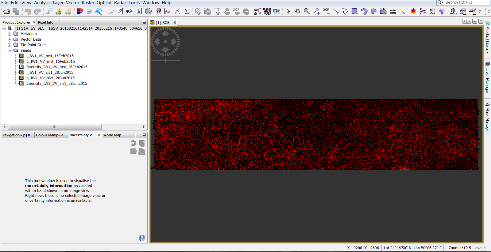
I have two images of sentinel 1 and I have done the coregisteration steps both separately and with ESD and I have not received any error, but when I open the image as a RGB, only red is displayed !!
I’ve done this several times, with SRTM 3S and SRTM 1S, and all my plugins are updates but it shows the same results.What’s wrong?
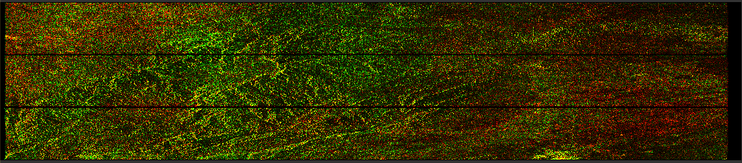
You can see this in the image below.
Even without error message the outputs can be of bad quality. Please open the InSAR Stack tool to check the number of GCPs and their accuracy. It is explained in this tutorial (figure 14):
InSAR Displacement mapping with ERS data
Have you selected the correct bursts in S1 Split?
I opened this window, but ‘coregisteration residuals Tab’ was completely empty!! and as you can see in the image, the baseline is a large number !! Is the wrong orbit file downloaded?
I chose the same bursts in both images!
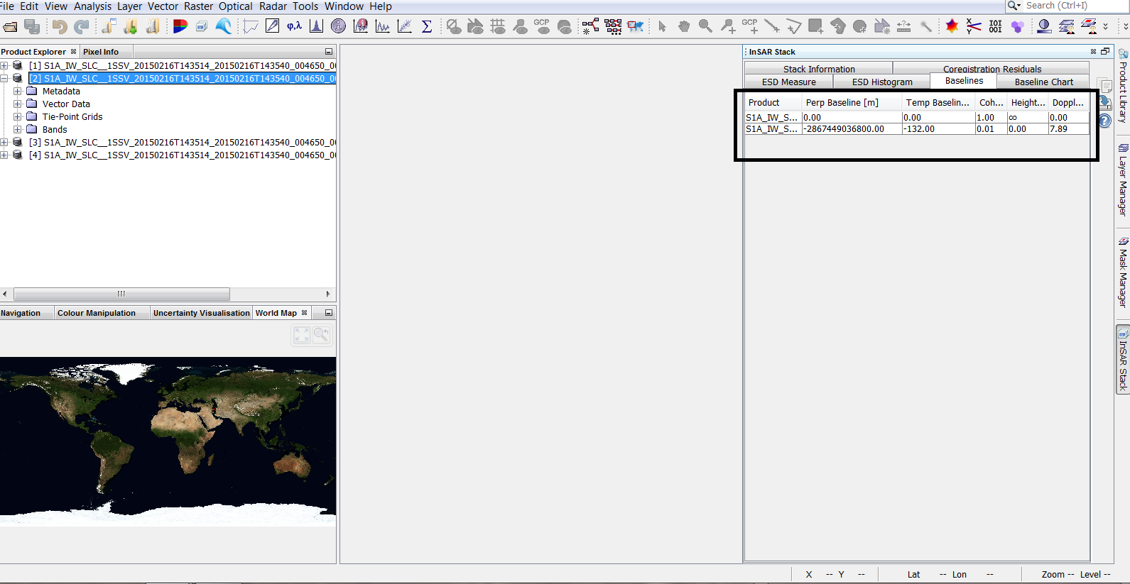
the perpendicular baseline looks suspicious. Can you please post the image IDs of both products in here?
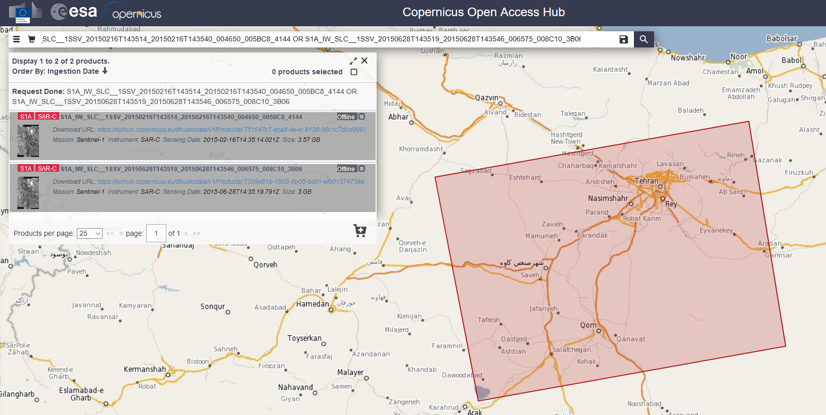
my images :
S1A_IW_SLC__1SSV_20150216T143514_20150216T143540_004650_005BC8_4144
S1A_IW_SLC__1SSV_20150628T143519_20150628T143546_006575_008C10_3B06
thank you.
As both belong to the same track, the baseline should be smaller 150 meters at least.
What were the steps you applied on the images before BackGeocoding?
The baseline should be smaller or greater than 150 meters? The images have the 120 meters baseline.
Because there were no better images.
steps :
Tops Split - Applying Orbit File - Back Geocoding and Enhanced Spectral Diversity Respectively.
I meant from a technical perspective, Sentinel-1 baselines cannot be larger than 300 meters (most of them are between 20 and 45 meters). So 120 would be reasonable, yes.
Yes that’s right
Now, in your opinion, and according to the previous explanations, where is the problem? I’m really confused!
Looks like a wrong orbit information was inscribed into the product.
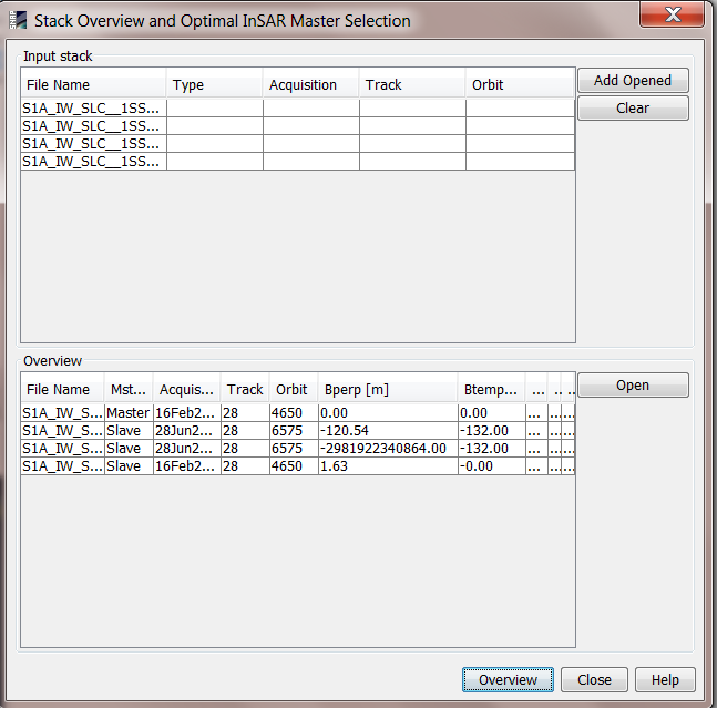
Can you compare (in the InSAR Stack Overview):
- Baseline of both original products
- Baseline of the products with orbit files applied
Thanks a lot
I did this, but apparently the slave image orbit file was mistakenly downloaded .What solution do you suggest?Is it possible to download the orbit file manually?
Please delete the orbit folder in the SNAP user folder (/home/$User/.snap/auxdata) and apply the orbit files again.
I think something went wrong during this step.
I did it several times and deleted the folder, but it’s still the same!
Is it possible to download manually?
for example from :
https://aux.sentinel1.eo.esa.int/POEORB/
Yes, you download them and place them inside thr folder. But I wonder why SNAP takes the wrong orbit.
Have you tried the switching the orbit file source in the operator? Maybe the less precise ones are without error here.
Thank you
Download the file related to the date of the image on this site? And what folder exactly should I place it?
I downloaded it and put it in folder 06 (month of image), but it was the same again!
No, I didn’t try Because the accuracy of the output is important to me
It’s explained here: Error in applying orbit file
Please give it a try to see if the precise orbit is corrupt.
I did it with its own image’s orbit file and the baseline was correct .
the result of geocoding and ESD Respectively is as follows
That means the provided precise orbit is corrupt. Maybe there is a way to report it here: https://qc.sentinel1.eo.esa.int
Thanks a lot
Unfortunately, I did not find a way to report it and I have to try to download a new image.
Thanks again