DEM Assisted Coregistration Problem

Hi everyone,

I am having trouble with this tool.

I wanted to stack those two files.

subset_0_of_S1B_IW_GRDH_1SDV_20170308T165807_20170308T165832_004620_0080DA_8AEC.data

subset_1_of_S1B_IW_GRDH_1SDV_20170320T165807_20170320T165832_004795_0085FE_0A30.data


they have about the same extent. I did all the recommended steps from here . When I try to coregister them, this is the result:

What is the mistake?

Thanks!

Can nobody help me? Do you need additional information?

What do they look like on the world map? Do they overlap? Which DEM are you using? Does it cover this area?

Thank you for your answer Iveci.

I used the default DEM (SRTM 3Sec).

They do overlap as you can see in this world view screenshot.

they look like this:

if no DEM is found on the server the area remains empty.

Try the DEM 1ArcSecond or downloading it manually to make sure it is used by the module

1 Like

okay thanks! I will try that and give feedback

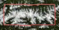
I downloaded and tried it with the same GRD products you used and it works fine if you apply the dem assisted coregistration first and then terrain correct. I also tried terrain correcting first and then running the dem assisted coregistration and this resulted in empty output. I think the dem assisted coreg is not expecting map projected data. if you want to terrain correct first then you could apply create stack however, I believe orbit correction, dem assisted coreg and finally terrain correction should give the best result.

2 Likes