Just a question on the LOS export.
How may I export ascii file including lat lon east north and up from unwrapped interfrogram in SNAP(after importing unwrapped interfrogram from snaphu) ? I couldn’t find this subject in the forum and in the S1 manual.
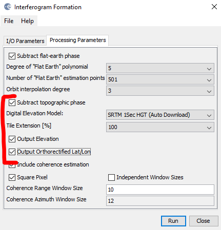
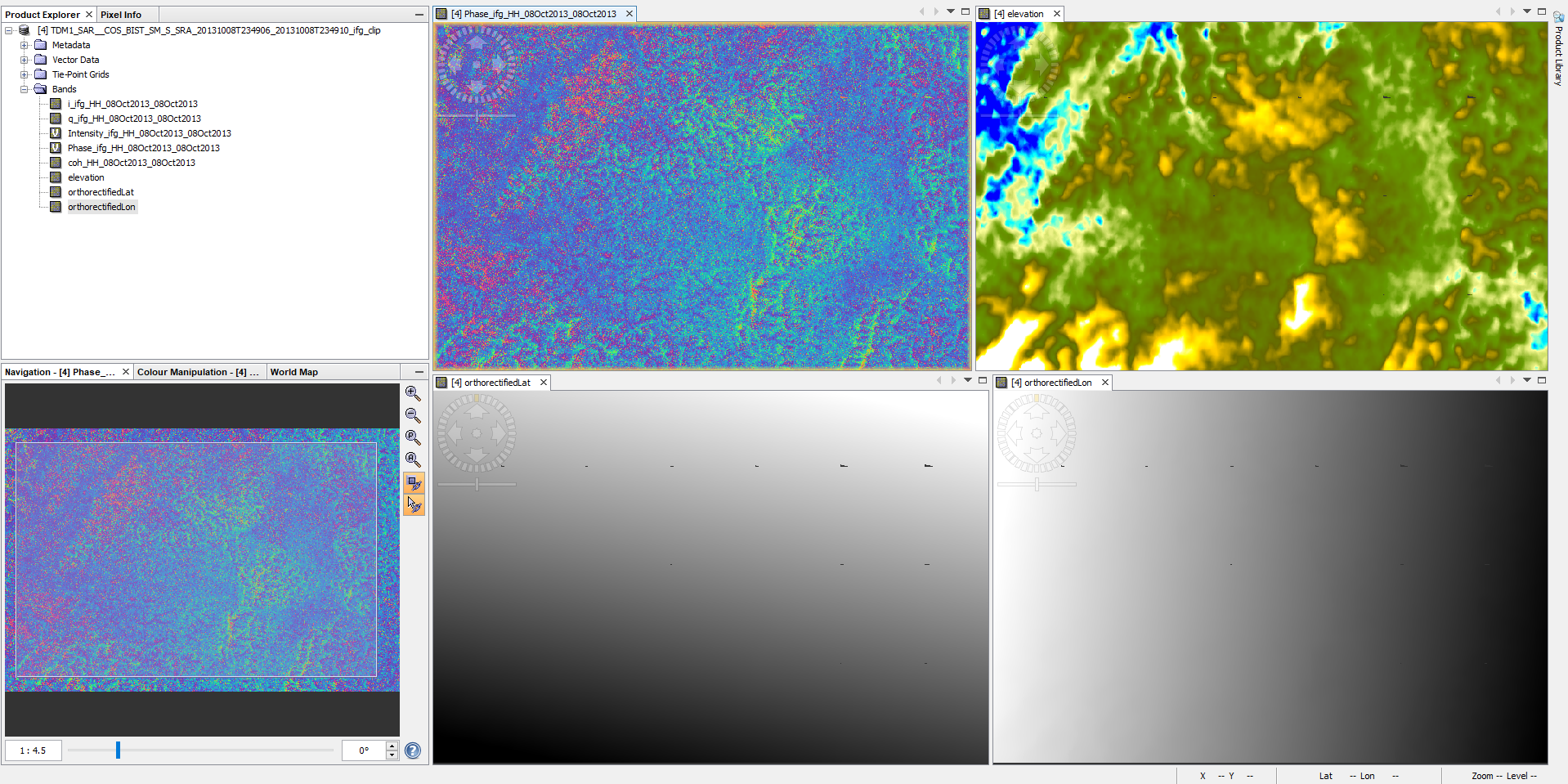
But ASCII files can only contain one raster at a time, so you will have to repeat it for any information you need. Make sure you check lat/lon files and elevation in the interferogram step.
Dear @johngan,
The your results in LOS geometry is nice, I am new in PSInSAR technique.
Can you share for me and formun the proscessing that you run subsidence for the area of Ho Chi Minh in Viet Nam.
It is necessaryfor me and my thesis.
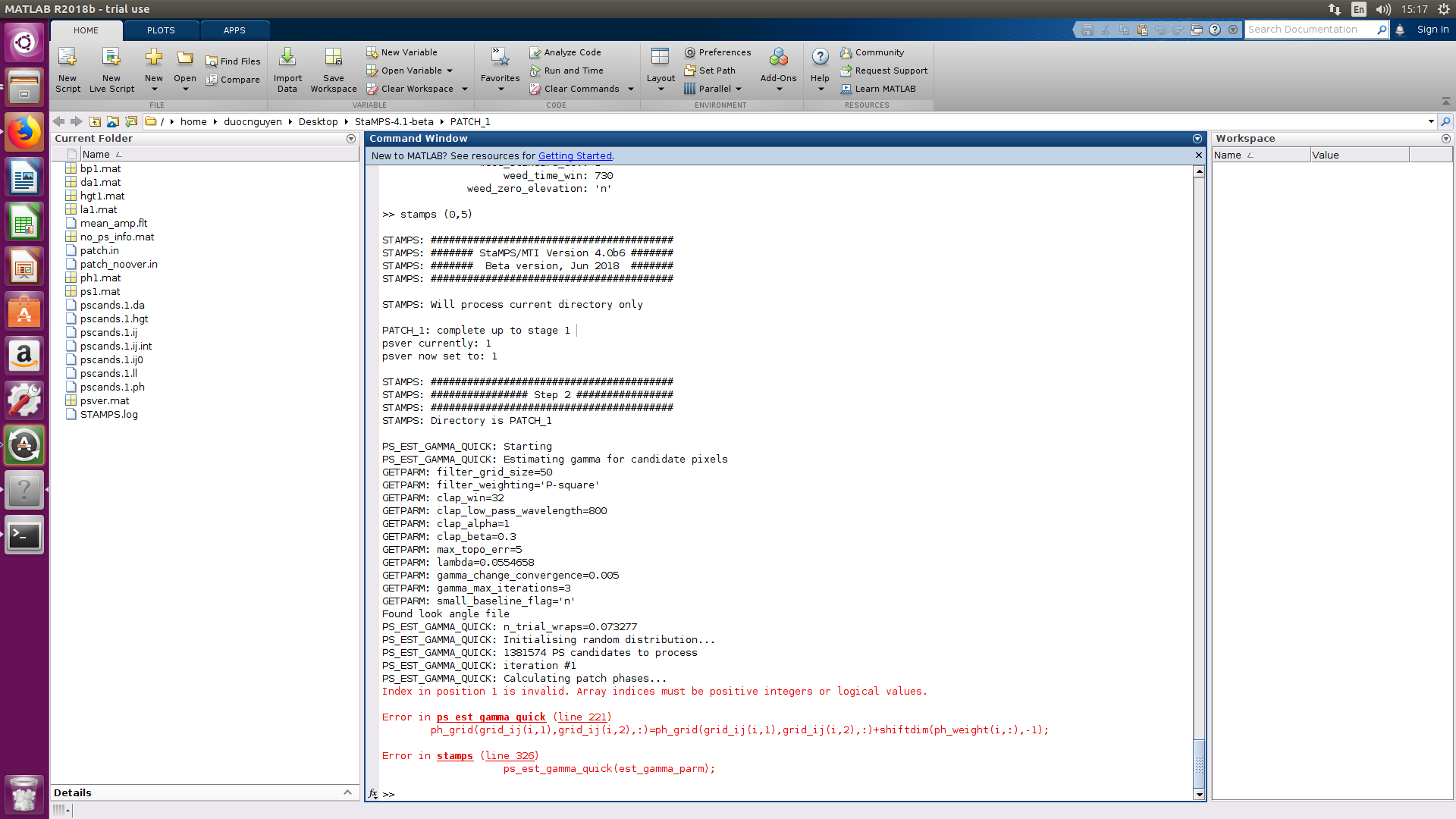
Can you debug a bit and see the value of the variables which are giving the error? As you get exact information on file and line giving the error… you may try to do some debugging.
Normally this might be due to invalid values such 0 or NaN used as indexes… so maybe you can filtering them out.
Thank you your advice,
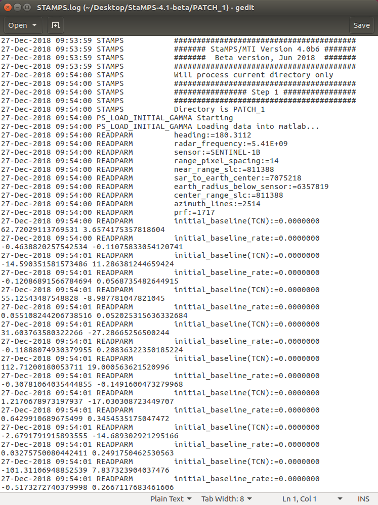
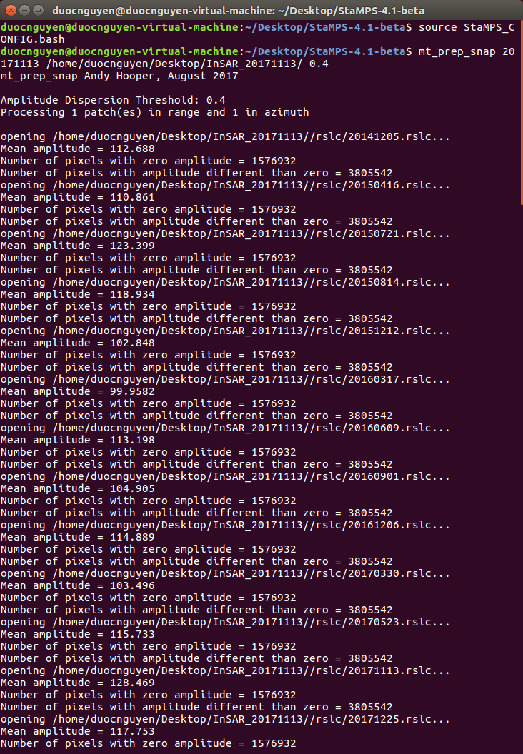
I try tocheck step by step in SNAP and StaMPS (Stamps.log), but I am not sure but I do not see 0 value or NaN value.
Can you see figure and do you have idead for this problem?
Dear @mdelgado,
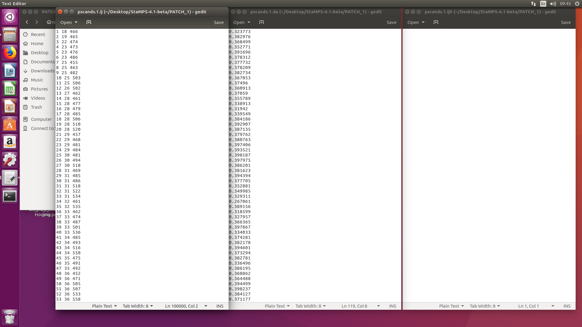
I have checked pscands.1.ịj, pscands.1.da, pscands.1.ij0, but they do not have 0 or NaNs value and “pscands.1.ij0” does not value, does right?
@ABraun@falahfakhri@johngan can you please sort out how this is done using SNAP?
Is it possible to use 20 pairs (A+B), (B+C) , (C+D) … so on which will produce separate stack for each pair and also separate interfergram. So my query is about how we can produce stack of all these interferograms at this stage for performing a time-series analysis?
Thanks @falahfakhri, i read all the conversation btw u and andy.
At the end of the day we dont have any perfect methodology on which we rely.
What if we calculate the subsidence using No.of pairs (A+B, B+C, C+D, …) till last step (displacement) separately and averaged the results of all displacement layers.