hi everyone,
I’m trying to detect land subsidence using DInSAR technique
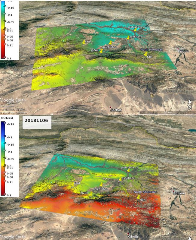
I have processed two series of ascending and descending S1 tops images
now I have two questions:
1- is there any way to compute the correlation between two displacement results? (like 201808master-201805slave for ascending and 201508master-201808slave for descending data)
2- I have exported the results to kmz format and I want to compare the results at the early steps, but it seems that there is a notable difference in the northeast part of the displacement results, how can I find out the cause of that?
two possible explanation (probably both apply)
- both give you deformation along the line of sight (LOS), so ascending and descending can be different, especially when there is vertical and horizontal motion. There are approaches which try to combine both results (Vertical Velocity Displacement along Ascending and Descending tracks) and we plan to implement this in SNAP as well in the future
- unwrapping errors in one (or both) of the results can cause large differences over the image. It depends on the degree of coherence and the quality of the interferograms how reliable the results are
ok I will consider that. can I use this bandmath in order to calculate vertical displacement?: “LOS displacement calculated in phase to displacement” / (cos(rad(incident_angle))) .
in a very basic way, yes. But there are more advanced methods (based on two or more images) which are more accurate. So the differences between both rasters (asc and dsc) will probably not be resolved by this formula.