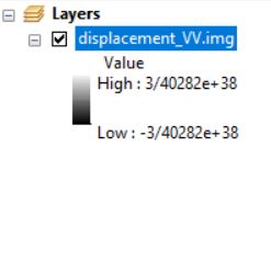
The two histograms look really different. So I wonder if you really look at the same data.
Have you tried to load the exported GeoTiff back into SNAP? How does the histogram look like then?
Hi,
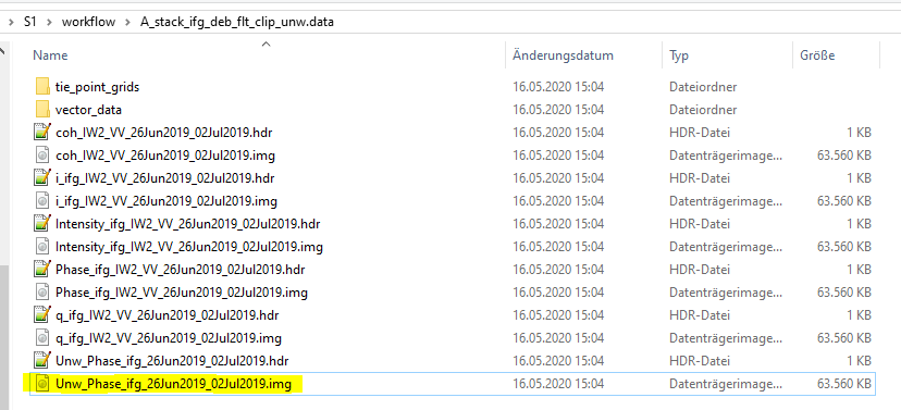
I have a bit similar problem. I want to export unwrapped phase only into geotiff but I can export i, q and coherency already. Can you help me? I checked both of before multilooking and after multilooking phase for exporting. I don’t want any filtering.
Thank you in advanced.
Thank you. But I want to use my rapped phase that it seems it is temporary at this step and haven’t any thing such as your attached image.
both the wrapped and unwrapped phase are inside the snaphu folder and also in the .data folder of the unwrapped phase after import back into SNAP.
Yes. it is. I have another matter. when I want to open coherency or my phase in geotiff format in arcmap or matlab, all of values are zero!!!? What was wrong please?
my recommendation is: do not export to GeoTiff, leave the img files as they are. They can be opened in ArcMap and matlab
Please check here:
Dear Braun,
There is a problem in opening img file in GIS or envi. The coordinate system will be loosed. I need the exact location of snap files in envi.
Another question, Do you know about “pseudo” geographic lat/long? what is this and why it isn’t correspond to geographic lat/long?
Thank you in advanced
before you can impot it into a GIS you need to geocode any SAR product (Range Doppler Terrain Correction). Otherwise the pixels are not referenced to a coordinate system.
But once this is done, the pixels have coordinates. The only thing you have to do sometimes is to tell the GIS what coordinate reference system you used for the Terrain Coorrection, e.g. WGS84 which is based on geographic coordinates (latitude and longitude in degrees)
There is a Pseudo Mercator projection used by many online maps, but it’s not an official geodetic system.
where is it? is it in toolbar?!
In the Layer Properties Symbology
thank you so much, done!
I have another question. can I “extract by mask” the img file via arcmap?
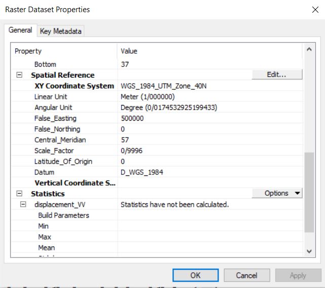
my shapefile is on “WGS_1984_UTM_Zone_40N” and the disp.img file source is “Unknown” even I terrain correctioned it on snap! any idea?
ArcMap does not recognize the projection based on img/hdr files but still puts it at the correct location. If not, please assign the coordinate reference system (UTM zone 40N) in the ArcCatalog.
The tool you are searching for is called Extract by Mask: https://desktop.arcgis.com/en/arcmap/10.5/tools/spatial-analyst-toolbox/extract-by-mask.htm
I tried to use arcCatalog as you said, but now I cant see the result in arc map! and the dis range seems weird now:
please have a look at the recommendations in this tutorial on how to use img files in ArcMap: Export of products from SNAP
thank you so much
I tried to reproject the data using geometric operations, problem solved! I didn’t know “WGS84DD” doesn’t work for exporting to geotiff
Thank you so much for all your replies,
I want to use metadata in GIS and exporting as geotiff removes that,
I use QGIS but I couldn’t import .img files to QGIS(,
Do you know any other way to import .img files to QGIS?
Or maybe I can try converting .img files to GTIFF’s via gdal.
this should be possible actually.
Please have a look at this tutorial: Export of products from SNAP
It worked,
What I was doing wrong was importing .img file outside of it’s main folder,
probably main folder have couple metadata so importing .img file inside its main folder did the trick, thanks!
Metadata are in the .hdr files. These are ASCII files that can be viewed with most programming editors. ArcGIS Supported Raster Dataset File Formats calls this “ENVI Header” format. Many other applications (e.g., QGIS) can read this format, and there are additional metadata files with other filename conventions.
1 Like