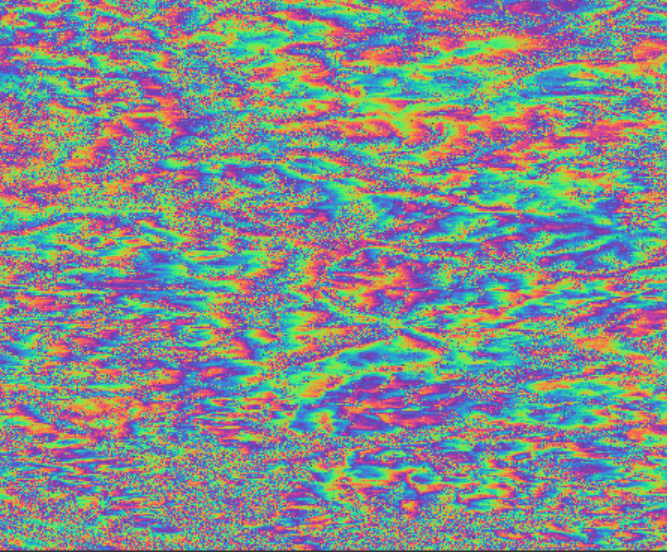
Hi all. I have been creating interferograms to look at the activity of various large landslides in the southern French Alps. In many of these interferograms there are wide areas with unexpectedly high interferometric phase, for example this interferogram created for the 12-day period 08.07.16 - 20.07.16:
My question is, could these likely erroneous phase differences across wide areas be the result of an error in my batch processing chain or are they more likely the result of the atmospheric phase screen? If the latter, can such an image be used (following interferogram averaging, for instance) or should it be discarded?
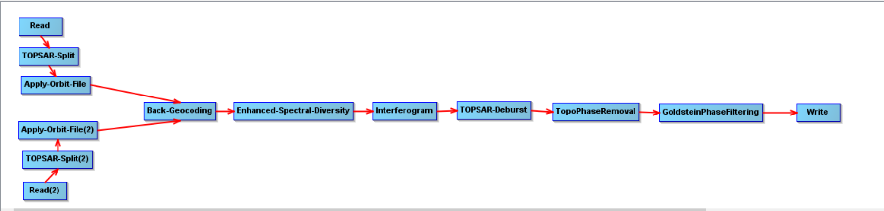
Hi falahfakri, thanks for your reply and for redirecting me to your previous comment. Are you suggesting that I should during the back-geocoding tick the box that says “Output deramp and demod phase”? Also, I had originally included the S1 range and azimuth shifts but I was told that these operations are not intended for TOPS data. I did not do the export the SNAPHU step yet.
I think that you can works with this value of coherence, but is necessary document you, in the link, you can to get information about coherence and atmospheric artifacts
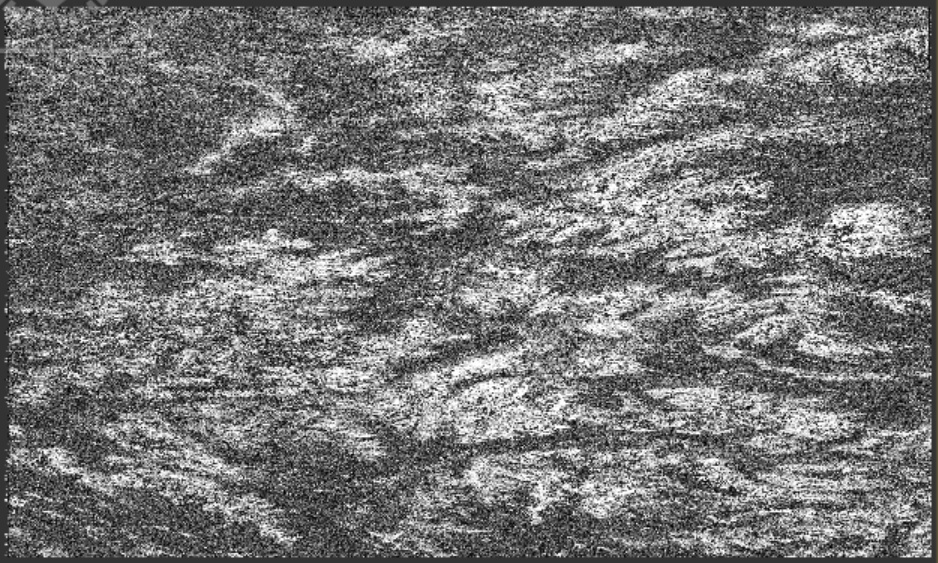
Assuming the topo-removal step has worked correctly the remaining phase still contains phase-terms related to atmospheric artefacts, errors in the DEM, and terrain movement. It would be instructive to see the InSAR-phase before the topo-removal step.
Also, what is the meaning of “unexpected high interferometric phase”? What is your expectation, and on what is it based? I can understand that you may find “unexpected difference in terrain height”, i.e. comparing to an existing DEM, after phase unwrapping. Is there any particular area where the i-phase is unexpectedly high?
By that I just meant that I doubt that there has been as much ground
displacement in the 12-day period as shown in this image’s interferometric
phase, which is why I asked if maybe this was due to atmospheric artefacts.
An interferogram generated from 2 SLC scenes relates to terrain height (i.e. the DEM), not to changes in terrain height. For that you need to combine more than 2 scenes (i.e. perform differential interferometry).