Please May me know ho can use the Image with a geotiff format inside the SNAP
Please share more information on your data and what you want to do with it.
Hi, I solved the problem with my Image
Is it possible help me to give me the link to download ENVI 5.3?
Thank you in advance
ENVI is a commercial software. We will not tolerate any discussions about piracy in this forum.
1 Like
Apologies, I didn’t know that. apologies again.
actually, I use SNAP software but the licturel ask me to use the ENVI software. Howerve, May I get a pair from Images to do exercise in Interferometry? all pairs that I downloaded are not good incoherence  . Thank you in advance.
for high coherence you have to keep the temporal baseline as short as possible.
Please have a look at these: InSAR Principles: Guidelines for SAR Interferometry Processing and Interpretation (ESA TM-19)
Have you seen the tutorials on InSAR? What data are you working with and what is your overall aim?
Actually, I read a lot, but I am not lucky in downloading. However, My project in university is to create DEM from two Sentinel Images by using SNAP.
May I ask you to give me any Pairs of Images can I make Interferometry, If it possible in the desert area.
Thank you in advance
You can find all relevant information in this publication: Braun 2021 Retrieval of digital elevation models from Sentinel-1 radar data - open applications, techniques and limitations
Especially the ASF Baseline tool will help you identifying a suitable pair with short temporal and long perpendicular baseline.
This tutorial shows a practical example: DEM generation with Sentinel-1 - Workflow and challenges
Thank you so much for the replay. Actually, I have this tutorial. I will try again.
As well as this paper I have seen. So I got a lot of information from them. Thank you so much.
Do you have a geographic area of interest for DEM.generation?
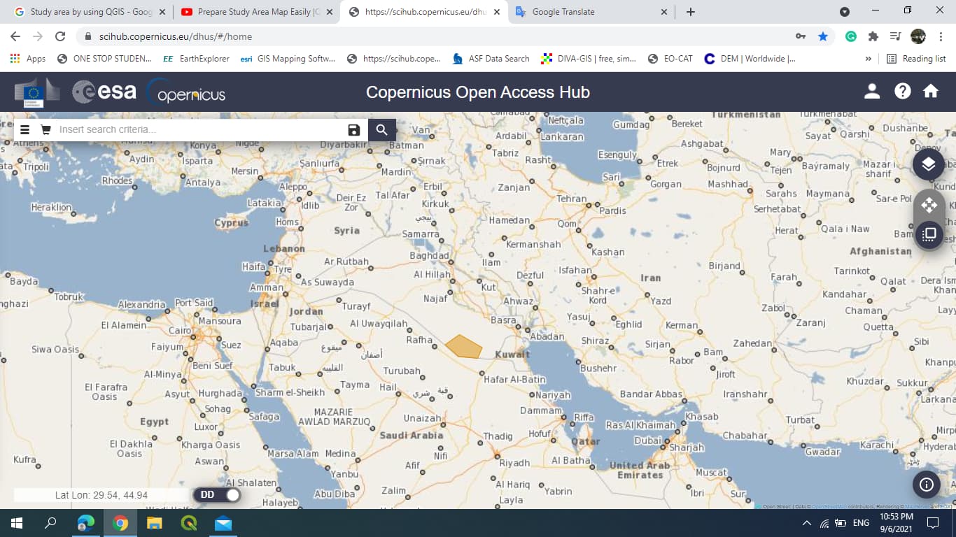
Yes, sir, this Study area is my study. It is in the South of Iraq. Lat, Lon( 29.57, 44.94).
you can use the ASF Baseline tool to find image pairs separated by12 or 24 days and perpendicular baselines larger than 150 m
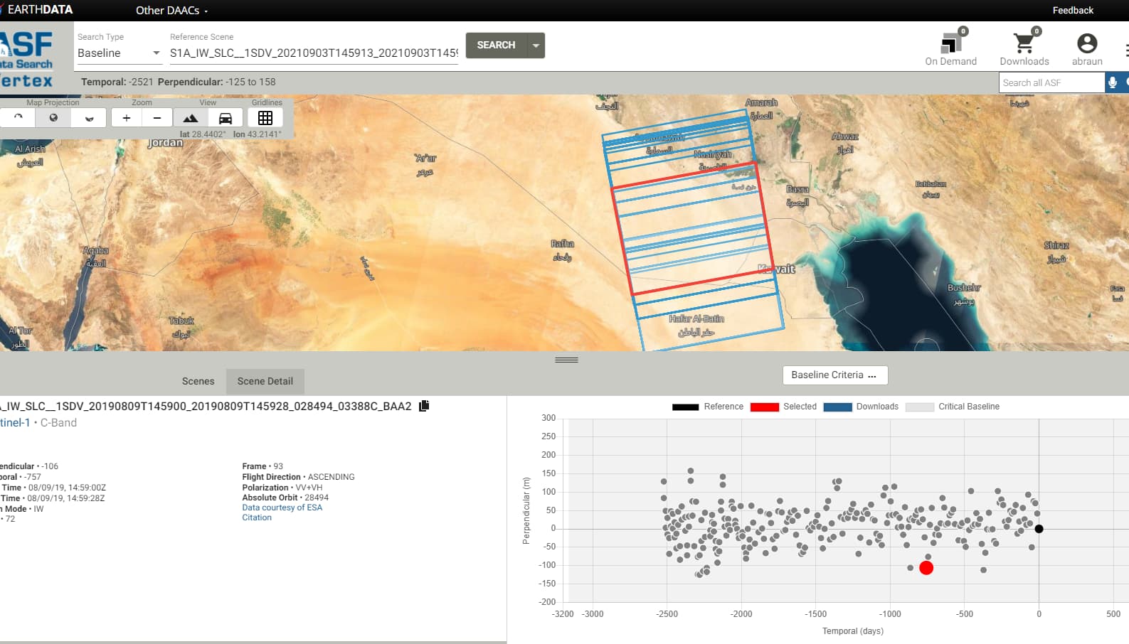
Actually, I tried ASF, but the same problem, However, can I use this image that appears here.
May I ask you to choose another one even I use in my project, please?
Certainly, your choice of a pair of Images is much better than mine.
Thank you in advance
Apologies, Now I get this image that you shown to me, which another one that you advise me to download please?
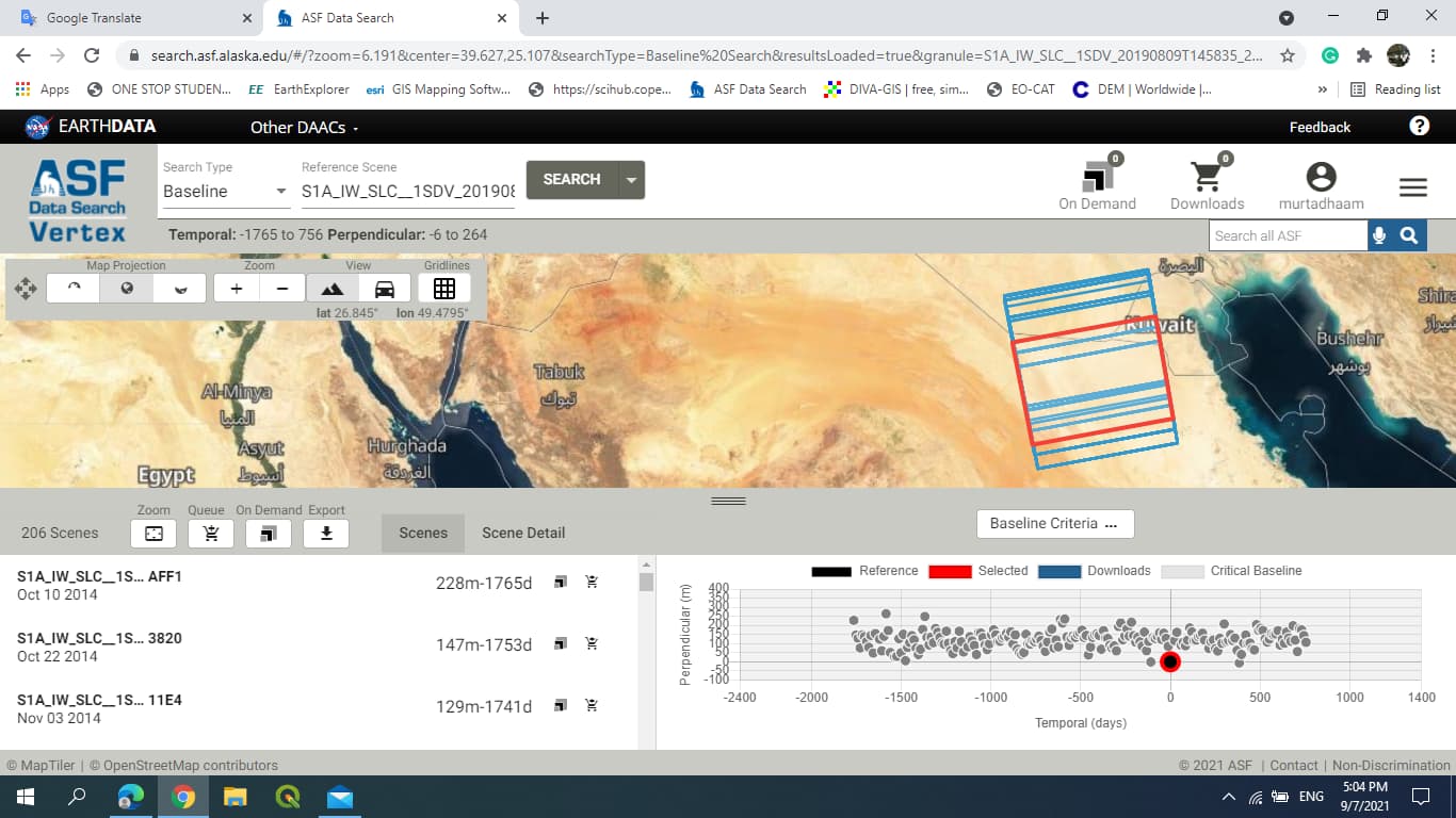
the pair between 09 August and 16 Jul has 129m and 24 days. If no rainfall occurred during this time, it could work out.
Please make sure that the footprint of the selected images covers your study area.
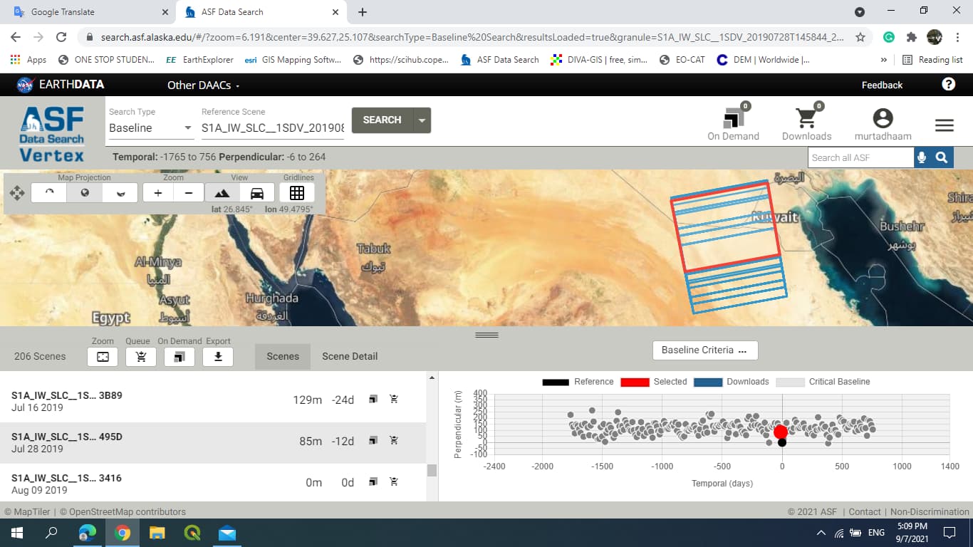
The second image doesn’t cover the study area, so I will choose the 16/July and 28/July, it cover the study area.
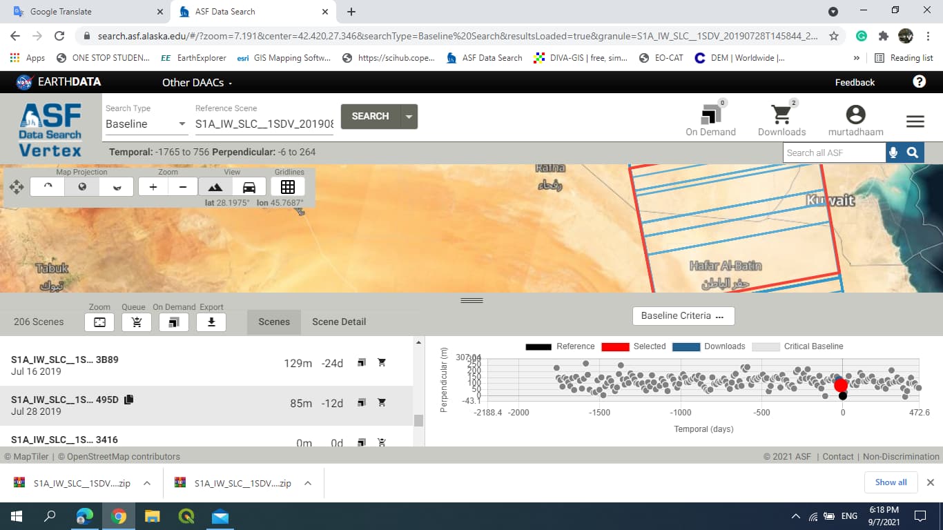
Also in this time no raining in Iraq