Hi @ABraun
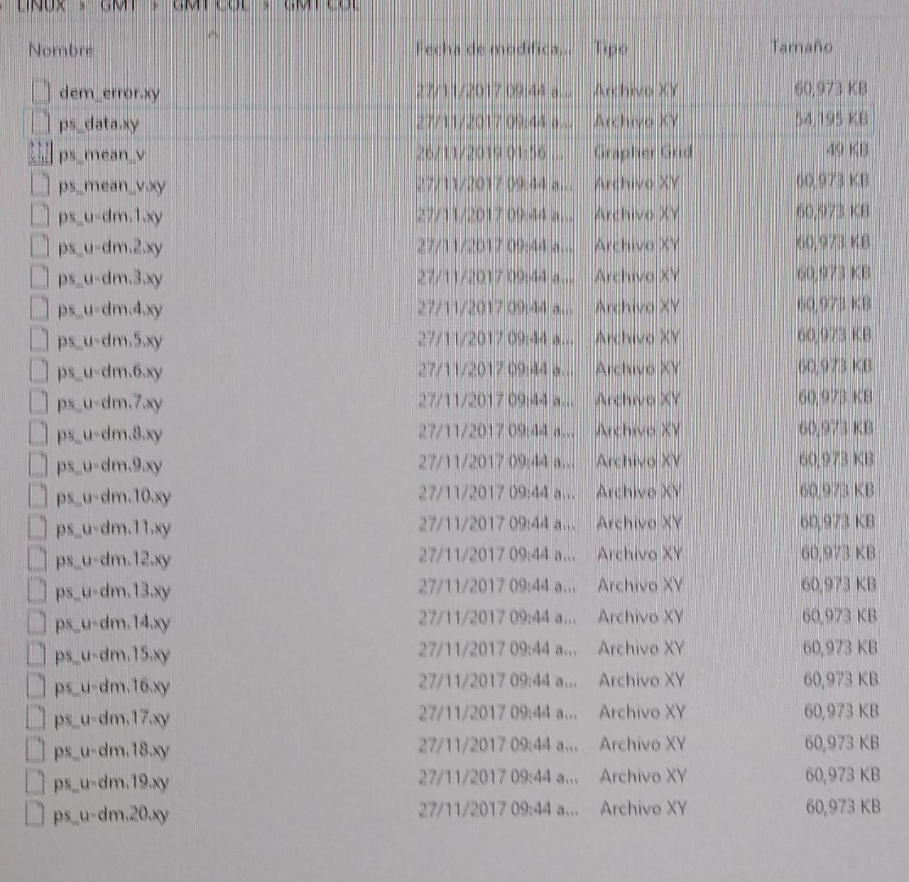
I want plotting my results (mm/year) in GMT, I have the following files,which one I should be using???
thanks for advance
Hi @ABraun
I want plotting my results (mm/year) in GMT, I have the following files,which one I should be using???
thanks for advance
I have no idea about that, sorry. Haven’t seen this .xy format in this context and never used GMT so far.
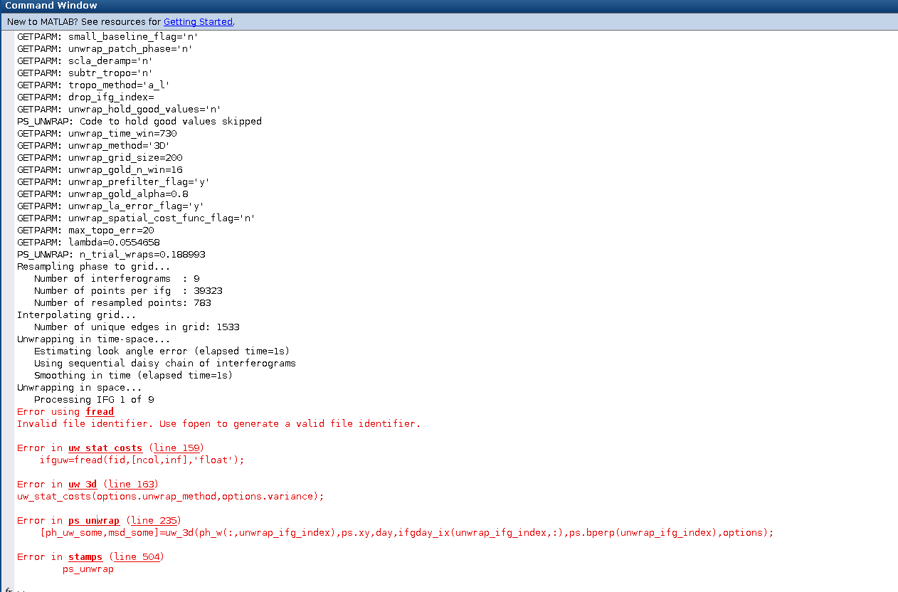
Everyone
i have a problem with my sentinel-1 images, those image have no value line in demarcation zone.
i follow a process with s-1 tops split>> apply orbit file >> back geocoding >> s1 ESD >> s1-tops deburst, then is interferogram formation. I process with 28 interferogram pairs.
the problem is some pixel showing NaN value cross some images
How i can reslove NaN value pixel or must change SAR images?
Always depends which results you want to plot.
ps_mean_v has the mean LOS velocity as you can imagine.
ps_u-dm.X.xy contains the single unwrap interferograms with information on the PS points only, not containing the information for each pixel in the image, but only at the PS locations.
I hope this helps
file not found!
@survivere13: It has been re-uploaded - please see here:
thank you so much
Thanks for the advice!!!
Hello all snap users
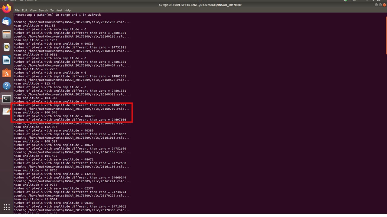
I created my ifgs by use of snap and wanna export them to stamps, after run mt_prep_snap i got a lot of zero aplitude pixels , how i can solve this problem. any help appreciated
than all
how did you solve your problem? did you just merged the results?! 
Have you checked if your interferograms look alright?
Zero Amplitude pixels are not bad in general, but it’s good to keep an eye on it.
thanks
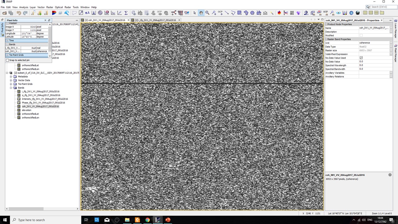
unfortunatelyI have deleted all ifgs and only keep stamps exports results.pscands file size is zero too.all of files size look reasonable as below pics . do you have any idea about them? is there any way to solve
that’s unfortunate - it is always good to check intermediate products before proceeding.
You can try to open the slc/par files using the Gamma import of SNAP. It should be enough to check if the interferograms were created correlctly.
hi everybody
if my area is in both IW2 and IW3 which step is the right step to merge them?
TOPS Merge after TOPS Deburst
hi ABraun thanks for your time,
so i sohuld do the
I don’t know where this description is from, sorry. I also don’t think stack averaging is required here.
If you want to perform PS InSAR on multiple sub-swaths, the easiest way is to process each sub-swath (IW2 and IW3) separately and later merge the results you retrieve from StaMPS to a joint file.
As you are working with single persistent scatterers (points) and not processing interferograms, you can neglect the smaller phase jumps between the sub-swaths. I don’t think they will be visible in the result.
If you want to pre-process both swaths before applying StaMPS (I have never done it, but I would do it like this): Process the interferograms of both sub-swaths, deburst both and then merge them to a joint product. As you need many scenes for PS InSAR, this seems a bit much work for me.
Another idea: Have you tested if images from another orbit direction (ascending or descending) cover your study area within one sub-swath?
I think it would be much easier if I merged them after results thank you so much
yes I also checked descending images and it’s worse because the area is between to different images ![]()
thanks for your time
good luck with it then!
HI All,
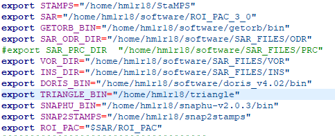
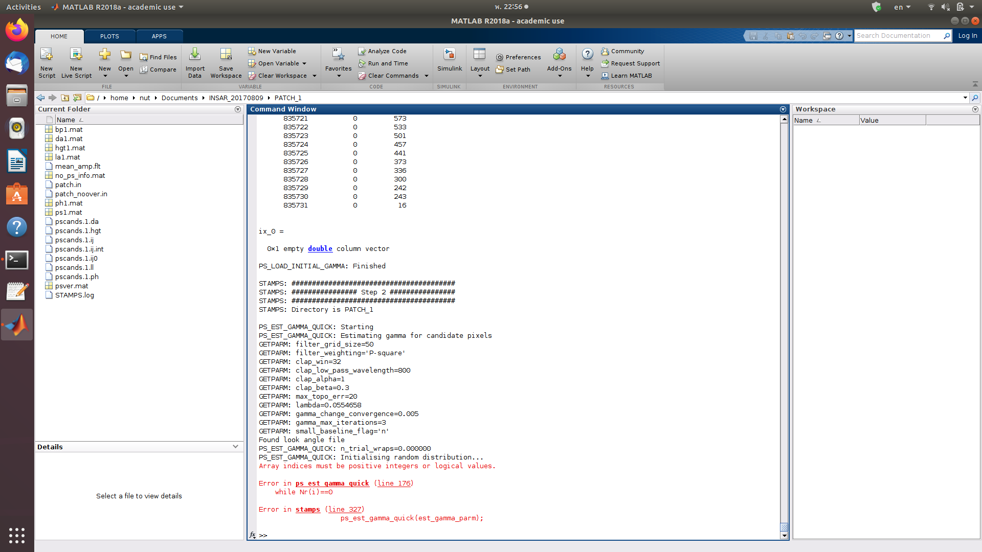
I am trying to use Stamps to perform PSI processing on trailing dams in mines. I have managed to follow the majority of the steps given above. However, I am running into an issue with stamps(6,6). I have added the relevant pathways to the triangle and SNAPHU modules to the Stamps_CONFIG.bash file.
Do I have to compile the triangle software before I run it? As I currently do not have a .bin folder within the traingle directory?