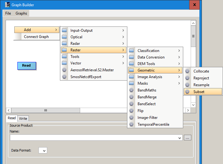
This might sound like a trivial question, but I can’t seem to find a solution. I’m trying to subset S1A files over a given region. This perfectly works when clicking Raster > Subset… from the menu. However, if I want to do this in batch mode using a graph, how can handle this subsetting? I cannot find the subsetting module in the graph builder. What am I missing?
It is important that you are clear about the difference between pixel coordinates and geographic coordinates.
Pixel coordinates are tricky in the batch mode because you likely have shifts between different images, especially when using data of different tracks. Geographic coordinates are good but as long as your data is unprojected (if you want to subset SLC products) the geolocation may also shift a little bit. So don’t choose a too narrow subset window.
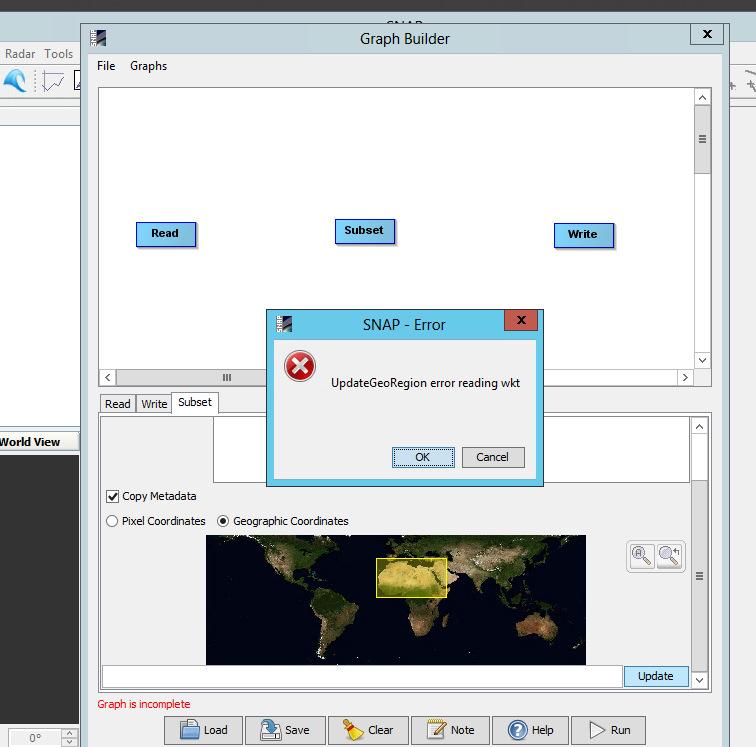
Actually, still running into problems. I found the module now, but I can’t get it to work. In the stand-alone module (outside graph), I can just specify border lat/lon coordinates and that works. I’m not able to enter these in the graph builder apparently. Trying to draw a ROI on the map results in an error:
you are right. I get the same error now.
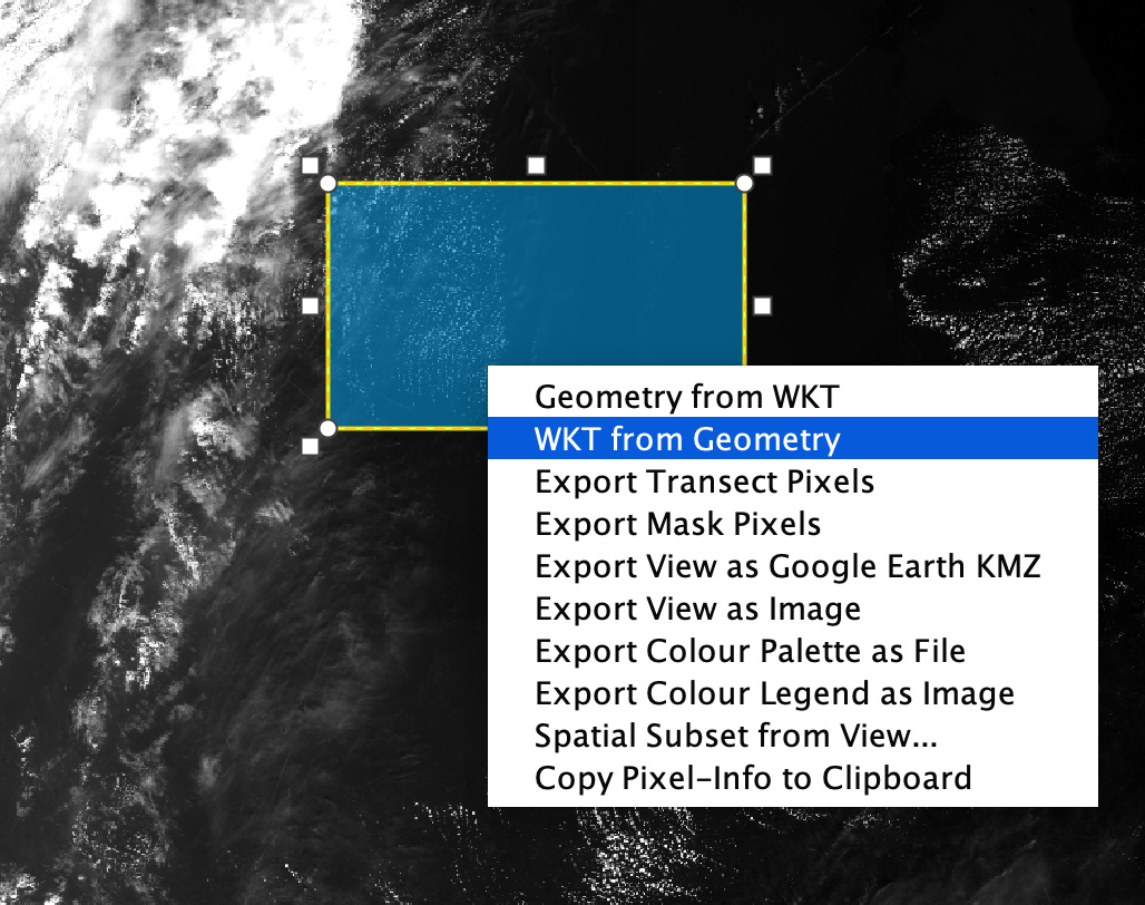
I didn’t get it because I digitized a polygon in QGIS, took the WKT code of it (with the getwkt plugin) and copied it directly in the empty line in snap.
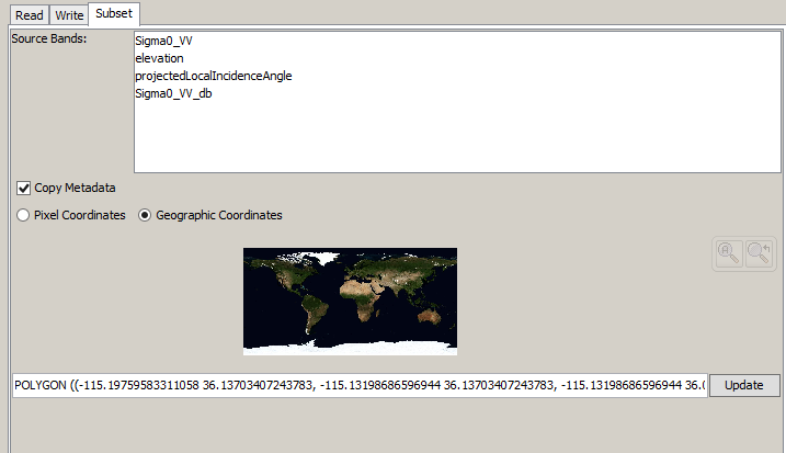
You can also completely do this in SNAP: Digitize a new vector with the boundaries you need. If you then double-click it see get its WKT code. It can be copied to the clipboard and then inserted in the subset module. Click “Update” subsequently and the yellow area changes.
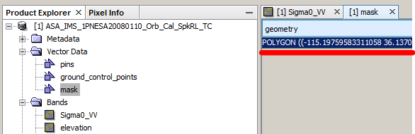
It seems that your product on which you have created the polygon has no geo-coding information. Because the point do look like pixel coordinates or is it UTM?
Within the polygon geometry you should use WGS84 lat/lon values.
I am using raw Sentinel-1 GRD and I’ve created geometry by Rectangle drawing tool on opened scene of Amplitude VH (but whatever - this is not probably important). Then, I’ve opened in product overview by double-click and righ-clicked and copied to clipboard… Paste into the command line of subset and deleted style_css which was also copied (probably bug)
did you solve your problem? i have the same question. as for subset ,i use the ‘WTK form geometry’ in snap, but it is not work. My graph builder dataset is sentinel2- 2Alevel product.
this is my xml file