Undergrad here. My PI doesn’t know how to fix this. Anyone have ideas?
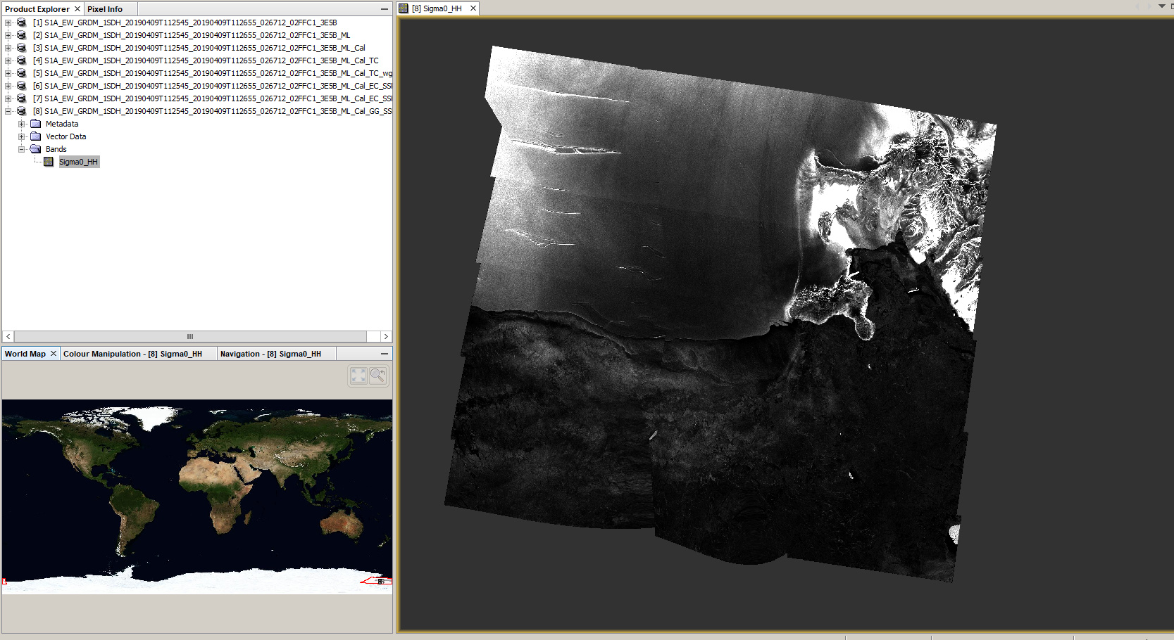
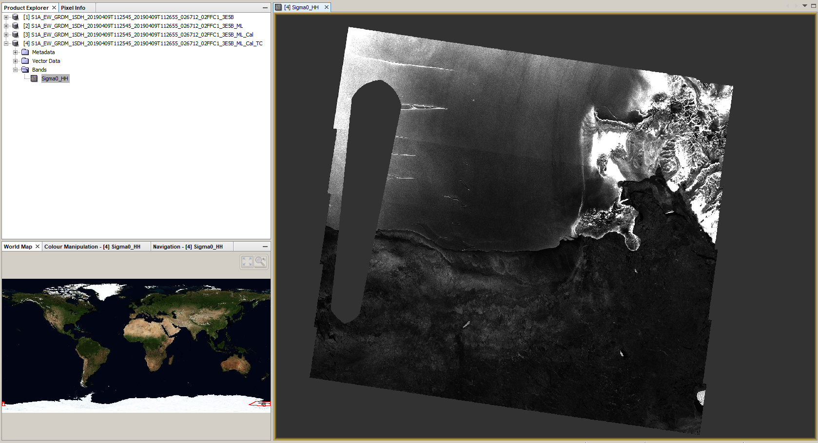
This is Sentinel 1b, level-1 GRD, EW
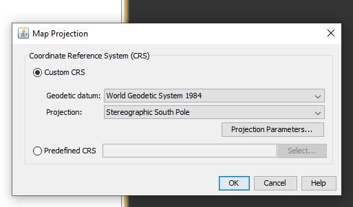
Image has been radiometrically calibrated using the HH gamma band, speckle filtered, corrected for the stereographic south pole, and backscatter corrected to dB Value.
looks like the DEM introduced this pattern.
Did you try to uncheck the “Mask Areas without elevation” option?
I’m not certain at which step I would have an option to do that. It happens with the introduction of Geometric Correction: I have used Ellipsoid correction to the Stereographic South Pole and attempted to use Geolocation Grid but it spits out a mess.
This is only availabe for the Range Doppler Terrain Correction, so it doesn’t apply here.
Have you tested WGS84 as projection for a test?
Does this happen to be close to the 0 or 180 degree meridian? There are some other known issues in those places and I’m wondering if this is related.
Yes, it is close to this area. I am doing this for an internship based on work that a phd student did last year and they didn’t have this problem. Unfortunately, they’re currently in remote field work and cannot answer questions in a timely manner and only I have until mid-August to finish my internship.
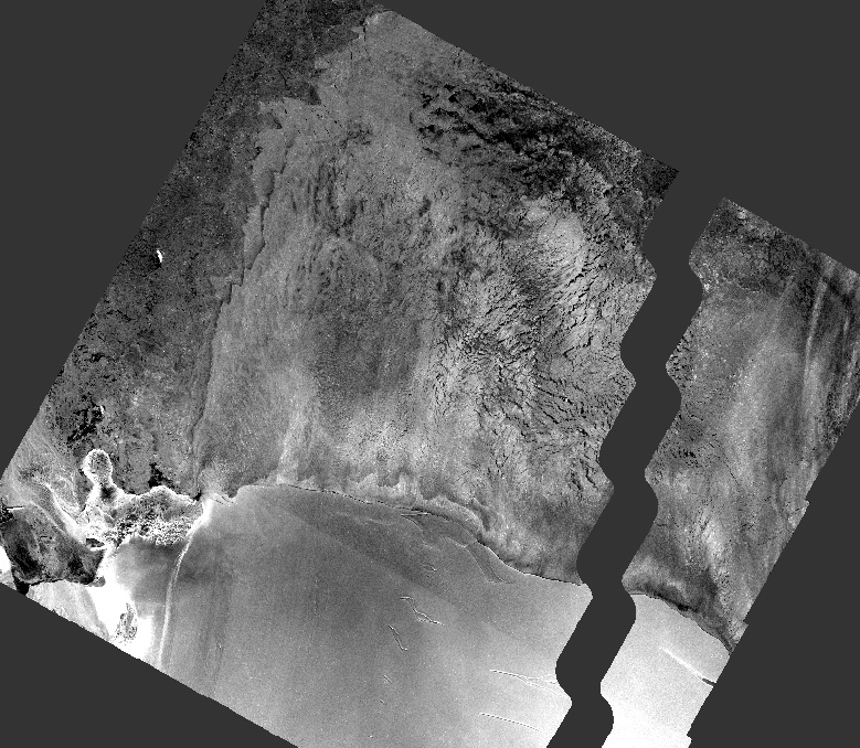
Essentially, it looks like the images are ‘inside out’ as if you looking at it from the backside.
Using the WGS84 projection creates a mess and is still gaped.
Could you please post the id of the product so I can try to replicate this behavior?
S1B_EW_GRDM_1SDH_20190409T103616_20190409T103721_015728_01D845_8E1F
Not the exact same but I had the same problem
I cannot reproduce the error.
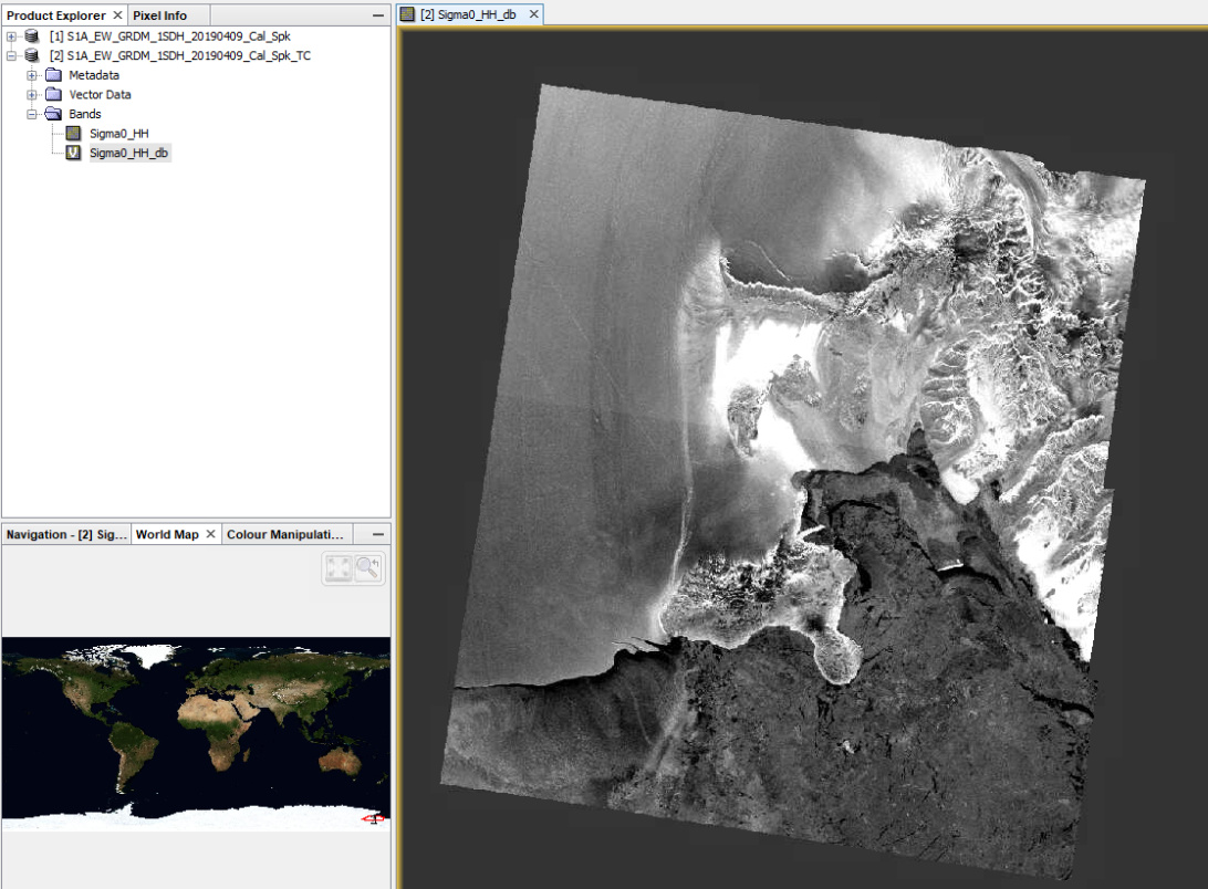
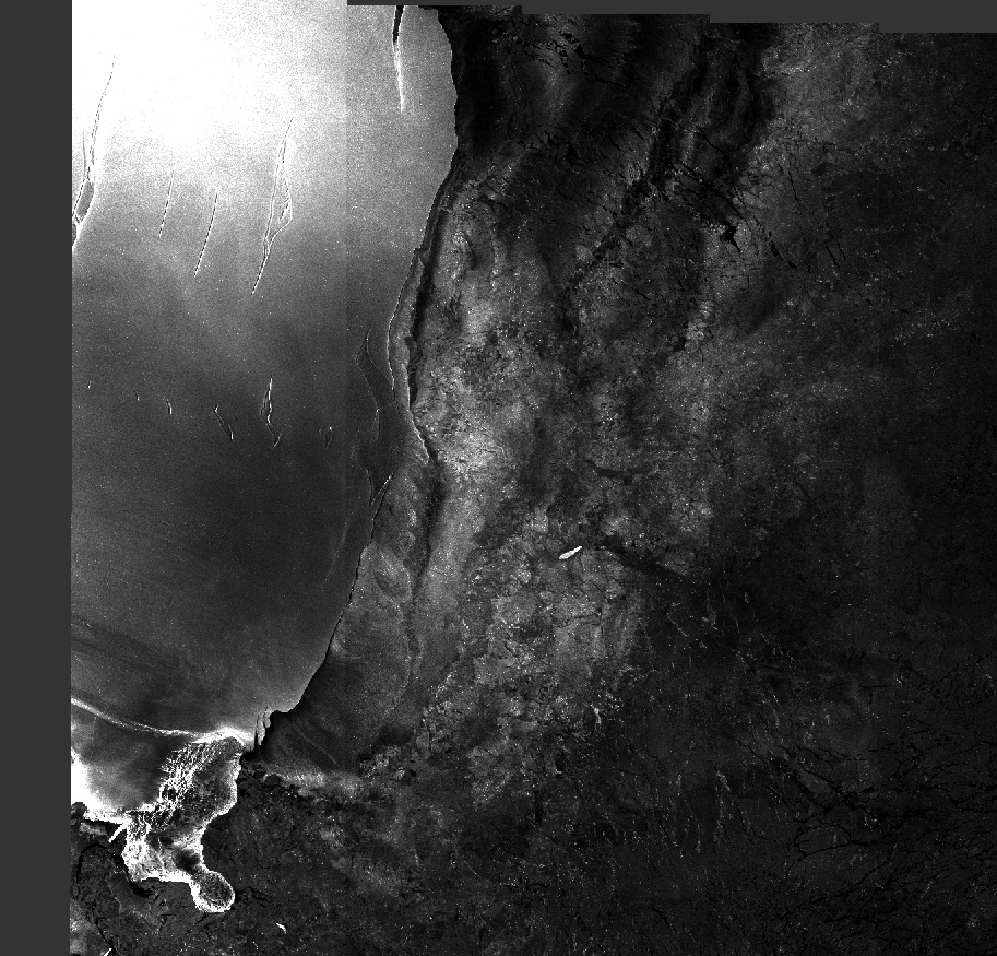
I made a subset (too much ocean), calibrated the product, then applied a speckle filter and then applied Average Height Range Doppler. Both WGS84 and Stereographic South Pole work fine:

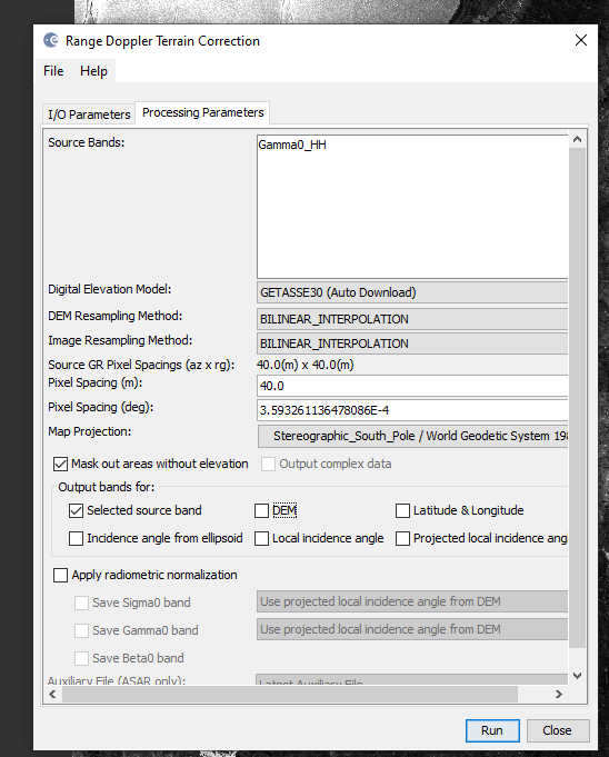
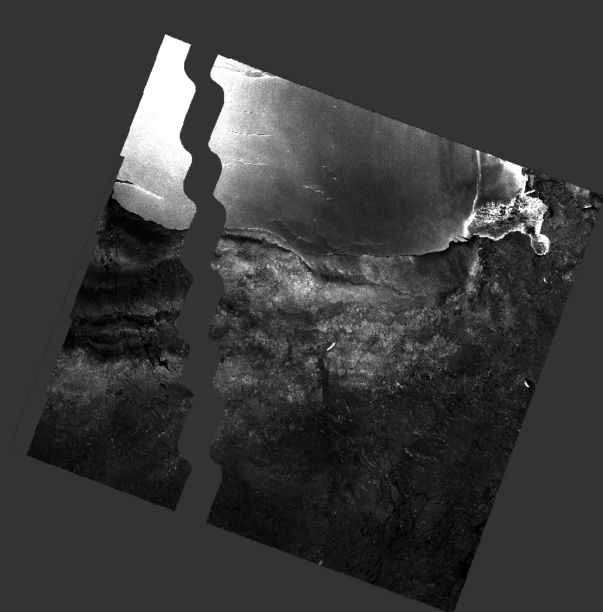
I also tested Range Doppler Terrain Correction using GETASSE30 (un-checked “Mask out areas without elevation”), and this is the result
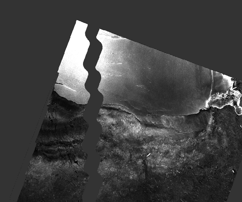
Hmmm. I feel like I’m doing something wrong that’s so basic that everyone else wouldn’t have thought to tell me I should or shouldn’t do it. Also, I’m looking at the open areas in the ocean, the polynyas, so I do need the full stretch off the ice shelf sometimes.
I notice that you’re using sigma, I was told to use gamma: does that have anything to do with this?
I don’t think that the introduced pattern is caused by the difference of Sigma0 and Gamma0.
Your product is upside down compared to mine. Are you sure you have not accidently selected Stereographic North Pole?
Have you checked if the pixels are still inside the product before Ellipsoid correction?
How does one do that?
Also, I noticed at your image comes form Sentinel 1A and I have been using 1B. How much of a difference would that make? Attempting to download the same image but will have to wait for offline retrieval.
Sentinel-1 A and B are quite identical, this cannot be the cause of the problem.
Just have a look at the product after speckle filtering. Is the gap already there?
You can also retrieve Sentinel-1 data from here: https://search.asf.alaska.edu/
What happens when you apply Range Doppler Terrain Correction using GETASSE30 as DEM and Stereographic South Pole projection?
I tried it again with the entire image and now have a similar pattern.
It is maybe caused by the 180 degree border (date line).
We recently had a similar problem: About single polarization and dual polarization SLC interferometry
What worked for me is the Geolocation Grid ellipsoid correction