@dsmilo Thank you for being kind to send your comments.
I can not provide figures about coherence just after the coregistration since the processing is done by the graph. I can make an experiment, but I guess the estimated coherence by the InSAR stack overview can be considered.
I’m considering the result not-good-enough since I’ve obtained much better results after unwrapping.
What I can do by now is to try with DEM where the sea is set to NaN
coherence is created in the interferogram step and transferred to the subsequent products (unless explicitly excluded)
they are not really comparable, because the estimated coherence does not include decorrelation by different types of landcover in a spatial way. Would be interesting to see how the coherence of your study area looks, especially because you say that you retrieved better results with other image pairs (if I understood you correctly).
In your figure, I see a coherence band
It looks like the lower left quadrant of your scene is either water or very dense forest, with very low coherence, so the unwrapped phase is completely unreliable there. The rest of the scene looks reasonable.
1 Like
I’d like to thank all that reply here -
@dsmilo it provided me other view of the picture since the processes are quite slow and no fringes can be seen
@ABraun - always ready to give a nice advice
@EJFielding - you are correct some of the data are from sea surface.
Below I will put an image after terrain correction step with values above 0.3 over-imposed GE raster
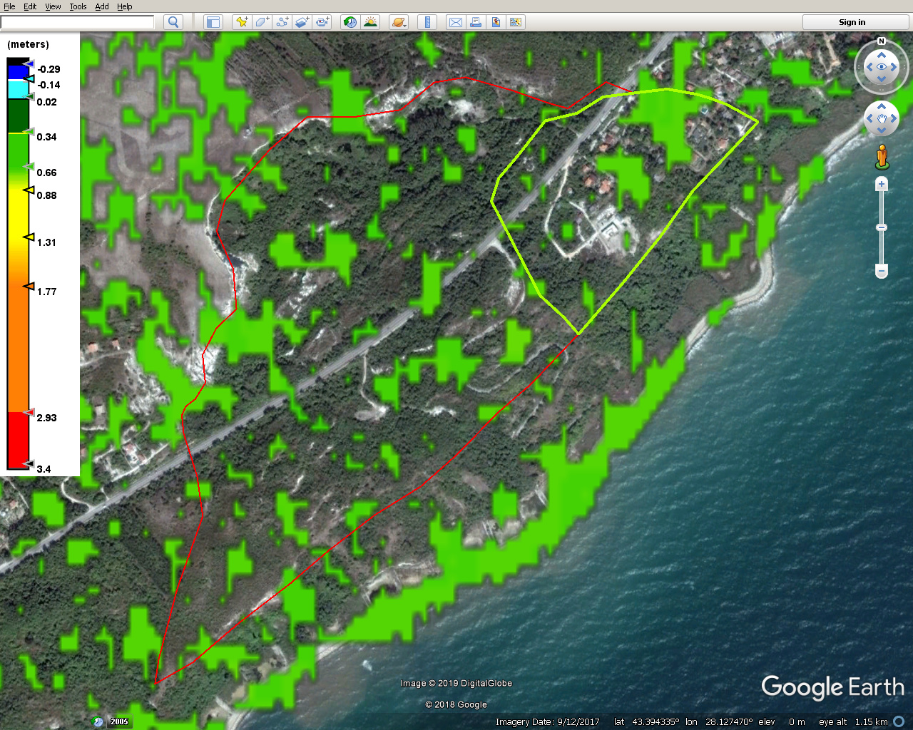
red and green lines are two of the landslides registered
1 Like
An interesting study on spaceborne landslide monitoring and measurement was recently published:
It summarizes the potential and constraints of multi-temporal radar approaches and gives recommendations for best configurations.
1 Like
@ABraun Thank you. The paper is nice as provides clues how to select SAR data for a project.
1 Like