Cordial greetings to all. I find it very pleasant to read the problems and solutions that are raised in the forum. By reading and rereading what they express, I have learned enough to make an adequate interferogram.
I have used the A Braun tutorial and others from 2021
I have numerous questions for the successful development of DinSAR in a mountainous relief area with a tropocial moist forest forest cover. It is a dam site in the tropical humid forest where the civil works of the project are concentrated in an area of 0.25 km2. I am interested in knowing if the surfaces covered with concrete present systematic deformations, such as surface subsidence.
The first to ask are:
If Bn (Bperp) = 0 and Btemp (days)> 100-200 days, does the quality of the interferogram to be constructed improve?
Or is it preferable to use successive radar images with a Btemp of 12 days? and then obtain the average offset of several interferograms
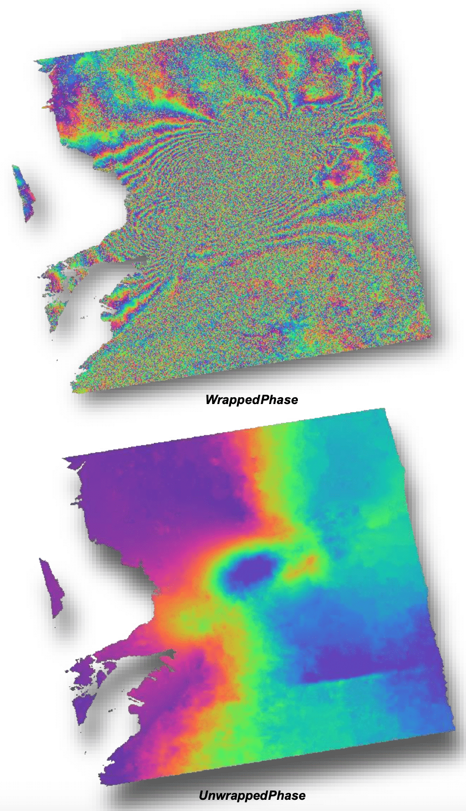
When developing the interferogram is where I have my greatest challenge. I must select the area avoiding incorporating forest and leaving only dewn surfaces covered with concrete.
In this case my questions are:
When unwrapping the interferogram is there a minimum area threshold to use?
If in the area of interest, there are pixels with a high coherence value but also with low coherence, how do I proceed to obtain a suitable unwrapped interferogram?
My problem is that when using “subset” zones larger than the area of interest, the unwrapped interferogram is a systematic color ramp to express the displacements, which as well expressed in the forum is an error indicator