Hi everyone,
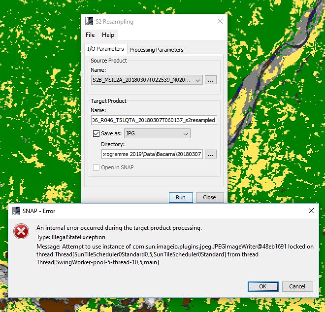
I am now having the L2A product derived from sen2cor. I would like to output the scene classification image result and then process it in ArcGIS. However, the SNAP remind me of resampling the L2A product. I am now trying to resample it through the S2 resampling processor. I tried and changed parameters many times. But every time when I was coming to the end of the process, the system will give me an error result like the screenshot. Is there anyone who can help me solve the problem?
Many thanks.
This message might be related to the RAM,
RAM is not enough to complete the process,
Also sen2cor and resembling are the preprocess steps , before any othe advanced.
I think so. As I try to resample it at the scale of 60m resolution and it achieved!
Do you know how large the RAM should support the resampling?
By the way, would you like to share the idea of resampling with me? If I hope to analyze L2A product, is it very necessary for me to resample the product directly derived from sen2cor? And why?
Cheers!
Please take a look at the following post, it gives a brief summary about resample meaning,
Source of the post
sen2cor is Atmospheric correction operator convert the image from TOA Top Of Atmospher to the Bottom OA, it’s more necessary to apply when you compare multiple date,
For good case the RAM should be 16 GB.
Many thanks for this. Actually at first I just want to get the classification image of L2A product and then put it in ArcGIS to make comparison with other data. But if I do not do resampling I can not drag the classification image out of SNAP to do further analysis. Do you have a good solution for this?
Best wishes.

I finally checked that my computer RAM is 32 GB. Actually at first I just want to get the classification image of L2A product and then put it in ArcGIS to make comparison with other data. But if I do not do resampling I can not drag the classification image out of SNAP to do further analysis. Do you have a good solution for this?
Many thanks for this.
This is not clear to me, But as I explained to you in the previous post, the goal of the re-sampling and sen2cor, as a pre-processing steps, once you have implemented whatever classifier, it’s possible to open your result in any GIS software,
Please take a look at the end of this post,
Source of the post
Thanks a lot, I think your relating post is pretty useful!

