hai, i am a newbie here to process data with sentinel 1 and snap.
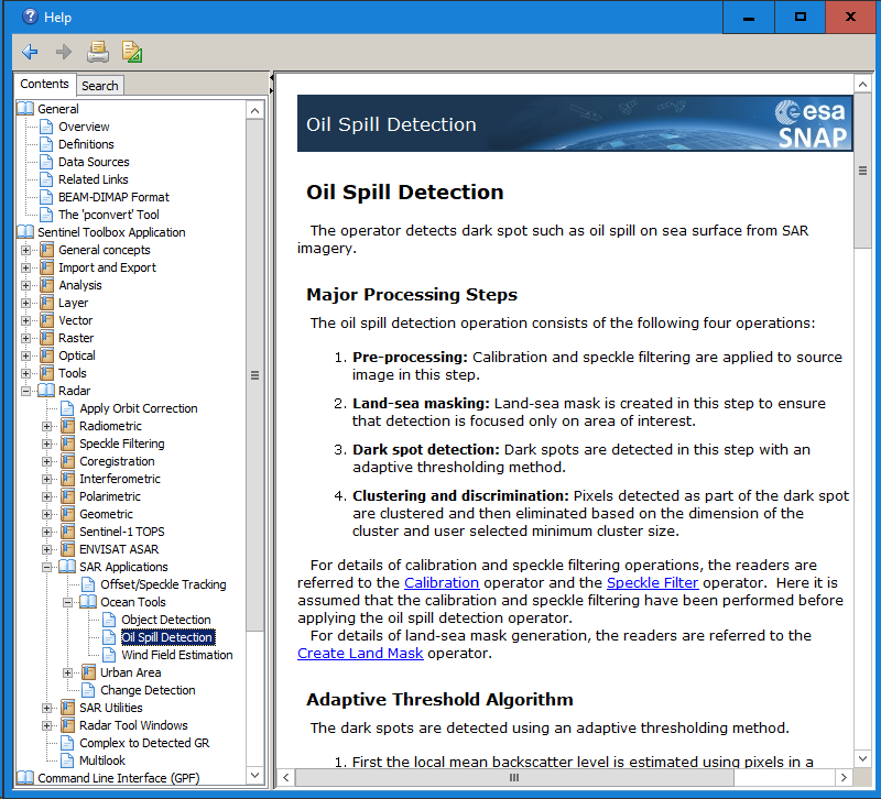
i am interest to detect oil spill using sentinel 1 with tools oil spill detection on snap, the area is in a bay, so land still found there.
is existence of land influence process and result of oil spill detection ?
You mean if you can search for oil spills over land areas? The SNAP module only works over water bodies but is quite reliable as long as the water is calm and the surface is smooth.
I did read help windows, it give an logic explain, i mean formula like in wind field estimation. Hehe
Thank you for your journal recomendation Mr.ABraun, i will read to understand more
I’m afraid there is no formula which directly translates SAR backscatter into classified pixels of oil. It is rather based on moving window and thresholding techniques.
okay Mr, thank you for the answer.
i want to ask another question in this topic. what is the reason to put “background window size” value ? how to determine appropriate background windows size ?
Sorry for another topic i’va made, i think its different topic
So is it allowed to use same value of background windows size and Threshold on multitemporal data ?
I’d say your results are most comparable if the same parameters are used for every image. Also radiometric calibration is advisable for any multi-temporal analysis.