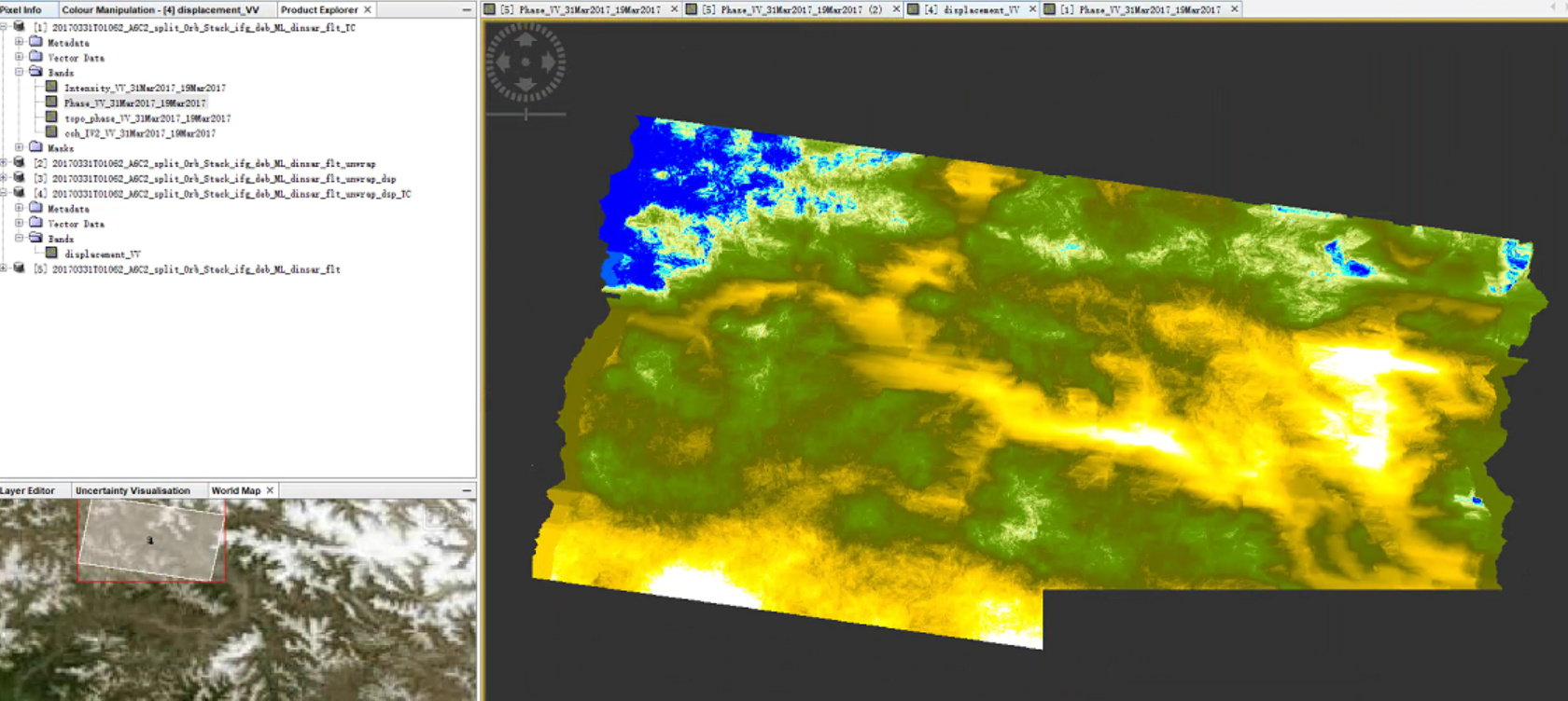
I am going to detect landslide in the area which is mountainous area but displacement map which I got and the fringes in the phase are very different, I need your suggestions, I am sharing my phase and displacement map here.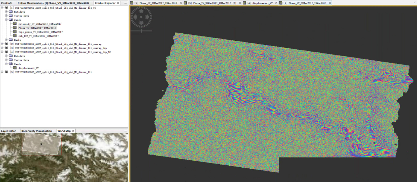
maybe you can specify your question.
Landslides are hard to measure because they often occur within short time and cause phase decorrelation. It is always worth to check the coherence image as an indicator for the quality of your result.
Have you considered these points?