How to remove the low coherence zone? Is it necessary that the cut-off number will the same for iw1and iw2. While we have the different deformation rate?
you mean if you should apply the same coherence threshold for different sub-swaths?
It would make sense too me to, but maybe a screenshot of your data would help to clarify your question.
have you tried to apply TOPS merge before the terrain correction so that both swath are in the same product?
yes sir, i tried, i used TOPS merge after deburst, and done successfully.
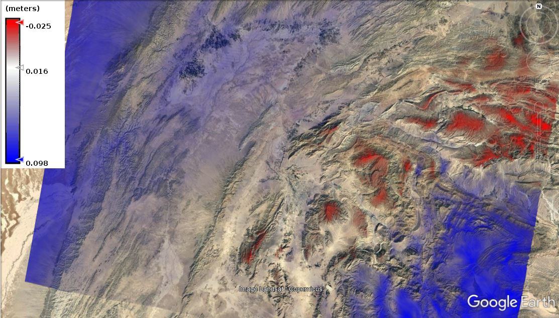
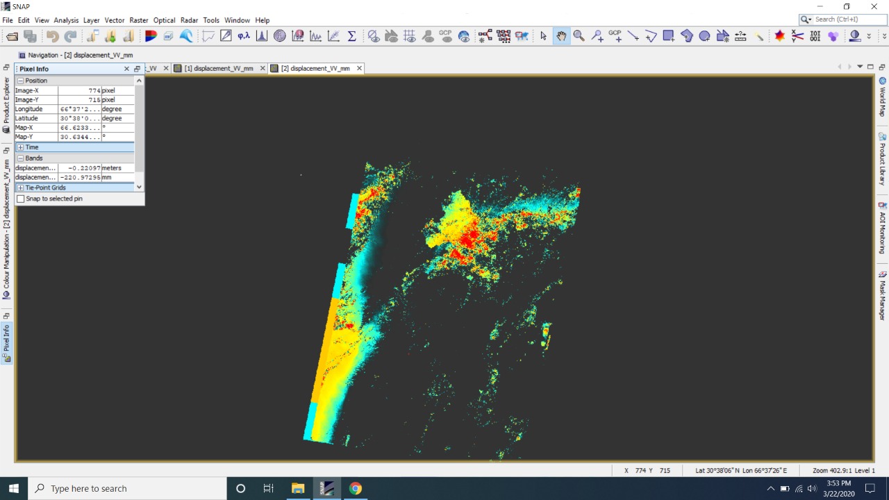
Sir what is this mean? this is basically displacement map showing subsidence and uplifting. my Question is, what these fringes type of subsidence and uplifting means?
I can’t tell if it makes sense, you are the expert in your study area 
Have you included
- topographic phase removal?
- phase unwrapping?
Doesn’t look like the typical displacement to me.
yes, all processes has been done. this subsidence is basically, due to ground water withdrawal and the area is active tectonic nature as well. i am confused that what this map shows.
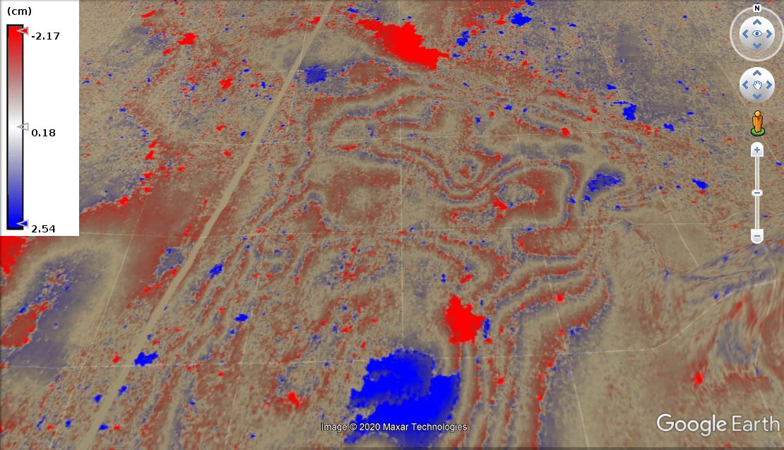
very interesting pattern. Would you mind sharing the initial (filtered) interferogram and the coherence image?
yes off course. kindly contact on Edit: address removed
I meant as a screenshot in here
1 Like
Phase img, low coherence has been removed, the above uploaded Picture was zoomed area some where in this phase.
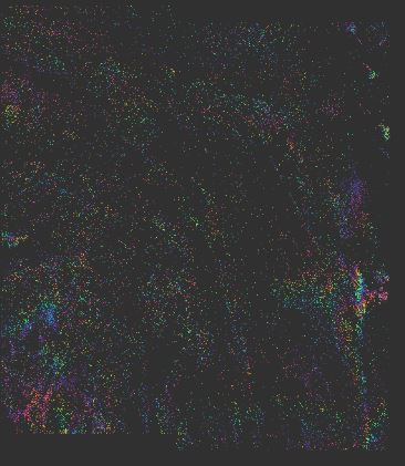
coherence of IW1 and IW2 merged sub-swaths
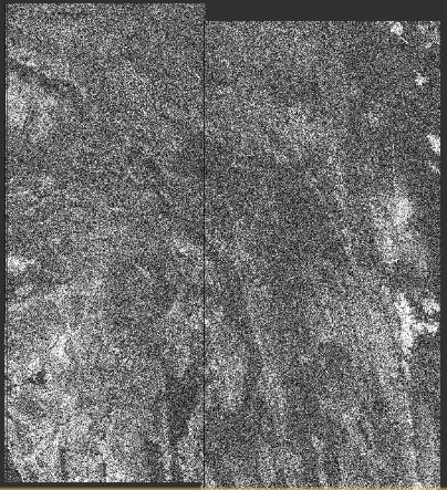
Uh, there are pretty much gaps and low coherence areas. I’m not convinced that the unwrapped results can be trusted.
Many of them could also be unwrapping errors caused by phase noise.
Do you have the chance to find an image pair with higher coherence?
sir i have used one year temporal time, the area is arid and not having vegetation. this is why the gaps are.
now what should i do to remove the phase noises?
The area has only these images pairs that i have downloaded. which has both VV and VH polarization.
Try temporal baselines of 6 or 12 days, but for different times of the year, to get higher coherence, less noise and clearer fringes. I think you can find more suitable pairs.
You only need VV for the analysis and you should select in in TOPS Split to reduce the amount of data.
Where is your data located?
1 Like
Thank you Sir.
Let me know, if I try temporal baselines of 6 or 12 days so how could I compute the subsidence rate for one year?
Maybe not reliably with one image pair, but with some more.
Please check how this is tackled in this tutorial
Sentinel-1 TOPS interferometry (page 23, ‘Suggestions for further analyses’)
1 Like
Got it, thank you very much.
I may dare to ask some-more Questions and hope you will reply immediately as this is your greatness.