How can compare my elevation result with ‘ASTER DEM’. There is a option to adding band for ‘ASTER DEM’ but it is empty. Shall I subtracted the mosaic I made from my elevation result for checking quality?
You told me:
As a last step, you can apply Tange Dopper Terrain Correction so both elevations are projected into a coordinate reference system Then you can stack them and compare the elevations.
Shall I do it now?
I tried to do it (figure 1) but them my result is like this (figure2). I think something is missing in image.
Another thing that is weird for me is here;
Why when i applied terrain correction by using external file, the result is bigger that my elevation result. Please look at below;
Only use the elevation generated by InSAR as the input (as you did)
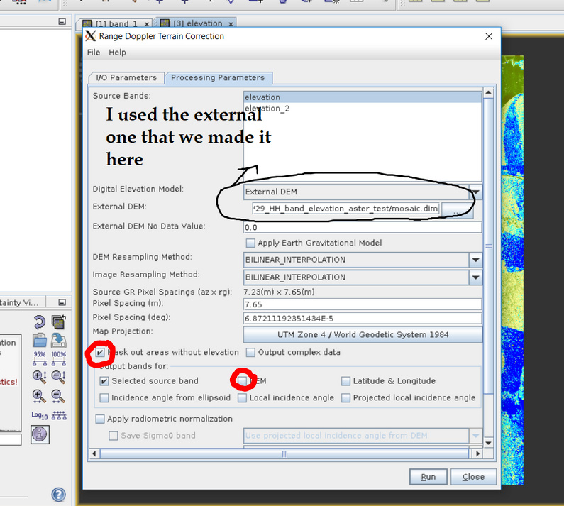
Using the ASTER here is totally fine. Make sure you check “DEM” in the terrain correction step. This writes the ASTER DEM in UTM coordinates into your target product so you can compare later.
If you do this with the InSAR elevations of both dates, the results will be of the same size and coordinate system and then you can select “Radar > Coregistration > Stack Tools > Stack” to bring them into one final product.
I made elevation result and the ASTER DEM in UTM coordinates (figure1) but it seems a little strange although I did not work with DEMs but why the ASTER DEM has DEM over some area of ice and does not have DEM over other parts?
Another idea, I made a mosaic and I think the resolution was changed after making mosaic.
Yes. Now I got the point, making mosaic reduces resolution.
Any idea about it?
that’s possoble. You can use the measure tool to see how large the single pixels are.
I see that you have just updated your post. Strangely, the DEM was resampled for mosaicing.