How to check mid incidence angle in sentinel 1 datasets?
these two may help you
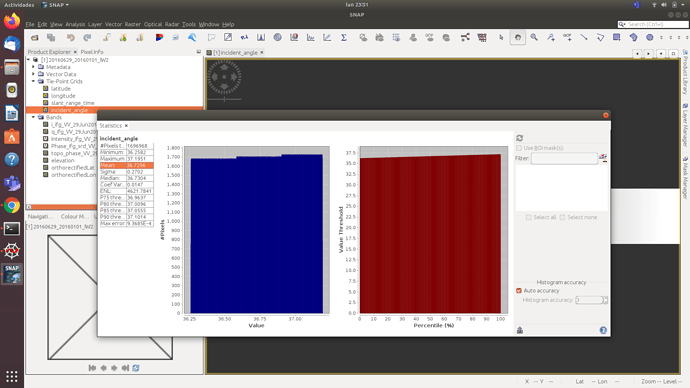
Thank you sir… I checked in SNAP Tiepoints its shows, mim,max and mean. whether its right one or else I have use band math functions to resolve…!
maybe there is also the mid-range incidence angle in the metadata, but I don’t know that.
Hello,
how can I determined, for each PS by Stamps, the angle of incidence?
in order to calculate the Vertical Displacement by the formula:
𝐷𝑣𝑒𝑟𝑡 =𝐷𝐿𝑂𝑆/cos(𝑟𝑎𝑑(𝜗𝑖𝑛𝑐𝑖𝑑𝑒𝑛𝑐𝑒))
perhaps it is by opening in SNAP the image of 1 of all the interferograms that are generated? (since they all have the same mean)
You can export the PS as points from StaMPS ad described here.
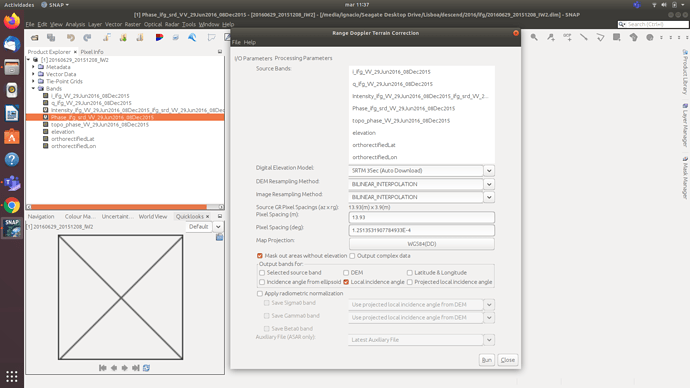
Then process one single image in SNAP and select “local incidence angle” as output band in the Range Doppler Terrain Correction.
Hi there
I have not understood your kind reply.
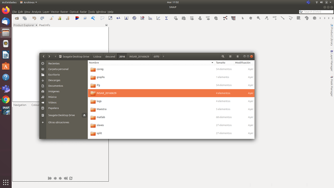
What image should I use in SNAP: master, slaves, ifg, split, coreg, INSAR_20160629?
since the CSV file you suggest me to use is not supported as read in SNAP
Assuming that the interferogram is the product I should choose, what source bands should I select to perform the “” local incidence angle “”?
Regards.
this calculation can no longer be done in SNAP, I recommend QGIS or another software where you load the exported PS and the raster of the local incidence angle
To get the raster of the local incidence angle, deburst any of your split products, then apply Range Doppler Terrain Correction (using SRTM 1Sec as DEM) with the option of the local incidence angle checked. This will create an img file inside the .data folder of the terrain corrected product.
Hi.
I have a doubt about it, if I compare the local incidence angle on different dates I get different values for the same pixel.
This generates me doubts about which image I have to choose to obtain the information of local incidence angle? or maby i should determinate the Mid incidence angle to use:
𝐷𝑣𝑒𝑟𝑡 =𝐷𝐿𝑂𝑆/cos(𝑟𝑎𝑑(𝜗𝑖𝑛𝑐𝑖𝑑𝑒𝑛𝑐𝑒))
Regards.
the local incidence angle should not change between different dates of the same track. Can you please give an example?
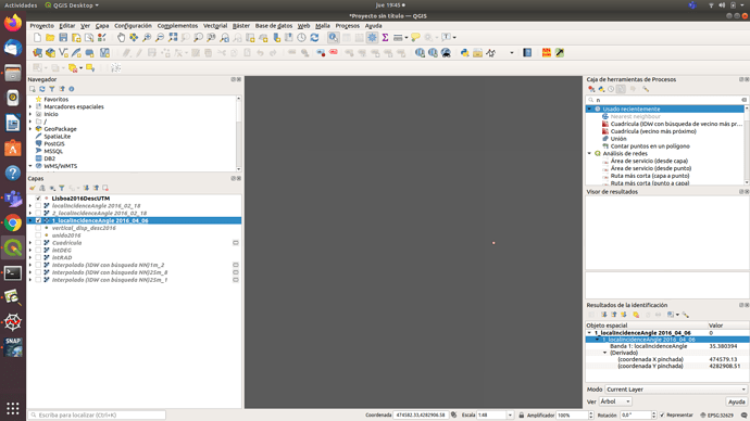
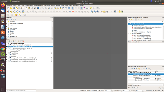
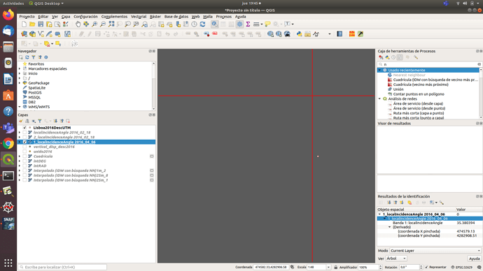
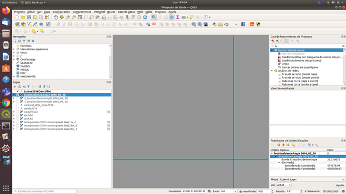
As you can see I have a PS (in pink), in that pixel I have compared the local incidence angle for different dates, first image (20160406_IW2.dim) date of 2016/04/06 the pixel reports a local incidence angle with value 35.38039.
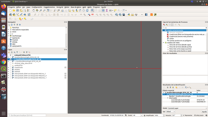
The second image date of 2016/02/18 the pixel reports a local incidence angle with value 35.245464
These two images were created as follows:
selection of one of the images created with snap2stamps by the command
python splitting_slaves.py project.conf
import to SNAP and use S1-TOPS deburst and range dopler terrain correction (as indicated)
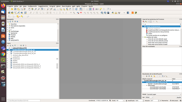
Also a third image was used to verify if the pixel value also changed if another product was used.
In this case IFG selection of one of the images created with snap2stamps by the command
python coreg_ifg_topsar.py project.conf
it is imported to SNAP and used directly range dopler terrain correction.
The value also changes even choosing for it the same date 2016/02/18
the pixel value is 35.210075
the coordinate you selected lies at the edge of several pixels. It’s not surprising to me that the values are ot 100% identical, because the three dates do not share the same grid (they are slightly shifted, depending on the acquisition geometry).
Also, the DEM is resampled to the resolution of the radar image using bilinear interpolation, so depending on the grid spacing this can also introduce differences.
Lastly, I doubt that the differences decimal places will distort your result in a harmful way, especially because the phase error is probably much larger that the angle used for conversion. You will also need the incidence angle of the descending image (potentially containing the same amount of variation).
I recommend using one ascending and one descending local incidence angle raster for the computation of the vertical component.
Thank you very much for the clarification
A question. about your suggestion
Would the vertical movement be the average between the result of the ascending raster calculation and its angle of incidence + descending raster and its angle of incidence?
Something like that?
Vertical raster = (ascending raster 𝐷𝐿𝑂𝑆/cos(𝑟𝑎𝑑(𝜗 ascending 𝑖𝑛𝑐𝑖𝑑𝑒𝑛𝑐𝑒)) + descending raster 𝐷𝐿𝑂𝑆/cos(𝑟𝑎𝑑(𝜗 descending 𝑖𝑛𝑐𝑖𝑑𝑒𝑛𝑐𝑒))) / 2
to me this looks too easy, because ascending and descending can point into completely diffeernt directions, especially when lateral movement is involved.
assuming that in a single pixel there are 2 PS (Ascending and Descending)
I understand that the value of both vertical displacements for that pixel (both ascending and descending), should be “similar” right?
it’s not necessarily similar, because of the different looking direction. A pixel can move away from the sensor in ascending direction while it moves towards the sensor in descending direction.
In case of straight vertical movement, thei value should be similar, but there are many cases where this is not the case, all depending on the type of deformation. We have many topics on this:
- Difference between vertical and LOS displacement
- Vertical displacement senitnel 1 interpretation
- Vertical and horizontal displacement
- The phase shift originates from horizontal or vertical displacements
Two posts with references to formulas:
Hi @ABraun .
To combine the ascending vertical displacement and the descending vertical displacement and being able to get 1 single result for each pixel, would I only have to apply the Vector Decomposition? That is, the following formula:
d = √ ddes² + dasc²
I’m afraid, i’ts not that simple, because the incidence angle plays a role as well.
A suggestion is made in this paper of @mdelgado Remote Sensing | Free Full-Text | Measuring Urban Subsidence in the Rome Metropolitan Area (Italy) with Sentinel-1 SNAP-StaMPS Persistent Scatterer Interferometry
Hello I just wanted to ask, should I normalise (use one mean incidence angle) to determine the vertical displacement from LOS or use the incidence angle raster to compute the same? Thank you.
