Hi,
I am trying to Mosaic a set of OLCI L2 files made with NASA’s L2gen. I have done this in batch for L2 files produced with C2RCC. POLYMER and OCsmart, however I seem to have an issue with L2gen files.
I believe it has to do with the fact the L2gen files stores the geolocation data as a variable and each variable with size of lines and pixels per lines. I am attaching an example file an example for th L2gen netcdf file and my xml file that has worked for other atmospheric correction processors.
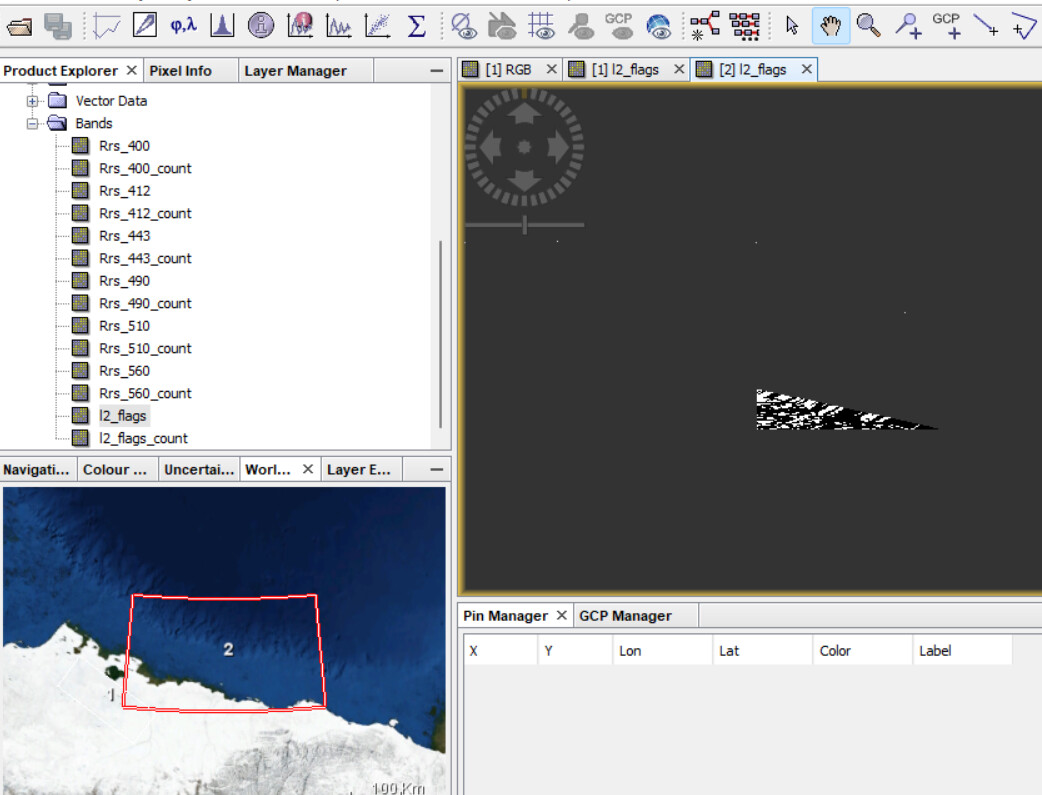
The source product you have provided is almost complete out of your defined bounds and has only a few valid pixels. But I think this is only an example.
But when using your settings, I see the small overlapping part in the mosaic.
What kind of an issue do you refer to.
One issue I see is at the edge of the source image. Even better visible when adapting the mosaic area to the input scene.
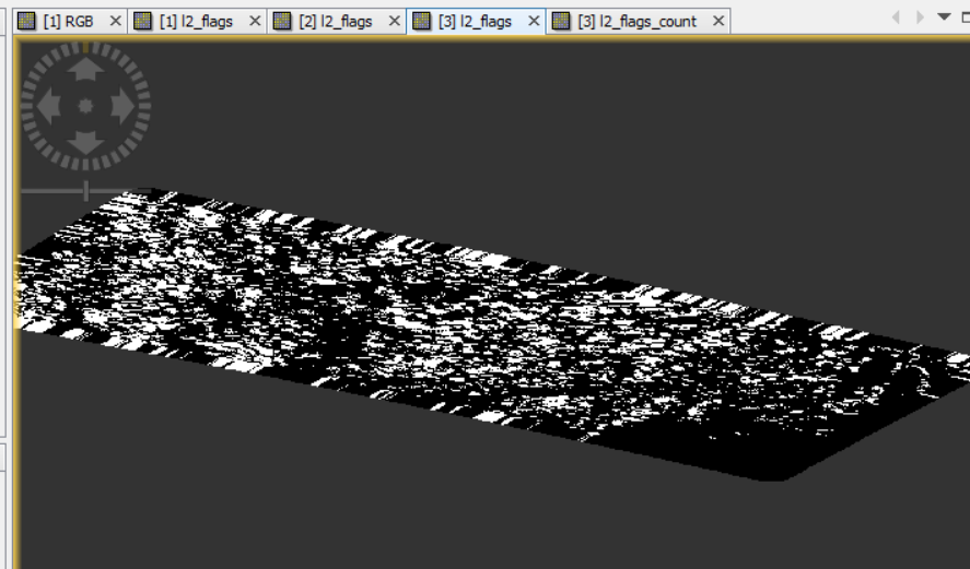
Up to a certain distant the closest pixel is searched, and this leads to a duplication of pixels. The searching is necessary for the pixel-based geocoding.
This has been observed before.
The second one contains a workaround. But this would mean that you need to do the l2gen processing again.
You cut out a larger area, do the l2gen processing on them, and then reprojecting the scenes and cut out the final region.
Thank you Marco. Sorry I posted a semi-complete question and yes you are right the file I added was an example, but should have added on with more significant overlap. To make this more clear I am attching the error message I get once running the code. For each file that is included in the mosaic and is read, the following is outputted:
INFO: org.esa.snap.core.gpf.operators.tooladapter.ToolAdapterIO: Initializing external tool adapters
INFO: org.esa.snap.core.util.EngineVersionCheckActivator: Please check regularly for new updates for the best SNAP experience.
Executing processing graph
INFO: org.hsqldb.persist.Logger: dataFileCache open start
done.
Error: [NodeId: Mosaic] Operator 'MosaicOp': Unknown element 'elevatioodelName'