Hi
I’m wondering if anyone has any insight into this issue or perhaps a work around. Is it a bug?
Here’s hopefully a clearer description of the problem which as i mentioned only showed up after v6.0.1.
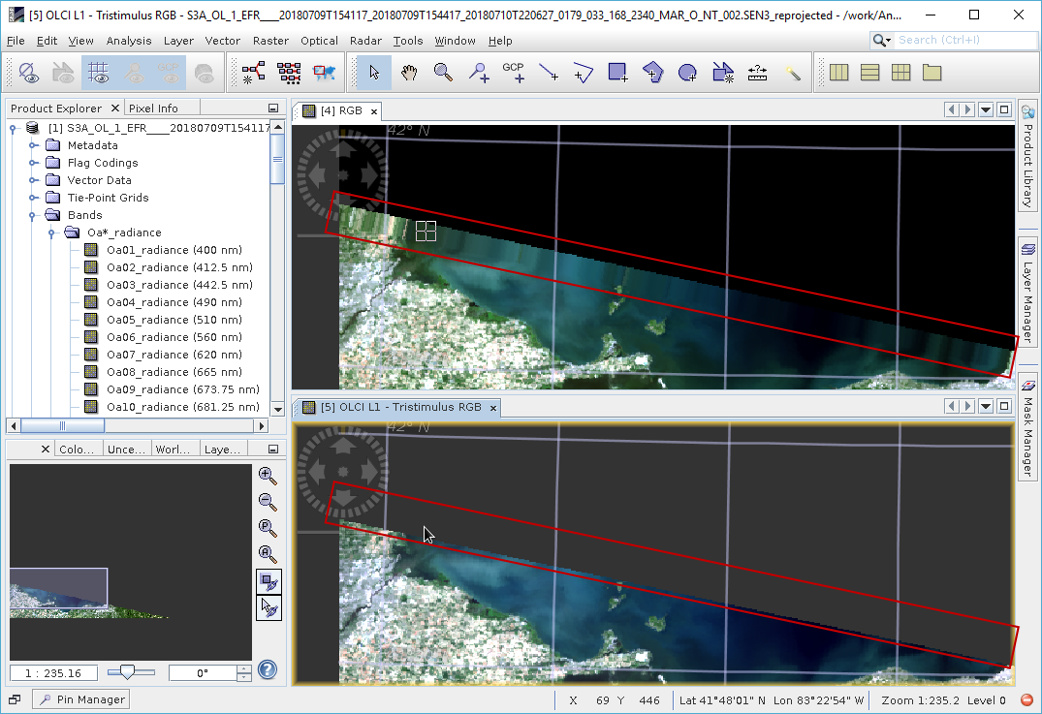
I’m reprojecting an OLCI L2 NetCDF file generated by SeaDAS l2gen from a Sentinel_3a L1B to a fixed WGS84 UTM N17 300m grid that is only partially covered by the input file. In this example the grid extents north of the granule. I’d expect all cells beyond the extent of the source data to be filled with NaN’s but since v6.0.2 that’s not the case (as seen upper image attached below).
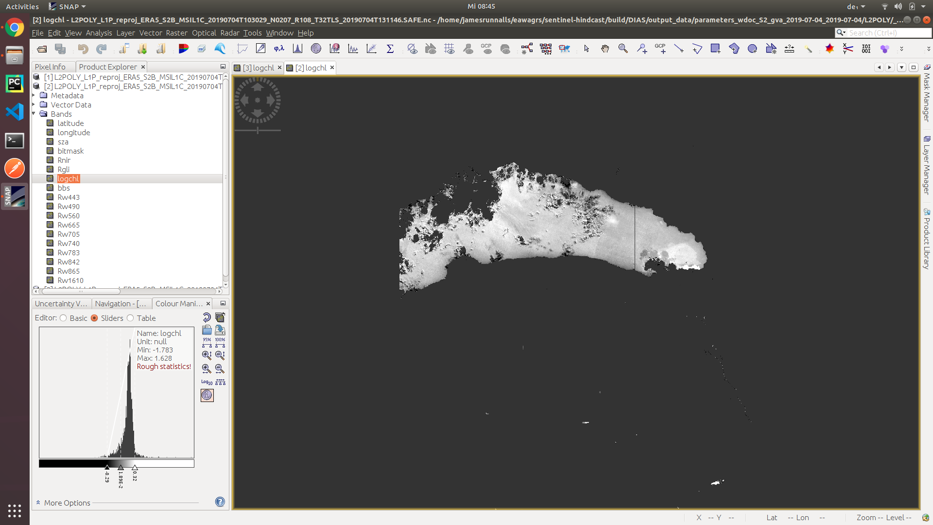
If performing the same operation, but changing the input to the L1B SAFE file, the projected image looks as expected (as seen in the lower image attached below). There is no buffering of the data beyond the extent of source data.
This problem is not limited to just this example, but occurs whenever reprojecting a granule that only partially covers the extent of the grid to which it is being projected.
The source in this example was S3A_OL_1_EFR____20180709T154117_20180709T154417_20180710T220627_0179_033_168_2340_MAR_O_NT_002.SEN3.
Sample reprojection graph:
<node id="reproj_node">
<operator>Reproject</operator>
<sources>
<source>read_node</source>
</sources>
<parameters>
<wktFile />
<crs>PROJCS["WGS 84 / UTM zone 17N",GEOGCS["WGS 84",DATUM["WGS_1984",SPHEROID["WGS 84",6378137,298.257223563,AUTHORITY["EPSG","7030"]],AUTHORITY["EPSG","6326"]],PRIMEM["Greenwich",0,AUTHORITY["EPSG","8901"]],UNIT["degree",0.0174532925199433,AUTHORITY["EPSG","9122"]],AUTHORITY["EPSG","4326"]],PROJECTION["Transverse_Mercator"],PARAMETER["latitude_of_origin",0],PARAMETER["central_meridian",-81],PARAMETER["scale_factor",0.9996],PARAMETER["false_easting",500000],PARAMETER["false_northing",0],UNIT["metre",1,AUTHORITY["EPSG","9001"]],AXIS["Easting",EAST],AXIS["Northing",NORTH],AUTHORITY["EPSG","32617"]]</crs>
<resampling>Nearest</resampling>
<referencePixelX>0.0</referencePixelX>
<referencePixelY>0.0</referencePixelY>
<easting>281282.934996</easting>
<northing>4764308.997997</northing>
<orientation>0.0</orientation>
<pixelSizeX>300.000000</pixelSizeX>
<pixelSizeY>300.000000</pixelSizeY>
<width>1377</width>
<height>639</height>
<tileSizeX />
<tileSizeY />
<orthorectify>false</orthorectify>
<elevationModelName />
<noDataValue>NaN</noDataValue>
<includeTiePointGrids>true</includeTiePointGrids>
<addDeltaBands>false</addDeltaBands>
</parameters>
</node>
</graph>
Thanks,
Andrew