what do you mean with DEM? I’m quite unfamiliar with snap, i’ve just tried everything suggested in this post.
Have you installed all updates?
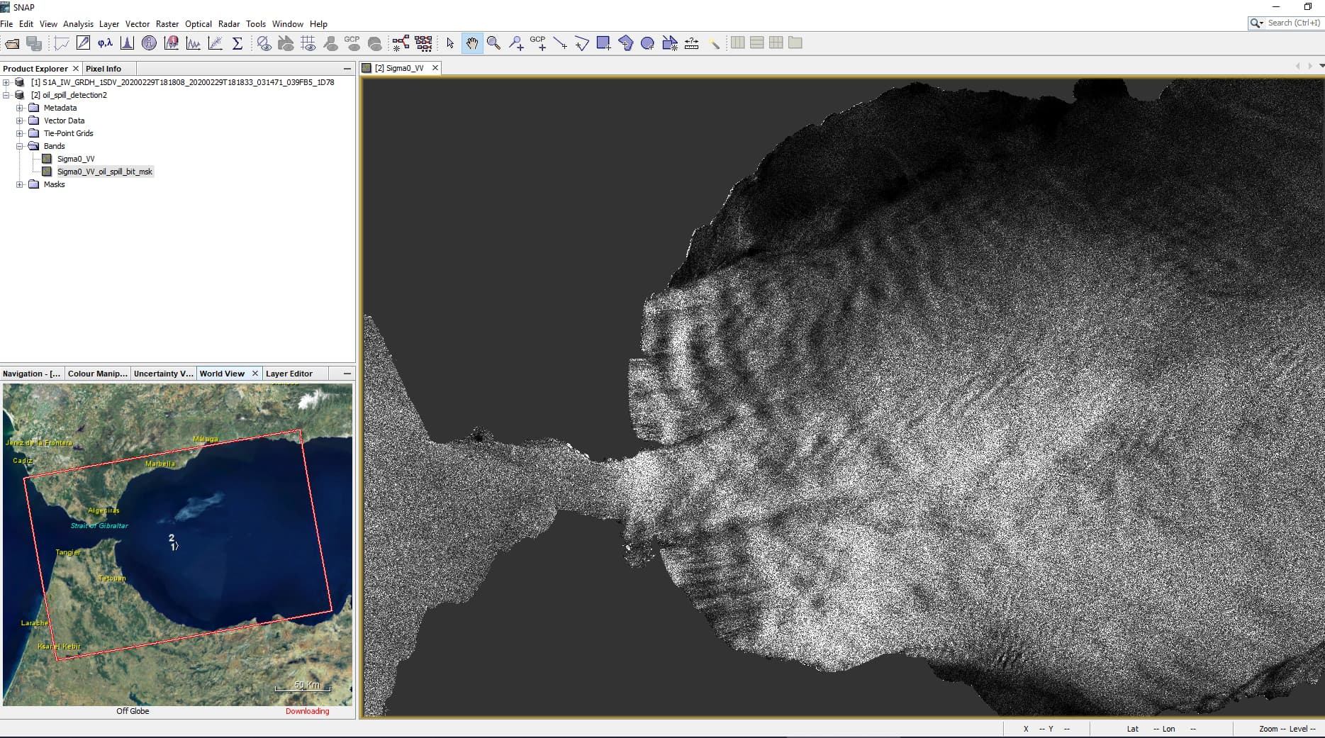
The location of digital elevation models (DEMs) has changed last year, so when SNAP tries to download one to mask out the land, it can get stuck.
Yes, I have installed all updates.
I just left it all night, and after 13hours (!!!), it has done the oil detection.
Isn’t it too much? There isn’t a way to speed up a little bit the process?
Ship detection is done in like 1 min, and this takes so long… is so strange. (12G of RAM given to snap)
edit: thanks for the answers and for the help
Yes, it should not take so long - somehow SNAP has problems downloading the DEM resources correctly.
Have you tried this?
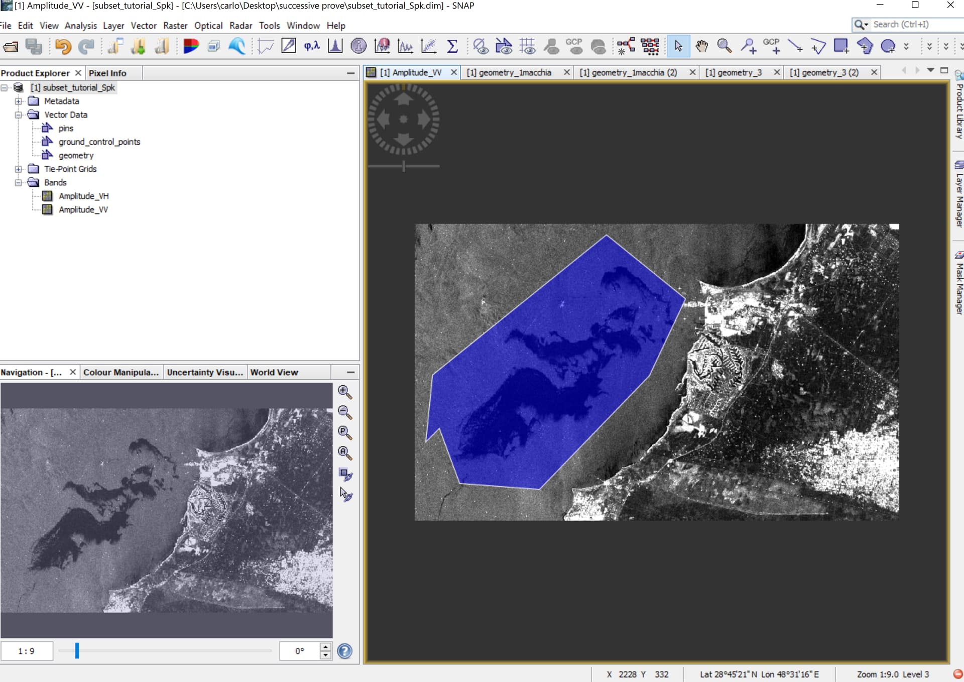
I tried that solution but I think I digitized in the wrong way a polygon around sea. I didn’t found a simple tutorial on the web. Is there an easy way to do it?
It should simply include the area where you want to detect the oil spill - either by a rectangle or a manually defined shape. So that you can tell SNAP where to search for - usually this is done by masking land using a DEM, but as this doesn’t help here, you can bypass this step by creating a polygon. .
Yeah I’m drawing a polygon around the interested area, but then it doesn’t appear in the “use vector as mask” section when I use the oil detection tool
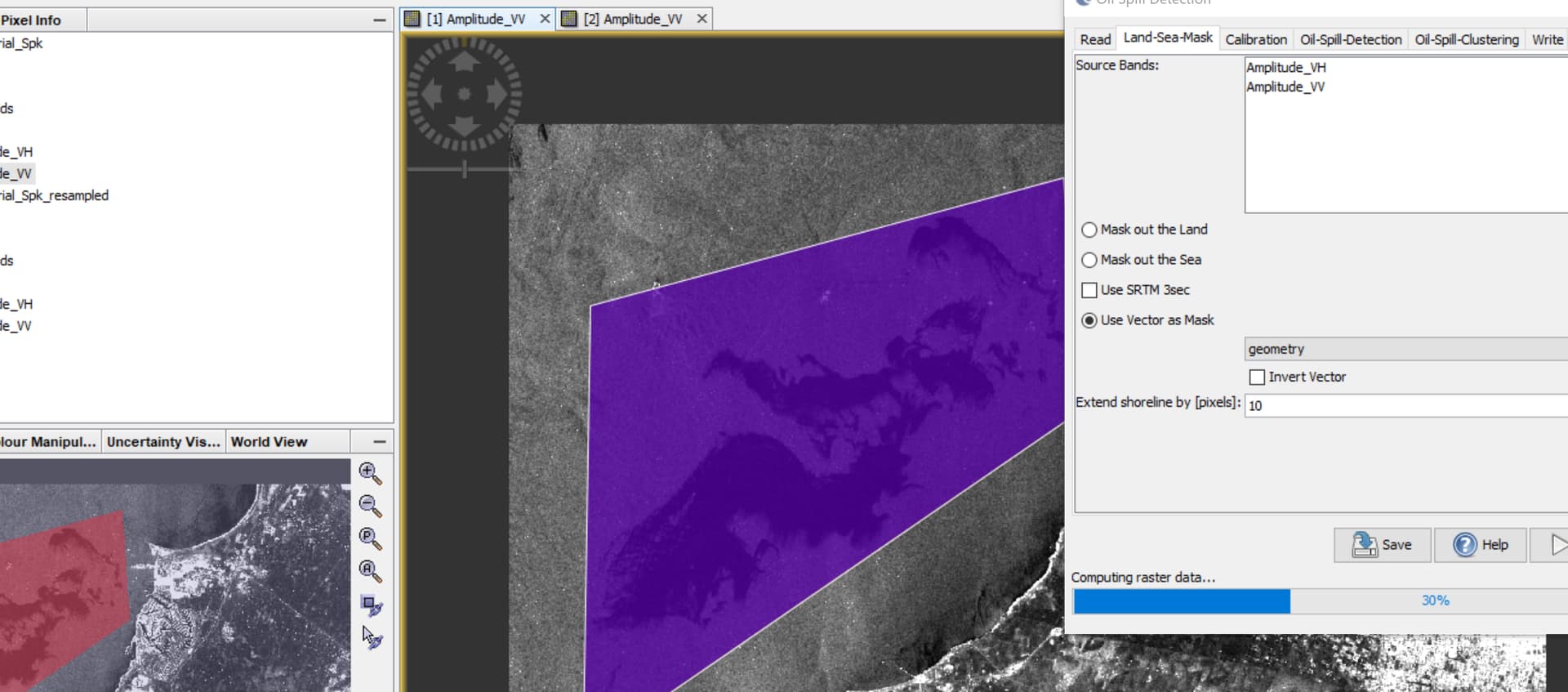
Please make sure you save the product with the new vector and then open the module again. It should appear in the Land/Sea mask operator.
After this, what should I do? Sorry for the stupid question, but dunno what to do more in order to make it a mask
edit: found a way to make it a mask (simply not used the polygon tool, just used the rectangle one), and now it appears in “vector as mask” section.
Now the problem is that it still goes slow like usually. 
No worries - there are no stupid questions. But in your first post, you said you had tried all suggestions from the topic, so we did not know which ones you had actually checked.
After manually masking the product without SRTM the tool should continue. Have you tried to run all of these steps independently and one after the other? (instead of the Oil Spill module which comines them)
Yep, it stops right here:
(Tried ofc just land sea-mask and calibration alone without oil spill and that works perfectly)
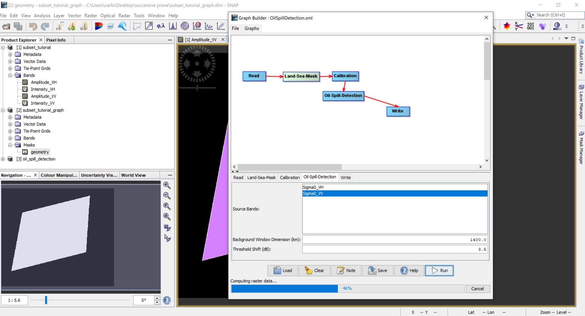
Any reason why you put 1400 kilometers in the background window? Seems a bit large to me…
I (as the guy before me in this topic) am following a tutorial, so that’s the parameter it suggests us to use (and the one it uses).
I haven’t quite understood how should I pick this number in other cases btw, any suggest?
Well, 1400 kilometers is obviously larger than an entire Sentinel-1 image (width 250 km). Don’t just follow recipes - especially when the outcome is different as you expected.
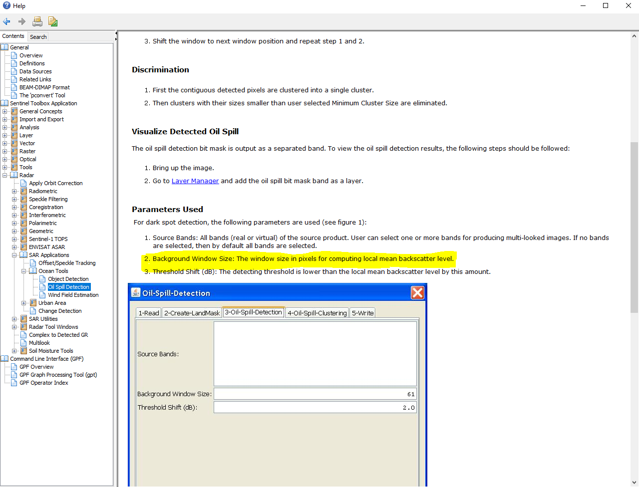
There is a description of the algorithm in the help.
To me, anything larger than the image itself (250 km) doesn’t make much sense.
I also used a subset of the image, so it’s probably even smaller than 250… That was a Rus tutorial, can’t believe it is THAT wrong…
I’ll try btw right now with 250. I’ll let you know thanks for now.
used 100… still blocked
Just tested it and it (technically) works fine. Please try once with 0.0 as background window instead.
Just tried. With 0.0 it runs as normal (few secs), but the oil_spill_bit_smk is empty.
Before this try, I let it run with 100.0 as background window (instead of 1400) while I was away from the pc, and in 5 hours it has done the 32%.
Ok, so the DEM is not the problem. Now you can increase it to 5 km
done it. It’s blocked also with 5 km
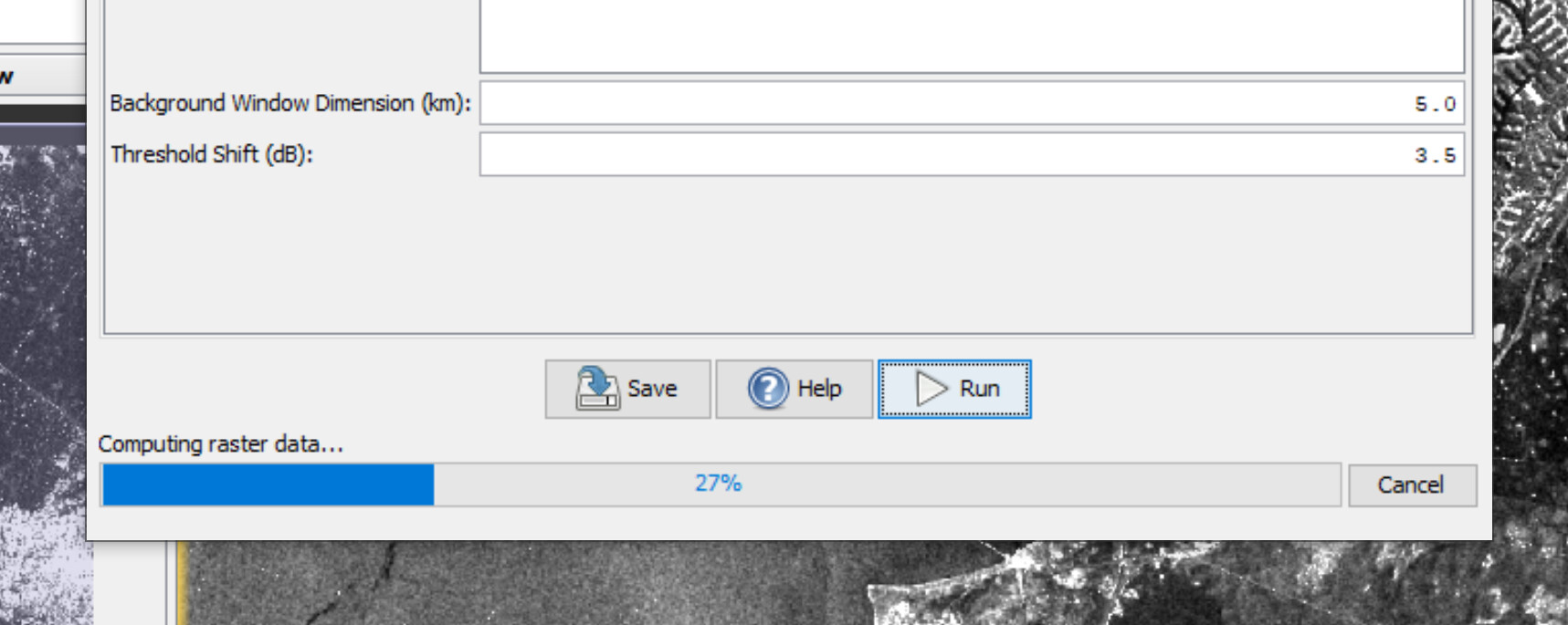
update: it gave a result 8 minutes later (still better than 16 hours), with 5km, but ofc the mask isn’t as good as the previous calculated (not at all, its quite completely “empty”). I’m afraid that if have to increase progressively the background windows, I will end up with lot of hours anyways…