Hi I have this issue for a while and been posted on another post and EarthData forum. but still not solved after trying like pixelGeoCoding options tick on/off.
This geolocation offset not consistently happen to all scenes, we notice sometimes the vector boundary aligns with the OLCI level 1 imagery very well, esp in summer months.
could this really caused by raw data, or further software processing issues like tie-point, projection, etc?
thanks,
Chui
----------------details ------------------
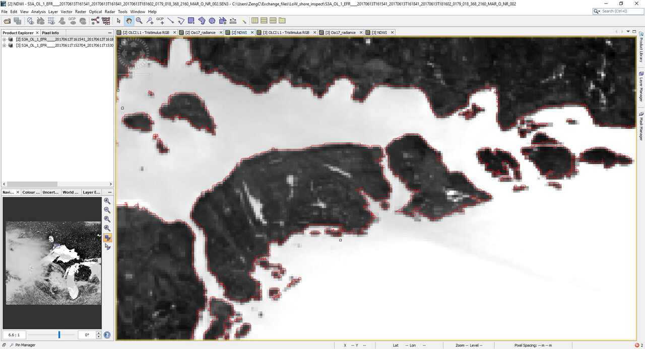
I work on Sentinel-3 OLCI level 1 images of the Great Lakes, and notice some raw images (in SNAP, load the xxxx.SEN3/xfdumanifest.xml) seems have geolocation offset when comparing with higher resolution images sensed a few days apart.
the following are two examples from my test at early June 2017. both show offset along the south shore of the peninsula/islands.
site 1 (Lake Ontario)
vector shapefile reference:
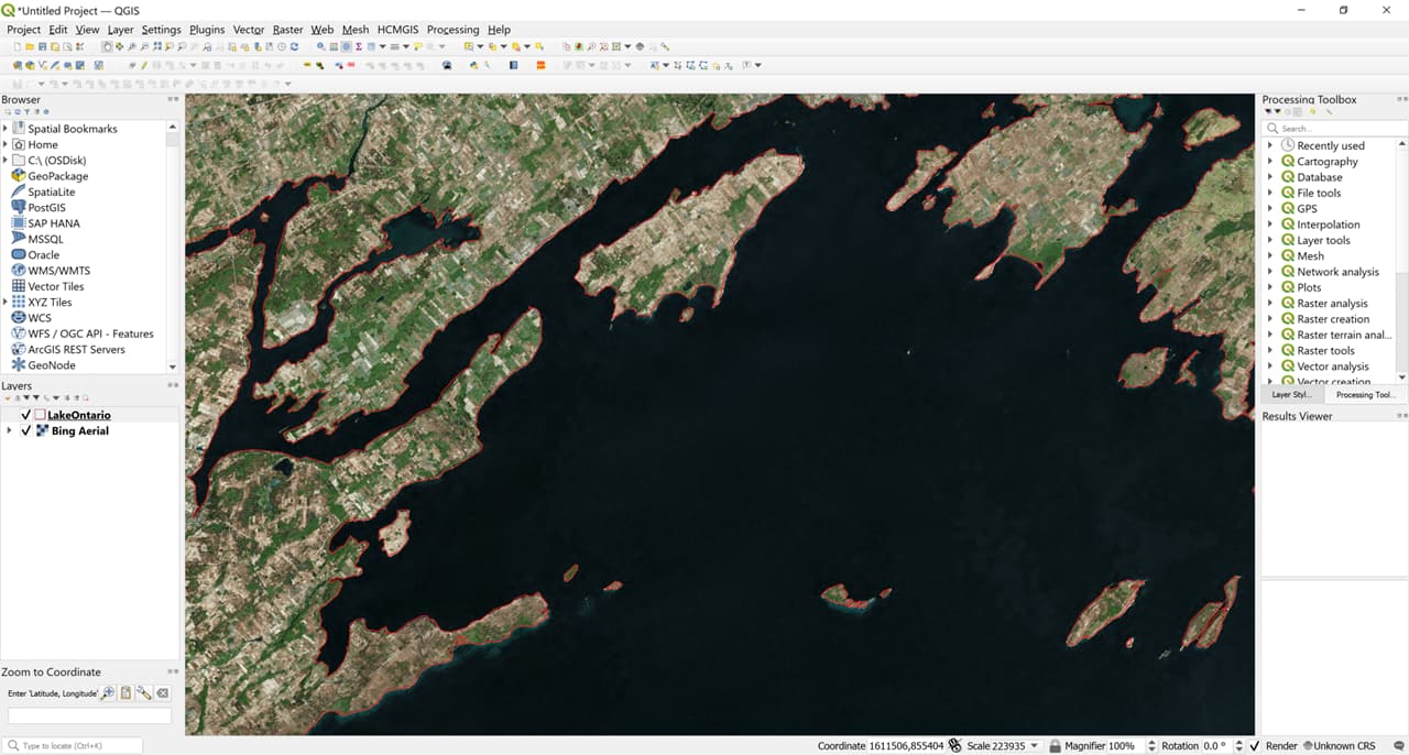
OLCI level 1 RGB composition (S3A_OL_1_EFR____20170611T152704_20170611T153004_20180502T143746_0179_018_339_2160_LR2_R_NT_002
):

NDWI [ (Oa08_radiance - Oa17_radiance)/ (Oa08_radiance + Oa17_radiance) ]:
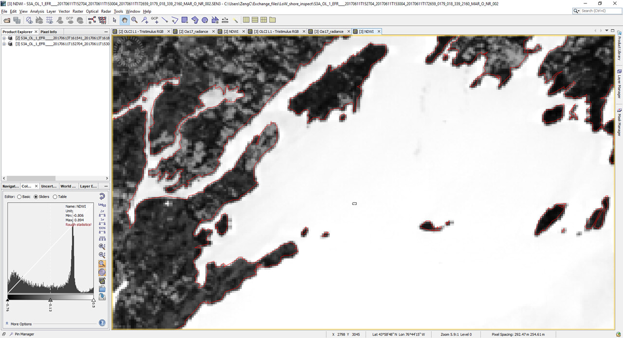
you can see in the NDWI map above, the south shore has 1-2 pixel offset comparing to the lake boundary shapefile.
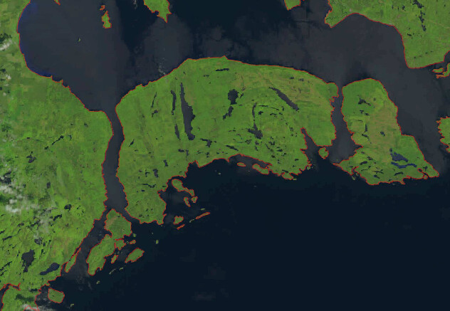
site 2 (Lake Superior)
Landsat-8 true color reference align well with the vector boundary file:
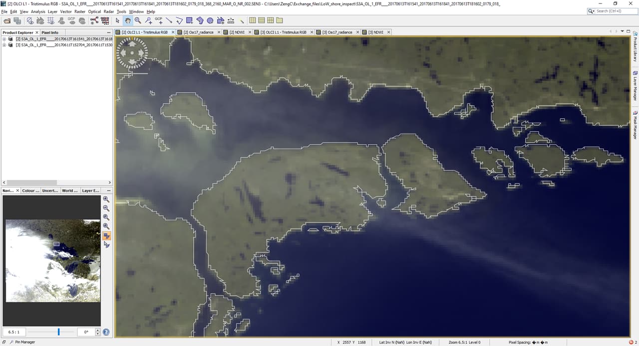
OLCI level 1:
OLCI NDWI :
all file above in my google drive.
here are the data products I used for the test:
OLCI products: (download from ESA:
S3A_OL_1_EFR____20170613T161541_20170613T161841_20180502T203026_0179_018_368_2160_LR2_R_NT_002
S3A_OL_1_EFR____20170611T152704_20170611T153004_20180502T143746_0179_018_339_2160_LR2_R_NT_002
Landsat-8 products: (download from Earthexplorer:
LC08_L1TP_025026_20170609_20200903_02_T1
LC08_L1TP_016029_20170610_20200903_02_T1