Dear all,
When we convert phase (fringes) to displacement by SNAP. We have positive and negative amounts. What is the meaning with positive and negative amounts?
Note: I know positive and negative amounts in fringes are going toward or away from the satellite but I do not know what is the meaning with positive and negative amounts in displacement map?
Cheers,
Marjan
3 Likes
it means movement of the ground along the line of sight between your first and second image.
Yes I know but I do not know what is difference between positive and negative signs? Satellite is descending in our case. I got displacement map but it is from -5cm to 27cm and I do not know what is the meaning with negative and positive signs? for example what is difference between -5cm and +5cm in displacement map?
This is amount of displacement from converting by SNAP (Phase to displacement).

0 means surfaces were equal in both images.
Negative means that this location is farer away in the second image, thus indicating subsidence.
Positive means that this location is now closer to the sensor, indicating uplift.
EDIT: This always depends on what is your master and slave images. The values always are relative to the master image.
3 Likes
Thanks. Do you mean there is not any difference between ascending and descending in displacement map?
I mean Negative means that this location is farer away in the second image and Positive means that this location is closer to the sensor in both (ascending and descending in displacement map)?
NOTE: I think this is true for ONLY ‘displacement map’ because as I saw in below link, there is different interpretation for ascending and descending in interferogram image.
Am I right?
http://vldb.gsi.go.jp/sokuchi/sar/qanda/qanda-e.html#q2-9
now I get your point.
It depends of the scale of the deformation and on the angle of the deformation towards the sensor. If it is just subsidence, it makes no difference. But for uplift, it does make a difference if it just an uplift or - as suggested in the given example - the uplift is additionally moving a surface closer to the sensor along the LOS.
Dear friend,
Yes but I mean in DISPLACEMENT MAP (NOT PHASES AND FRINGES), negative means away from satellite in LOS and positive means close to satellite in LOS. Is it OK?
I haven’t tried it but I guess so, yes.
Does it make a difference if you use ascending or descending data?
I do not have ascending data in this case. Actually I found that link that explain about positive and negative signs in ‘PHASE and INTERFEROGRAM IMAGE’ but I do not know meaning by negative and positive signs in ‘DISPLACEMENT MAP’ in SNAP.
with “displacement map” you mean the raster that is created by “Phase to displacement”? Or is this some special mode in SNAP which I didn’t know so far?
As it no longer refers to the phase values it can be assumed that these values are uplift (positive) and subsidence (negative). Or, in case of lateral movement: Away (negative) or towards (positive) the satellite:
Yes I mean “Phase to displacement”. OK thanks I got it now.

Dear friend,
I have one question about this part. You sent me this,
The sign of the displacement should be the inverse of what is currently done.
Decrease in phase should be positive
Increase in phase should be negative
But still I am not sure about meaning positive and negative signs in displacement map.
Maybe one of the developers can clarify this. According to the mlodule info @lveci has written it.
Yes. Thanks. I should ask him because for my topic this one is important.
maybe he’ll answer in here directly because he gets notified about this post (caused by the @)
Oooh…I did not know. That is good:slight_smile:.
Hi @falahfakhri
Please look at this conversation.
Thanks @falahfakhri…See you tomorrow
What is your idea about this topic @Suprd
Alright well I haven’t found any Earthquake related Interferometry on me now, which is a pity (maybe someone can upload his Earthquake Phase, Coherence and displacement results?).
Displacement is the function of phase as I mentioned earlier today, hence this statement is correct:
My question do you want to recalculate SAR-displacement into vertical component (z-Axis, normal vector to the geoid~gravitational model)? For that you will need the two stacks of SLCs to have the ascending and descending orbit. As they were doing in your post here and it really is quite demanding: [quote=“marjanmarbouti, post:5, topic:5826, full:true”]
Thanks. Do you mean there is not any difference between ascending and descending in displacement map?I mean Negative means that this location is farer away in the second image and Positive means that this location is closer to the sensor in both (ascending and descending in displacement map)?NOTE: I think this is true for ONLY ‘displacement map’ because as I saw in below link, there is different interpretation for ascending and descending in interferogram image.Am I right?InSAR Q&A
[/quote]
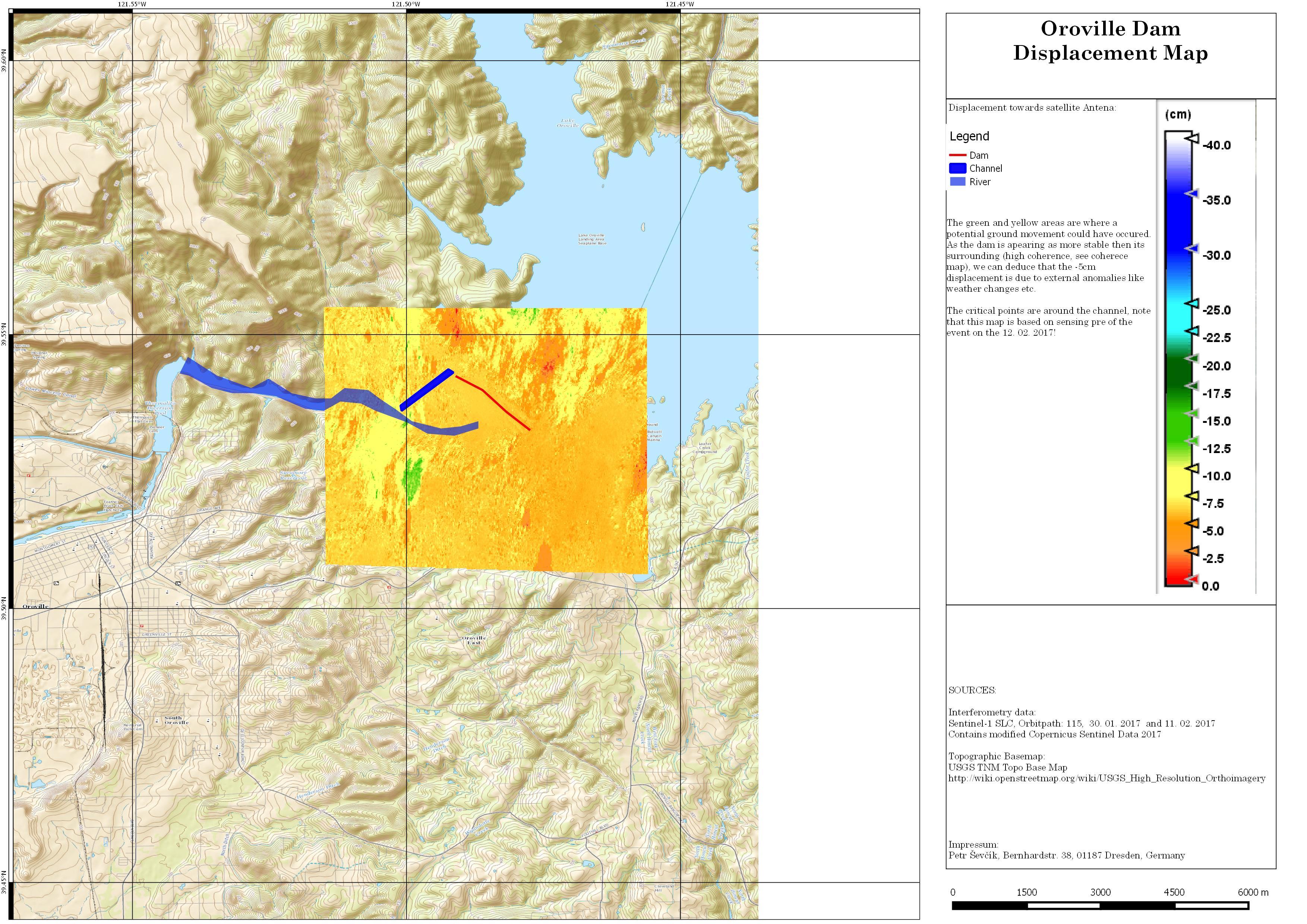
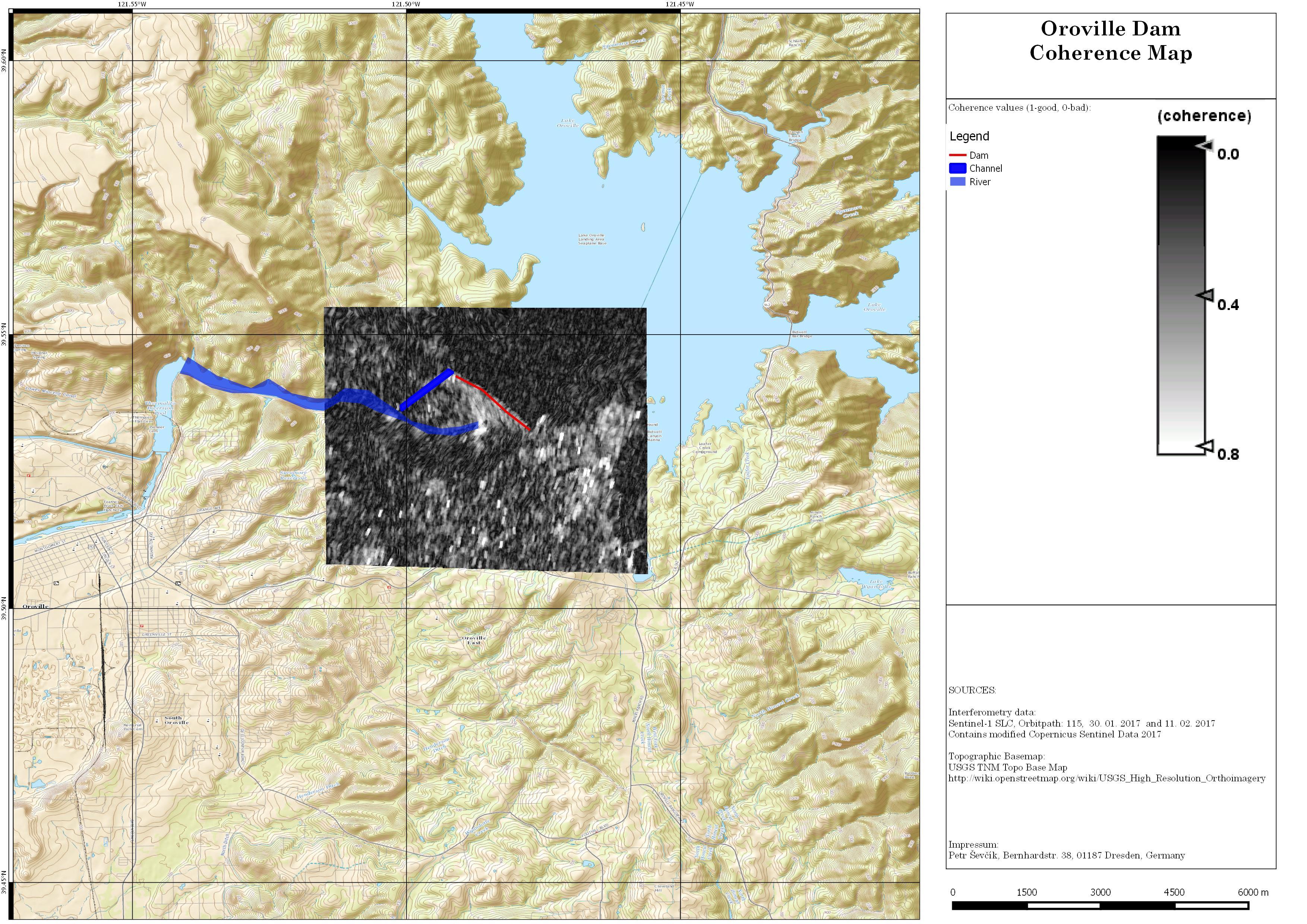
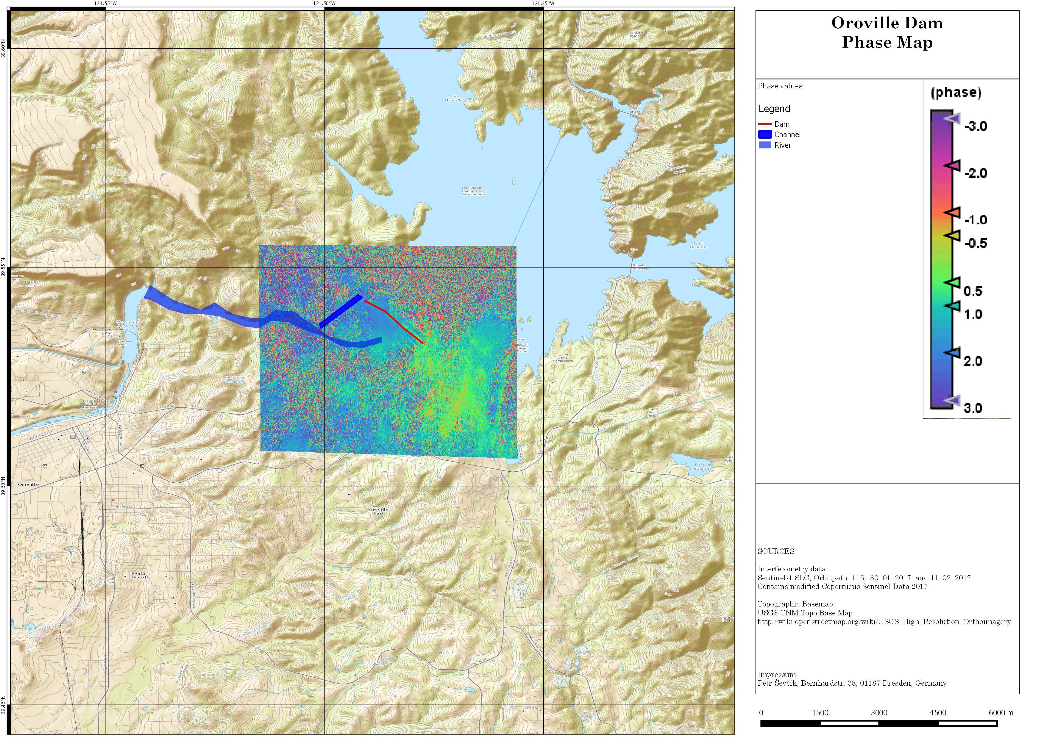
What I have done is a small prototype of the change of Oroville Water Plant. Extremely bad results due to poor coherence as it was only a stack between the two most recent acquisitions at the time. I was interested in the subsidence only, thus the negative movement to the antenna, therefore my scale only goes negative.
1 Like