Problem of Range Doppler Terrain Correction

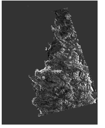
I am facing problem in sar mosaic.
After mosaic the output like that. Please tell me the exact processes of SAR Mosaic.

Hi, I am not sure if it is the right place to ask. However, i am wondering is there any reference that i can look for how the range-Doppler terrain correction works with DEM in SAR/sentinel-1? I haven’t found any scripts/codes/equations/documents yet regarding this.

1 Like

I think the Guide to ASAR geocoding explains it quite well.
Also Generation of geometrically and radiometrically terrain corrected SAR image products by Loew & Mauser (2007).

i have the same issue. my study area on a coastal region.after i made terrain correction for RADARSAT-1, i got blank image.

i used SRTM 1arc and 3arc, the results are same no change.

i made update for all new features and tools and install them-restart. the problem is still existed

Have you tried un-checking “remove areas without elevation”?

Hi! I have the same problem the image is black, but I am analyzing the coast. Could someone tell me which geometric correction is better for coasts and oceans?
image

to prevent the cropping of water, you have to select “Mask areas without elevation” in the Range Doppler Terrain Correction

grafik

Hi everyone.
I wanna implement Range-Doppler Terrain correction on Sentinel-1 data. but the region don’t have SRTM DEM for auto download
what should I do for correct TC?
Thanks in Advance

where is your study area located?

I use the Range Doppler Terrain Correction operator to get the result shown in the figure below. What is the reason?

this looks like a result from the offset tracking. Are you concerned about the red squares or the missing line? Please specify.

This is the result of the pixel offset calculation. Some lines are missing after using the TC operator.

Which DEM was used for Terrain Correction?
Have you disabled “mask areas without elevation”?
Which DEM Resampling did you select?

The following picture is my choice:


Occasionally there will be problems with missing lines/

what happens if you select Nearest Neighbor for DEM Resampling?

(1)When setting:
DEM Resampling method:Nearest Neighbor
Image Resampling method:Bilinear Interpolation
The result is the same, missing lines.
(2)But when setting:
DEM Resampling method:Nearest Neighbor
Image Resampling method:Nearest Neighbor
There are no missing lines in the results.


(So my problem is solved)

my field study located in Iran

you can try if ALOS World DEM delivers better results for terrain correction. It can be downloaded freely (after registration) here: https://www.eorc.jaxa.jp/ALOS/en/aw3d30/index.htm
You can use it as an external DEM (GeoTiff in WGS84)

ALOS provides DSM. Is it ok to use DSM instead of DEM?

shouldn’t make much difference…