Problem with loading screen for S-1 Back Geocoding

I’m not an expert for volcanoes, sorry. I recommend comparing your results to some of the published results for similar volcano types (strato, shield or dome volcano). It depends on what kind of displacement you expect with respect to the looking direction. A general uplift, a redistribution of materials, a tilting of the volcano? Each of them results in different fringe patterns.
It also makes a difference if there is a caldera or not.

Examples:
grafik
source

grafik
source

grafik
source


source

If you are only interested in the area within the blue circle, I recommend to clip the interferogram before unwrapping.
The smaller the proportion of noisy areas, the lower is the chance for false patterns induced by vegetated areas.

Can I clip the interferogram with subset tool before unwrappe it?
If I can do that, in what step do you suggest me? deburst, dinsar, multilooking…? or when I after to create the interferogram?

you can clip after debursting the interferogram.

Just make sure you select the subset in the export and also as reference in the import.

“Just make sure you select the subset in the export and also as reference in the import.” Sorry I didn’t understand good.

I just created clip file and it worked.

Thank you mister.

good job!
I just wanted to emphasize that you need the subset as reference product when you want to import the unwrapped phase again.

Ok.

I am going to make other proofs with other pairs and see if the initial problem doesn’t persist with other images.

Thank you for your guide.

Hi all,
Are there any updated on SNAP with Range Doppler Terrain Correction step?

I still stuck on this step.

Cheers,
Sing

related to this issue: SRTM ZIP-files are corrupted or not found

Please select SRTM 1Sec HGT (AutoDownload) instead, the error will be fixed with the next update.

Thanks very much,

Cheers,
Sing

Hi ABraun, any recommend for free source of SAR data for flood extent occur in 2008 and 2011
thanks

ERS or ENVISAT cover this period: https://esar-ds.eo.esa.int/oads/access/collection

Legend thanks !

Mr Abraun.

Could you teach me how to prepare SAR images for SBAS in SNAP?
Please.

Thank you.

please have a look at these two topics:

first here: StaMPS - Detailed instructions
then this: Please test the SBAS_snap2stamps (modification for SBAS)

Please note that StaMPS is not an ESA software and we cannot provide warranty nor support throughout the entire processing chain. The materials will help you to get through.

Dear ABraun,

I am getting the same image like yours after Back-geocoding.


How can I solve it, I used SRTM 1sec HGT DEM?
I am planning to do Interferometic coherence but I get noisy image like the following image

Is there any possible solution for this?

Greetings,
Karlmarx

Larger estimator window will reduce coherence-noise and bias. You could also slightly median-filter it before geocoding.

Dear Mengdahl,

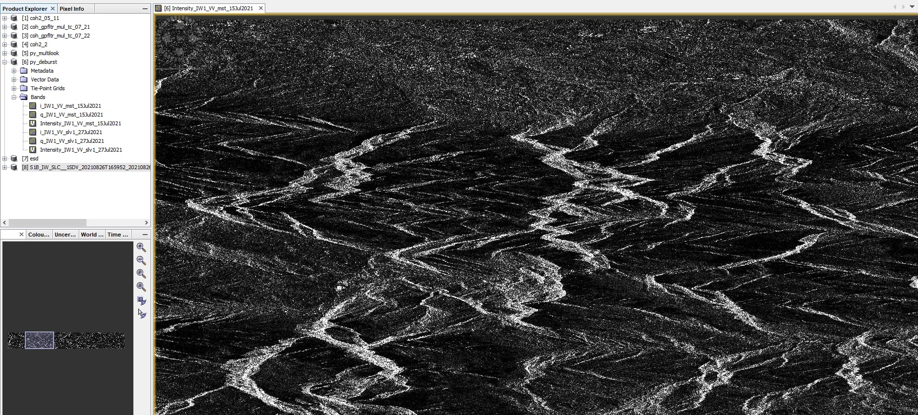
Now, I just noticed that my area of interest moved to another location. I have given the master and slave images of one region (North Germany)(blue arrow) but after back geocoding it moved to another location (Northern Italy)(red arrow)


. How is it possible? whether the automatic DEM downloaded wrongly while processing?

image

I use python 3.9.10.
master image: S1A_IW_SLC__1SDV_20210715T165853_20210715T165920_038791_0493BD_BCC7.SAFE
slave image:S1A_IW_SLC__1SDV_20210727T165854_20210727T165921_038966_0498FF_84F1.SAFE
I also downloaded the orbit files by pyrosar and saved in proper location.

Your first intensity image in your earlier post is clearly from a very mountaineous area so it must be the Italian Alps.

Dear Mengdahl,

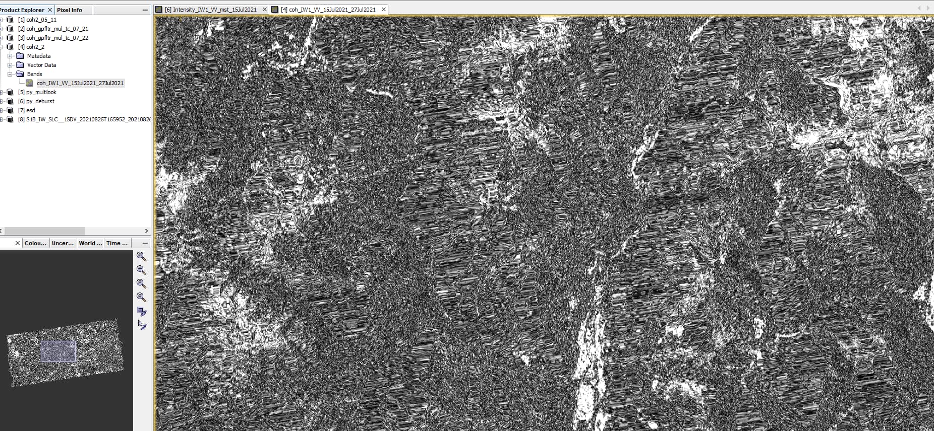
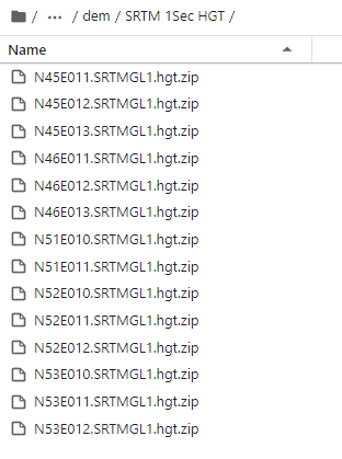
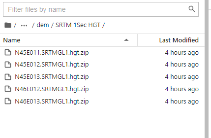
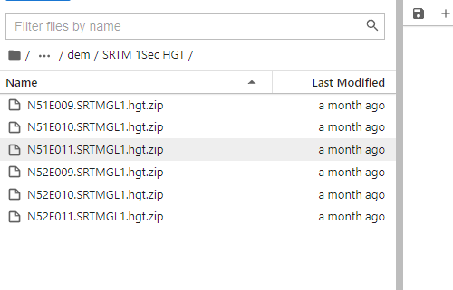
Yes, but both of my two input SLC images are from northern Germany and I don’t know how that intensity image went to Italian alps. When I was running the code, simultaneously in the folder ‘.snap/auxdata/dem/SRTM 1sec HGT’ I got, SRTM- N45E011, N45E012, N45E013 and N46E012, N46E013 .hgt files, which are not related to my input images
image
instead of getting the series of N52… .hgt files
image.
So I don’t know, why I am getting another region DEM instead of the right one. I believe that this should be reason for my wrong coherence image.

Greetings,
Karlmarx.

Hi, I solved this by choosing different swath and bursts of the master and slave images of SLC sentinel-1.

Greetings,
Karlmarx