I have downloaded one S-2 product of 17th august. SNAP can not display it properly while it is well visualized in the online platform sentinel-hub playground. What could be the reason?
1 Like
Hi Antonio
Can you be a bit more specific about your product, please? Is it S2A or B, and what is the Absolute Orbit and Tile number?
Thanks in advance
Jan
S2 MPC/CC Operations Manager
Hi!!
I hope I can be of some help, this is the GRANULE filename I found in its folder 
L1C_T34SDG_A011244_20170817T092934
Should be the correct one?
It is a data product from sentinel2A
and this is the screenshot from SNAP

It is obvious that the RGB mode, even without any atmospheric correction is really wierd.
I will look forward to your reply
Regards
Hi Antonio,
Yes, That’s the information I need.
My intial thoughts are that this is not an issue in data quality. What I think you are seeing is caused by the fact that the majority of the tile is homogeneous in nature (open water, without any changes in it). When this occurs, because of the slight variations between them, the individual detectors can be visualised.
I’ll download the Tile to check.
Cheers
Jan
Yes data quality should not have problems as for example the Sentinel Playground platform had not problem to display the product,so the problem may come fron the reader of the SNAP toolbox?? It is the first time this happens and I used similar scenes in the past
Yes.
It’s not really a problem. It looks worse than it is 
You can alter it by performing a stretch using the Colour Manipulation window.
I used to see the same thing when I was involved in QC’ing Landsat TM & ETM data.
If you make a Profile Plot in a single 10 meter Band (02, 03, 04 or 08) you should see very little variance in the Across Track direction from detector to detector.
Cheers
Jan
So as I used the Snap API with Python processing,with a proper contrast enhancement I should solve the problem,isnt’it??
Ha!
I’m not going to fall into that trap All I can say is that what you have seen is normal behaviour!
If you look at the Tile on the DHuS, you can see that thr Quicklook looks ‘normal’ compared to your SNAP representation:
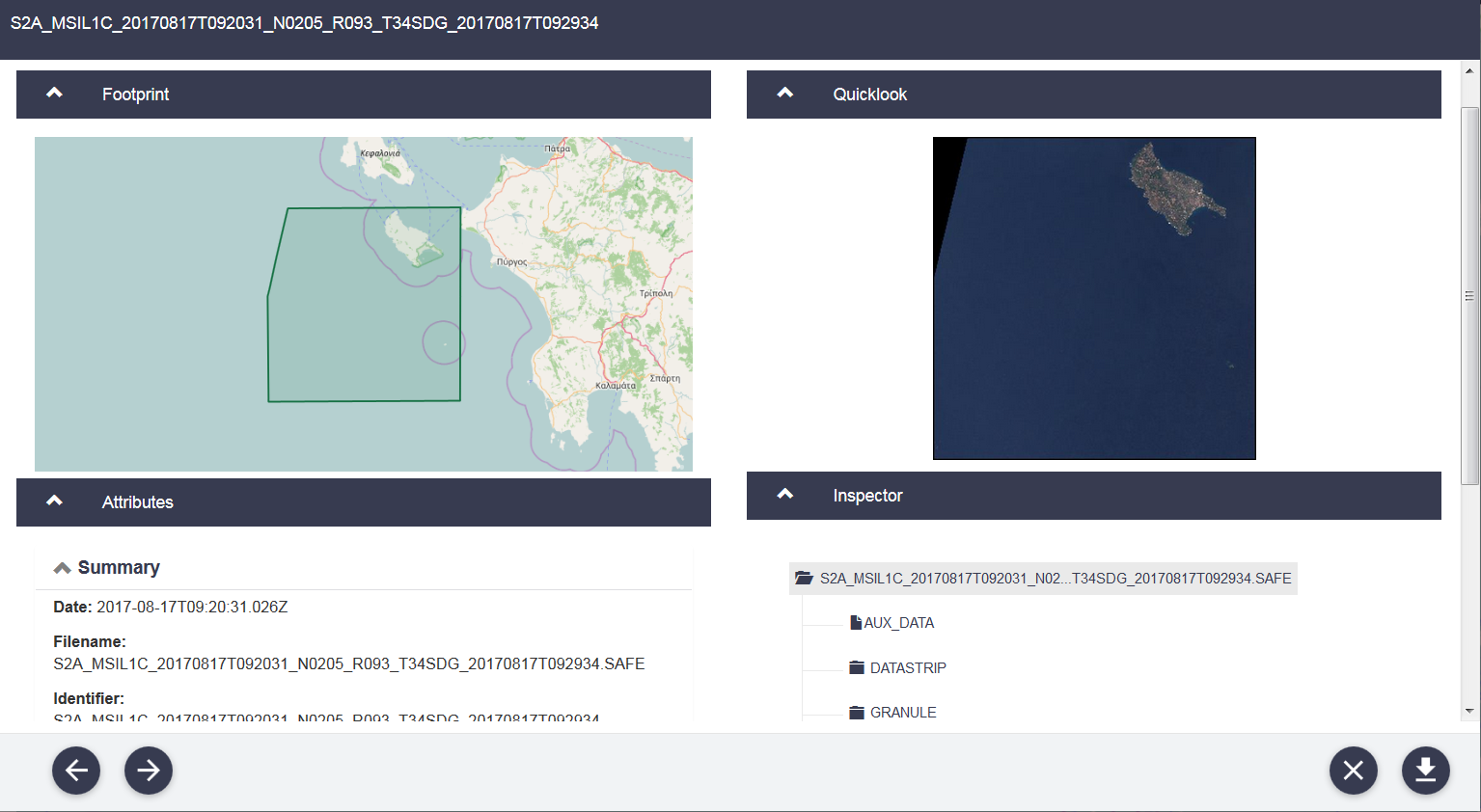
Also, the Product Attributes are all PASSED:
Format correctness: PASSED
General quality: PASSED
Generation time: 2017-08-17T09:29:34.000000Z
Geometric quality: PASSED
Ingestion Date: 2017-08-17T23:15:45.472Z
…
Mission datatake id: GS2A_20170817T092031_011244_N02.05
Orbit number (start): 11244
…
Radiometric quality: PASSED
…
Sensor quality: PASSED
Cheers
Jan
Yes i saw the correct viee even in the sentinel scihub before downloading,that’s why I was shocked!! i will try some test anyway I will keep you updated
Thanks again
1 Like
Hi Jan,
I actually got the trick, what I told you was correct but it was sufficient to subset the image, avoiding the large region with homogeneous values, and my disappointment went away.
I was assuming that the SNAP toolbox automatically implement some sort of contrast enhancement of the product data before displaying any band or composite image, but I was wrong. I played a bit with Python and here is the result of subsetting :
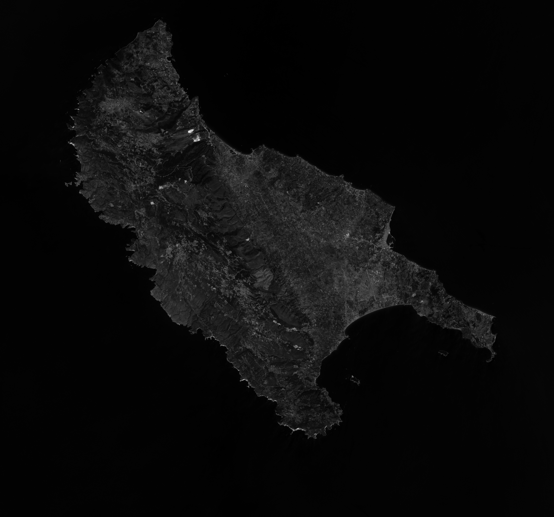
This is just Band 4 but that is enough as a check.
Anyway I discovered something interesting about S-2 handling in SNAP, it was an useful issue for me 
Really thanks for your support.
Regards,
Antonio
1 Like
Hi Jan, just to provide a complete reply here is the RGB version after a relevant tuning of the contrast in the 3 bands, the result seems to be good, doesn’t it?
At the end Python did what I expected

Really thanks for your checks and feedbacks
1 Like
Hello, I am an undergrad student who is using snap for one month now and I have a very similar problem with you. I was hoping that maybe you can guide me a bit on the solution that you followed, or if you know different one. The area of interest is near another island in greece:
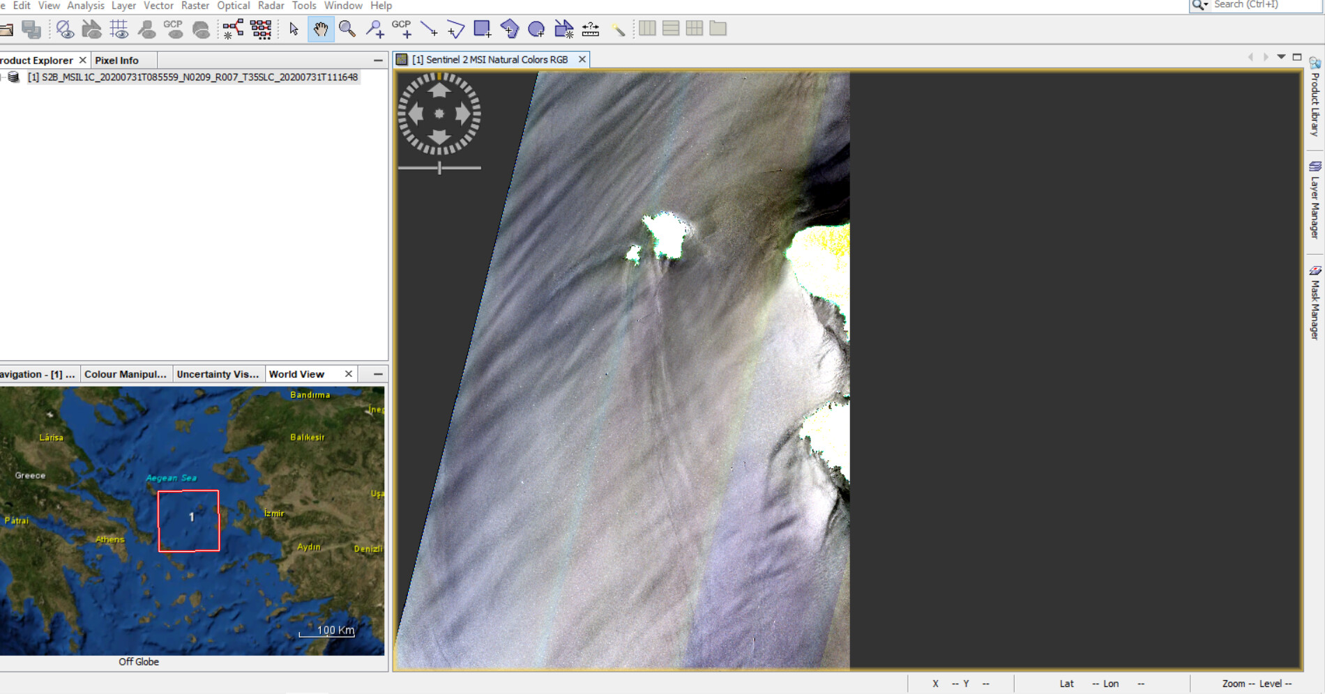
So, I’ve been trying to open many products from different dates of the same tile and the image looks okay on the quicklook, but when I try making a natural composite i face the same problem with oversaturated and very bright colours on the land, while the sea appears, strange?
The product file name on the picture is: S2B_MSIL1C_20200731T085559_N0209_R007_T35SLC_20200731T111648
Thank you
Hello @kvasilep
The reason that the land is saturated is because there is so much dark sea in your image. You can alter the saturation of the land by performing a stretch of the individual Bands using the Colour Manipulation window in SNAP.
Cheers
Jan
S2 MPC Operations Manager
2 Likes
The “strange appearance” of the sea is due to natural specular reflection of the Sun on the wavy/ruffled sea surface; what we call sunglint.
You can find info in this post Atmospheric correction above water surface
1 Like
Hello, and thank you very much for your answers. I spent some time with the sliders in the histograms in the Colour Manipulation for each band and the result was perfect!
Thanks for the help
1 Like