I have seen the old posts related to radar look direction,but I didnot found the solution on how to get radar look direction from sentinel-1 images.Did anyone found how to get the radar look direction angle from metadata of sentinel-1
Sentinel-1 is right-looking. Are you seeking more precise information than that?
Thank you for reply,
yes.It is looking right but I want the value of radar look direction.
Can you be more precise? If you need the incidence-angle it is in S-1 products and you can compute the local incidence angle with SNAP. If you need the vectors pointing from pixels towards the satellite at zero doppler, SNAP does not provide that information.
I need both incidence angle and radar antenna look direction .Incidence angle I got before doing ellipsoid correction because after ellipsoid correction i didnt found the incidence values in tiepoints.So I created incidence band before ellipsoid correction.I think it was correct.Please correct me if I am wrong in that process.
Next I need radar antenna look direction so that i can relate the movement of oil slick , wind like features.I think it is basically range direction I need.
Can we get range direction from sentinel-1??
It’s perpendicular to azimuth direction and the gradient in incidence angle across range.
You can do a quick calculation using the image footprint geometry.
ok. we can calculate Radar look direction from image geometry means using incidence angle.
Can you explain me this thing a bit precisely.
looking angle and incidence angle are two different things, but have the same size, the nomenclature can be confusing:
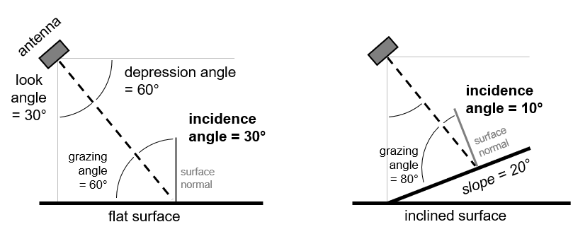
image source
4 Likes
Is there any way to manually calculate the radar look direction from image metadata?
for Sentinel-1, the mean incidence angle is stored here:
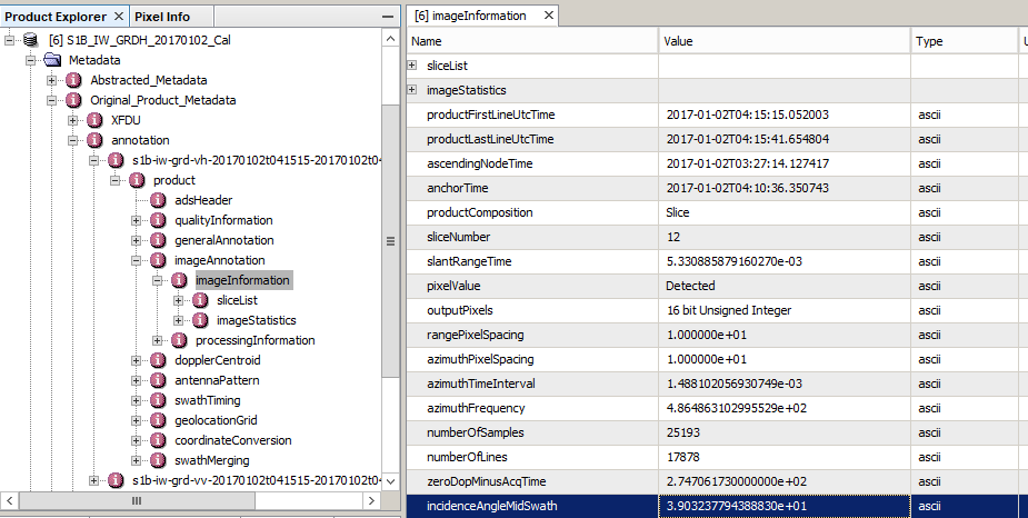
39.03237 ° in this case.
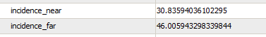
But due to the large footprint of the product, parts of the image have varying incidence angles
I guess Rani needs to know the azimuth direction to estimate local incidence angle (using a DEM). Azimuth (or range) direction is not in the metadata. I calculate azimuth from the analysis of the footprint by determining the nearest range side of the polygon. You need to know whether the orbit is DESC or ASCENDING to figure that out.
I see, sorry for the misunderstanding.
It is descending in my image metafile . I need incidence angle and radar look direction as two different parameters in my model.So as ABraun explained I created a band for incidence angle.But I need to give the radar antenna direction angle as one of the input in my model.I guess confusing was clarified.
So I want to get radar antenna look direction …
Azimuth and radar antenna look direction are perpendicular to each other.So even if I can calculate azimuth direction ,by adding 90 degrees I can estimate radar look direction…(I guess it is right )
Dear Andy,
I’d like to comeback to this an old point, I have a general question with this regard,
Does the Looking-side of the satellite Left Or Right with the same mode let’s say Ascending, design the goals of the study?, Or in other words,
A combination of of images ascending mode has left, and right satellite look, does this affect the processing chain of any goal? InSAR, PolSAR, Classifications.
If you ask me, the look direction changes everything.
Radar imaging is sensitive to the interaction of the microwave with a surface or target. A different look direction results in
- different incidence angle (both local and global)
- different orientation of objects towards the sensor (think of PolSAR images of San Francisco)
- different parts of an object hit by the sensor (think of building)
This leads to different proportions of surface, dihedral and volume scattering, different interferometric coherence, different backscatter intensity… Of course, this always depends on what is imaged and at which spatial resolution.
1 Like
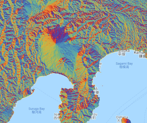
Try to check for possible radar distortions too. I usually check my study site using Google Earth Engine before I start processing. I look at the aspect and elevation to see possible sources of distortion from the terrain. Depending on where my study area is in the volcano (for example), I will pick the look direction that has a clear view of my site.
Image is aspect view of Mt. Fuji and surrounding area:
2 Likes
I’d like come back to this point once more. Is it possible to co-registered images of Ascending pass but have different look direction or Not?
Unless the satellite can switch the look-direction (left or right), all ascending passes have the same look direction.
1 Like
@falahfakhri are you referring to the per-pixel look direction angle?
One can, for each grid point, compute the angle to the the next point in range direction.
This can then be extrapolated to the full image grid:
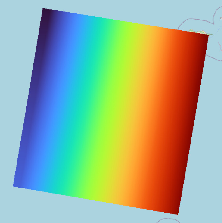
range is from -78° to -80° from North for this scene:
S1A_EW_GRDM_1SDV_20221215T071813_20221215T071913_046339_058CCF_601B
1 Like
The data in my situation is ICEYE, and I appreciate your help as always.