Good evening sir,
Is it possible to process the Sentinel images (Radiometric Calibration and geometric correction) before working on creating a stack for the interference process?
If those scabs need treatment, how can that be done?
Thank you in advance
Interferometry uses the phase information of the image which is lost after radiometric calibration. Therefore, this step is not applied for InSAR. Also, terrain correction should be done as last step (after interferometric analysis) to keep the original pixel values as long as possible.
Thank you so much, Sir
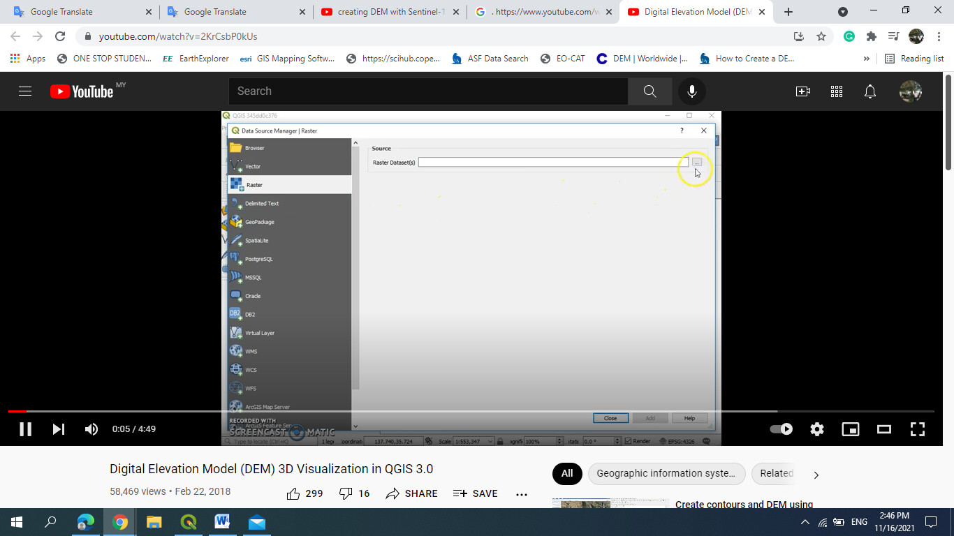
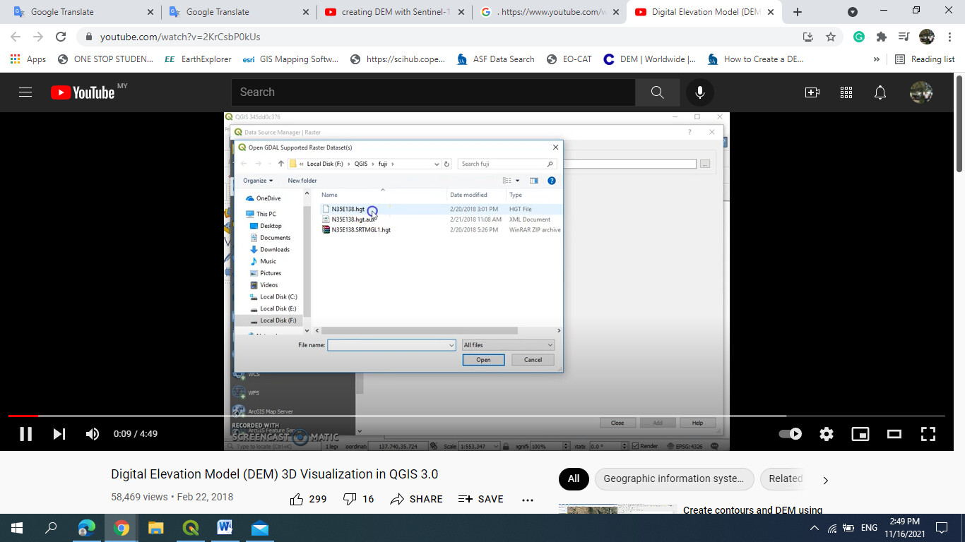
Apologies for the second question: How I can get the raster data for the DEM that I created or for the DEM SRMT? because I want to make a 3D in QGIS. this photo is for a tutorial on google.
Can you please specify what you mean?
Maybe this tutorial already helps you: Export of products from SNAP
Apologies Sir, I am so confused because I have to finish my project this Saturday, and this tutorial I have.
still just one thing
How I can make a contour line for the DEM that I created or the DEM for SRMT?
Thank you in advance 
First import your DEM or SRTM in QGIS, then you can
- create it with the Contour tool
- change the raster styling to contour

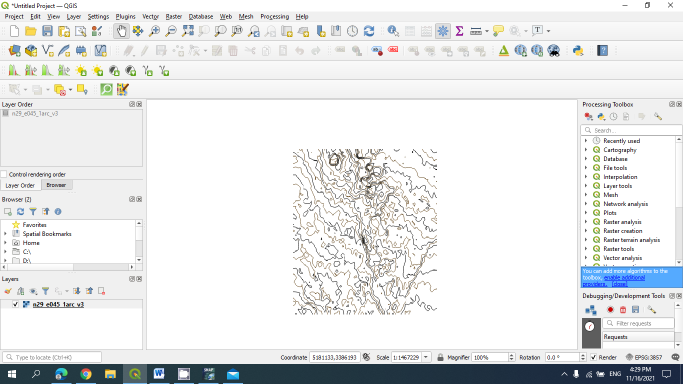
A tutorial can be found here: QGIS 3D View (Version 3.12.2) - YouTube
Please be aware that this forum is about SNAP in the first place 
Yes I know Sir
please forgive me because I don’t have anyone to ask I am alone in my class I don’t have any classmates.
Apologies again and thank you so much sir 
Interferometry uses the phase information of the image which is lost after radiometric calibration.
Apologies sir, you mean the radiometric calibration is done by ESA or what?
Please more explanation about this point.
Thank you in advance
No, but calibration is applied to the intensity while InSAR approaches make use of the phase.
Thank you so much for this explanation. 
Hi.
Yes, you have to pre-process Sentinel images before doing anything in Snap.
Apologies sir, May I know the steps or the requirements for pre-processing, please?
Thank you in advance.
These are strongly individual and depend on the aim of your analysis. Please provide information on what you want to do with the data.
Actually, I want to create DEM for a specific area to generate a topography map for this area.
Then you can follow this tutorial: DEM generation with Sentinel-1 - Workflow and challenges
Finding suitable images is crucial, so please watch out for both temporal and perpendicular baseline. Guidance is given here: Braun 2021 Retrieval of digital elevation models from Sentinel-1 radar data - open applications, techniques and limitations
Thank you so much, sir
Good afternoon sir, Please May I know the algorithm for the Interferometry? I want to present it in my proposal defense.
The second How to conduct pre-processing such as Shadow, foreshortening, Overlay, and coordinate system? Thank you in advance.
Please study the tutorials.
1 Like