Range-Doppler Terrain Correction raster size and coordinates inconsistency

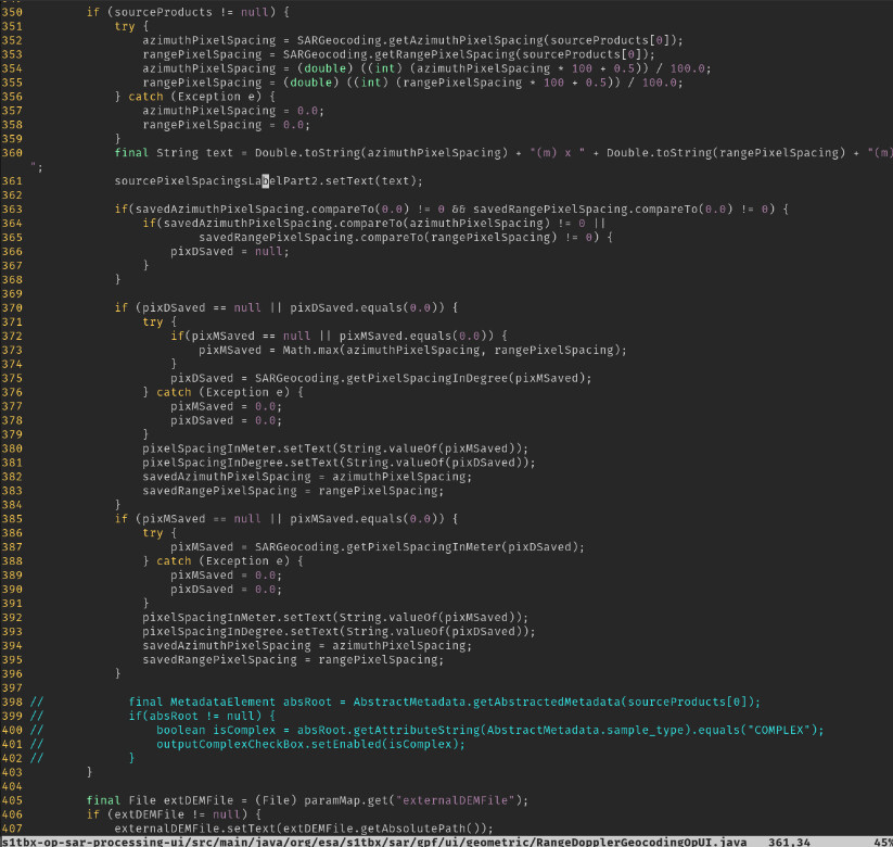
I was running coherence estimation routine and then created graph in order to automate this process. What was first a random discovery, now seems to be inconsistency. I did not manage to get the exact raster dimensions and geocoordinates out of the results produced manually in GUI and the one by GPT. I went through a lot of the posts to understand the pixel spacing settings. For GPT graphs it has to be 0.0 so the results are always mirroring the specific input. Then I tried to figure out where do the numbers come from in manual UI processing, since there are always precalculated pixels spacing in meters and degrees supplied in the view. What I found out that there are two entities that calculate this.

RangeDopplerGeocodingOpUI.java (triggered when operator parameters and configuration are opened in manual UI processing)

RangeDopplerGeocodingOp.java (triggered when there are 0.0 values supplied in the manual UI or GPT)

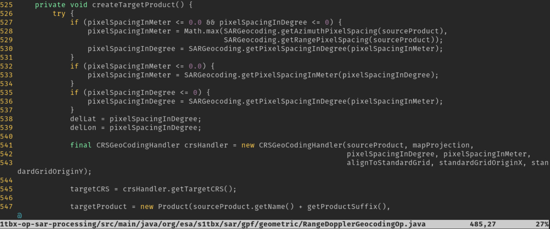
As can be seen on the screenshots there are different methods to calculate spacing for the terrain corrected output. Since these also influence geocoordinates I would like to understand, are they both correct (since couple of pixels difference is not that big deal) or one should be preferred over another?

1 Like

bumpidy bump anyone?

@jun_lu Could you take a look? The method to calculate the pixel spacing should be the same in both UI and the operator itself I think. Duplication of code should be avoided.

A JIRA ticket ([SITBX-921] - JIRA) has been created to track the problem. We will look into it. Thank you.

1 Like

Could you please provide more details regarding your test (such as processing steps, parameters, graph and product used) so that we can reproduce the problem? Thank you.

Thanks!

Here you go
Graph: https://alus-goods.s3.eu-central-1.amazonaws.com/validation/coherence_estimation_snap_graph.xml
Reference scene: https://alus-goods.s3.eu-central-1.amazonaws.com/validation/flood_in_belgium_germany/S1A_IW_SLC__1SDV_20210703T055050_20210703T055117_038609_048E45_35F7.zip
Secondary scene: https://alus-goods.s3.eu-central-1.amazonaws.com/validation/flood_in_belgium_germany/S1B_IW_SLC__1SDV_20210721T055001_20210721T055028_027888_0353E2_E1B5.zip

Processing parameters - use the default ones.

1 Like

Caculations of pixel spacing in meters/degree in both RangeDopplerGeocodingOp and RangeDopplerGeocodingOpUI have been harmonized. Now they should produce the identical result and there is no need to set it to 0. The fix should be available in the next release.

3 Likes