hi ,
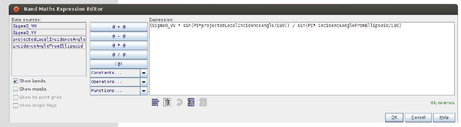
what is the purpose of slope normalisation? Is it optional or must? Some matierial say it is done with band maths as the image blew shows? Is it right or not? Thank you !
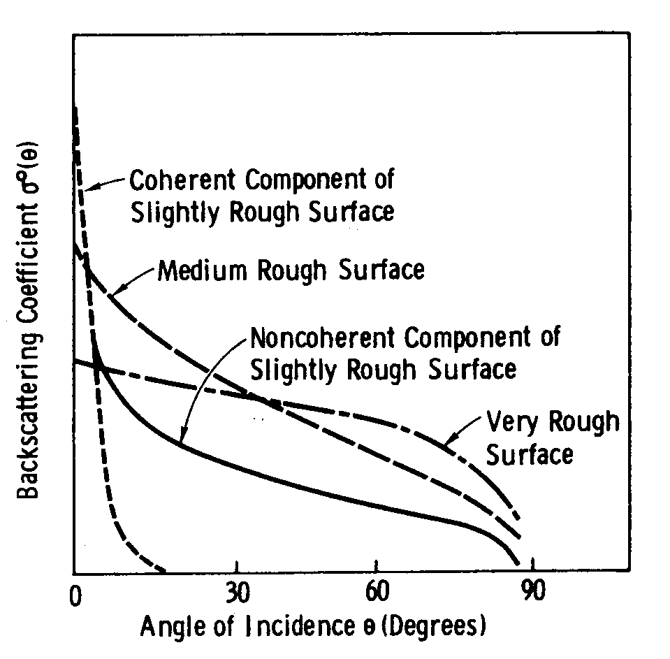
slope normalization is needed because the signal strongly varies according to the angle which it hits a surface:
You can also automatically do it in SNAP by calibrating to Beta Naught and then apply the Radiometric Terrain Correction. I made some comparisons here:
As a matter of fact slope normalisation is not trying to compensate for the possible non-isotropic scattering (depends on surface material), but for the size of the resolution cell (depends on incidence angle). Terrain flattening does this correction more accurately than slope-correction.
of course you are right. The roughness doesn’t matter for both angle normalization and Terrain Flattening. i used it to explain why incidence angle can have effect on SAR bascatter. This is, as you say, also a matter of pixel resolution which is not indicated by the figure.
thans a lot for your reply! I have another question. Can i subset the data by the area i am intrested in before i do every other prosessing steps ? So i can save a lot of time and storage sapce.But i am afraid that some unexcepted errors will occure if i do this. Do you understand my question? Thank you very much!
this should be no problem.
Thanks for your reply!So you mean i can subset the S1_IW_GRDH data that i am using now at first. Then i can apply orbit file->slice assembly->Remove GRD border nosie-> calibration->filter->terrian correction->mosaic? Am i right or not? And i have another question, can i do slice assembly and mosaic with batch processing? Thank you for your time, i really appreciate it!
I’d say yes. But I wonder why you want to mosaic if you make a subset first.
Because i want to estimate the water volume in lakes and reservoirs,and some of them located in different images.But the data volume is so big, so i have to think about subset them into smaller pieces and then mosaic. I’ve tried subset tool and Land/Sea Mask tool which was mentioned by lveci at this page How do creat subset image by vector polygon using S1-toolbox?. A rectangle area was used by the subset tool. And an ESRI shapefile was used by the Mask tool. The results showed that the subset tool can smaller my data volume,but the Land/Sea Mask tool was even more bigger ,like 6GB one slice! How could that happen? Can i subset my data with shapefile rather than rectangle area? I really need to smaller my dataset! Really thank you very much!
Are the ESRI shapefile and your data in the same coordinate system?
If you subset a WGS84 raster by UTM coordinates you usually get massive output data.
Yes,that’s the problem. I reprojected the shapefile,but still get an output with 3.19GB, it didn’t cut down my data volume at all. The result of Land/Sea Mask is attached below.
The result of subset tool is only 16.3M. But because of the rectangle area it doesn’t fit in some other situations, for example ,for long and narrow rivers. The output of subset is attached below too.
Thank you for your time! I can’t appreciate it more!
Is there any mistakes?
could be that the pixels outside the extracted area are zeroes. And therefore occupy nearly the same disk space. Is clipping outside snap an option?
Yes, they are all zeros. And I’ll try to find other options. You are really great and helpful! Thank so much!
Because i want to estimate the water volume in lakes and reservoirs,and some of them located in different images.But the data volume is so big, so i have to think about subset them into smaller pieces and then mosaic. I’ve tried subset tool and Land/Sea Mask
Hi Ellachang,
I am also interested in studying S1 SAR- based reservoir estimation for my master thesis. Could you share with me some experience in this field.
Now I am using S1 GRD data with pre-process steps: subseting -> calibration -> terrain correction -> speckle filter (Lee Sigma). Is it ok for the pres-process? And what method have you used to define threshold of image to classify image to water and non-water class?
I am quite new in this field, so I very appreciate any suggestion from you.
Thanks in advance.
It is better to speckle-filter before terrain correction.
Hi mengdahl,
Thank you for your response. Do you have any suggestion for method of speckle filter? I see many kind of method in speckle filtering toolbox but I do not have much understanding of their application. In case of water detection, do you know what method should be applied?
recommending a filter is nearly impossible because they strongly relate on pixel size, surface and the degree of speckle. Best solution is to systematically try and compare some filters, window sizes (and sometimes other parameters) on a small subset and successively finding the one that suits your conditions the best.
Regarding the water detection, these are quite helpful pages:
2 Likes
Hi, ABraun, if Calibration > Multilooking, the image is empty? I don’t know why,