Hi,
I understand your confusion but I think I can explain.
The round you observe is not really a rounding. The pixel closest to the entered location is looked up and set as pixel-location on the other tab. The the geo-location of this pixel is updated in the “Geo Coordinates” tab.
Regarding the cut at the edges.
If you have a look at the 4 corners of you subset you should still see the values you have entered. At least roughly.
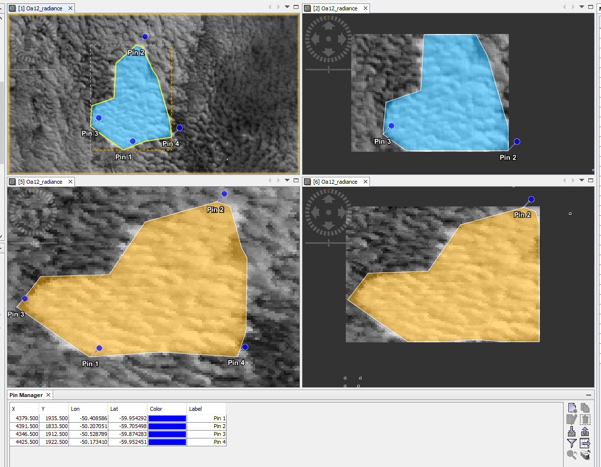
If you have a look the blue top left geometry and the yellow bottom left.
They are the same before and after reprojection (to WGS84).
You can see the Pin_4 is not anymore the most eastern point of my area. and the shape changed completely.
That’s one of the reason the edges are cut.
If you first reproject and then do a subset, the subset should be okay.
The cut off you can still see in the lower right image at the bottom of the area is probably caused by numerical accuracy issues.
It is good to add always a bit of a margin.