I have no Idea, sorry. But there is an extra section on python scripting: https://forum.step.esa.int/c/development/python
Maybe you find something using the search function with “jupyter”
I have no Idea, sorry. But there is an extra section on python scripting: https://forum.step.esa.int/c/development/python
Maybe you find something using the search function with “jupyter”
Thank you.
do you mean because the image is rotated?
Please read about the solution here: How can Sentinel-1 images be un-flipped?
As this is a very basic thing in radar imaging, I highly recommend starting with some basic operations first. There are lots of tutorials for beginners:
Achala, did you ever find a solution to this problem? I have exactly the same problem. After carefully following the standard steps to perform a radiometric calibration, the Sigma0_VV and Sigma0_VH bands appear a solid dark grey. The bands contain no data as the min and max values are both 0 under the ‘colour manipulation’ tab. Unsurprisingly, pressing the ‘auto-adjust to 95% of pixels’ button has no effect.
The product is: S1A_IW_GRDH_1SDV_20161123T112407_20161123T112436_014068_016B07_06CE.SAFE
I appreciate any advice you or others might have.
I just downloaded your data and calibrated it without any error.
It took some time until the image was loaded, but the color manipulation tab shows that there are values in the product.
Are you using the latest version of SNAP?
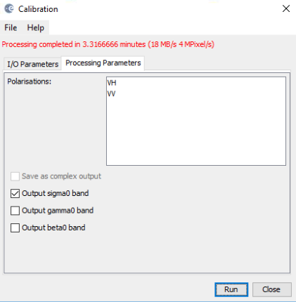
Was the calibration successfully completed (red message “processing completed in xx seconds”)? Did you try it again?
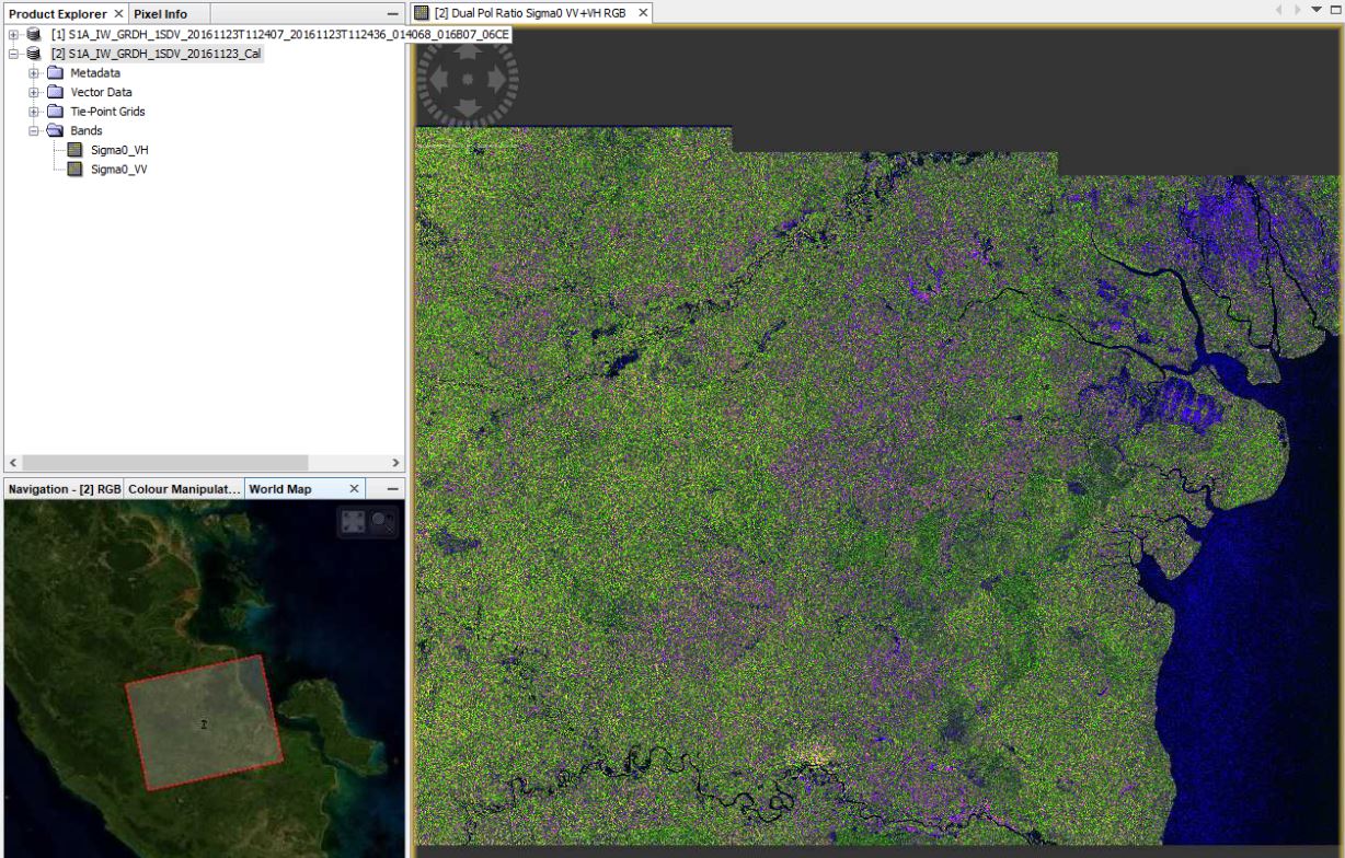
after calibration:
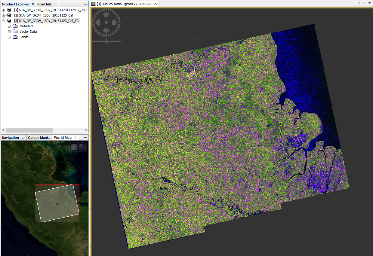
after trerain correction
Hi Andreas,
I really appreciate you looking into this for me, thank you!
I’m not sure why it is working for you and not for me. I downloaded SNAP 6.0 from ESA’s website just this week so the software is up-to-date.
I re-ran the calibration and it gives me a message saying processing completed in 31 seconds (which is a similar message to what it was saying on previous attempts).
I realise this is difficult to resolve when it is working at your end, but I am grateful for any other ideas or suggestions you might have.
Many thanks,
Sarah
a few thoughts:
The SNAP6.0 installer does not contain the updates, so you will need to update the toolbox yourself
Thanks for the heads up, Marcus.
Andreas, you’ve solved it! Previously I was opening up the extracted manifest.safe file, but at your suggestion I opened the zip file instead and the calibration performed perfectly. It’s unclear why it makes a difference, but it did in this case. Thank you, I am grateful!
that is strange indeed but maybe something went wrong with the unpacking.
I am happy that we found a solution.
Sir, I have done the decomposition of full polarimetric data therefore I got the multiband image but I have to do the fusion of SAR and optical data later on. So, can we perform decomposition to perform fusion later on because I have not found the research papers related to multiband- multiband fusion.
So, sir please suggest what preprocessing steps need to be performed for the application of fusion. As I have to perform the fusion of the images.
Please suggest Sir, as I am really confused in this.
there is no standard way for the fusion of optical and radar data, it can be achieved in multiple ways. Not all are supported by SNAP but it strongly depends on what you want to do with the fused information. Maybe you tell us a bit more about that.
Dear STEP forum
I just saw this nice Sentinel-1 image off the Azores from the ESA website
It says “This Sentinel-1A radar image was processed to depict water in blue and land in earthen colours.”
I am curious to understand how this would be done: Is it “simply” processing the image through SNAP (orbit file, calibration, multilooking etc) and then reading the processed image into e.g. Python, Matlab etc where specific colour palette (blue for water, earth colours for land) are applied to the image’s pixels?
I could see how to do that, but it does look way better than this.
Is there another way? is this an RGB with specific colour palettes ?
it is a memory problem - this error is discussed in detail here:
Is there a reason why you use SLC data instead of GRD, as you are basically creating a terrain corrected and calibrated band, you could as well use GRD and considerably reduce the processing amount.
Thank you for your advices.I will try GRD next.
Hello forum i was looking for the sentinel -1A data from 2014 through 2016 in Alaska satellite facility and also in Copernicus open access hub but I coudn’t find any do you know what the problem is ?
What parameters (product level, polarization, image mode) did you search for?