Hi,
I was looking at the footprint of a sentinel-1 product as I needed to filter the products to be downloaded. But I found that the footprint shown in copernicus shows a region larger than where data is present.
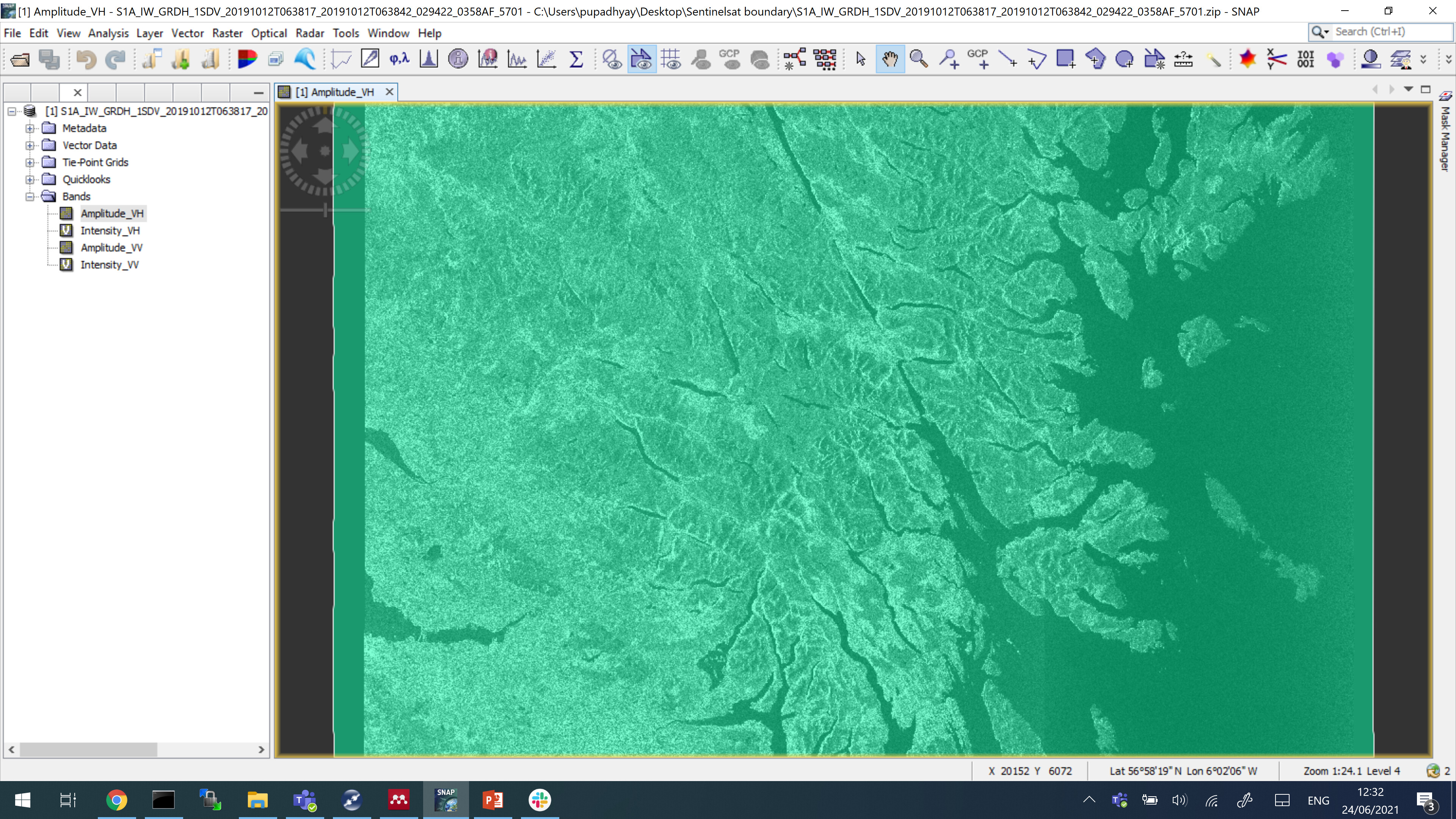
In the attached figure, it is seen that the vector geometry of the footprint (left side of the boundary) is actually larger than where data is present. It would be really helpful if anyone can suggest any way round this issue. Any help is greatly appreciated.
Hi,
Thank you very much for your reply. Do you mean ‘tile Id’ by ‘frame’? Sometimes a product has a tile id, but it does not cover the whole tile, so it might not overlap with a small region of interest in that particular tile.
For e.g. for a particular Sentinel-2 product,
The product S2A_MSIL2A_20210628T034541_N0300_R104_T52XDH_20210628T062225 has a tile id of 52XDH but it does not cover the whole tile. So, I might find that out after downloading the product. So, I filter the products based on footprint, before downloading using a python script
Please correct me if I am wrong in my understanding.
Hi,
Thank you for your reply. So, coming to the original problem, I guess there is no direct way to gather the exact footprint of Sentinel-1 product (as highlighted in the topic post the footprint was a little larger than where the data is actually present).