Hi everyone,
Do You have any idea why my final GeoTiff Pruduct isn’t GeoReferenced ?
I’m guessing that you did not terrain-correct the image?
Yep I thought my image was already terrain-corrected.
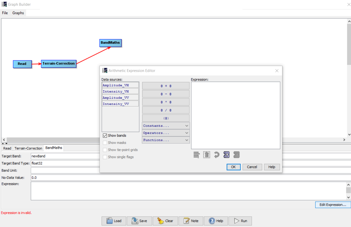
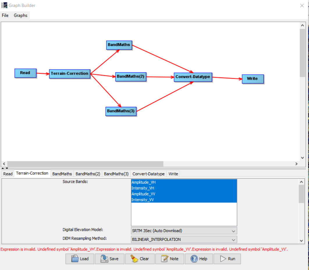
The only problem I have is that when I try to create a graph applying the terrain correction before the BandMaths, the input of the BandMaths cannot be the Terrain-corrected output…
Do I have to write the Terrain corrected product first and create another graph that will do the BandMaths ?
Thanks
ABraun
June 10, 2020, 1:18pm
5
the graph must be fully connected and the last step mus be a Write operator before you see all bands of previous steps.
That is what I did, but when I’m connecting the output of my 3 BandMaths to a DataConverter, it tells me that my the input of my bandmath don’t exist…
Do you have a clue ?
ABraun
June 10, 2020, 1:47pm
7
the band maths does not find the band names as proposed. Please open the expression editor to create the calculation based on the input bands.
Thank @ABraun ,
The weird thing is that before clicking on the Convert-Datatype button, I was able to see the inputs, that’s how I created the expressions…
ABraun
June 10, 2020, 1:51pm
9
maybe you have to actively select a source band in the Terrain Correction dialogue as well.
That is what I thought at first and they were unselected, but I selected them again and I still have the issue…
You mean like this right ?
ABraun
June 10, 2020, 1:53pm
11
I suggest to use either amplitude or intensity, but yes, like this. Sometimes, you have to switch tabs before the changes are applied.
I tried, I did my whole graph all over again and I still have the same issue…
ABraun
June 10, 2020, 1:57pm
13
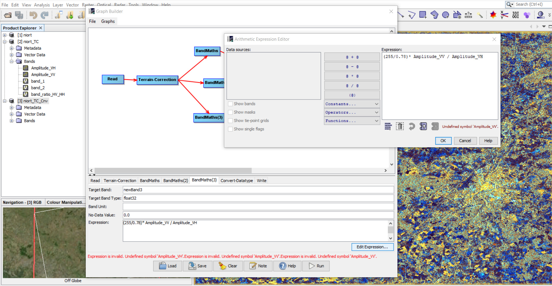
my suggestion is to re-create the graph, first with one Band Maths and once this works, you add the other two.
Unfortunately it doesn’t work… As soon as I add another band math, the graph crashes and tells me that my inputs don’t exist …
ABraun
June 10, 2020, 2:12pm
15
can you pleas upload the XML?
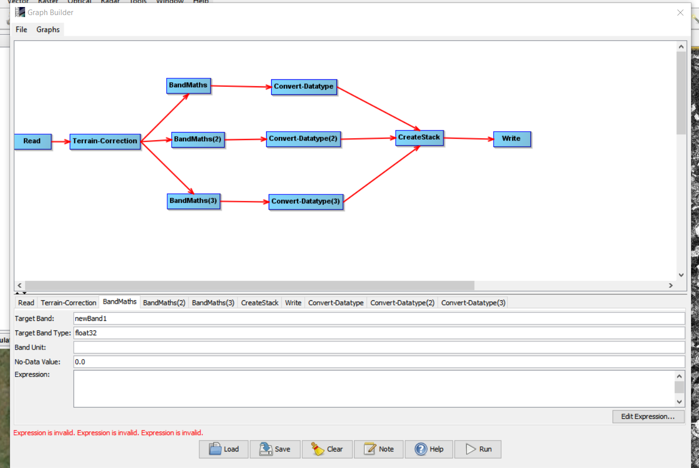
with all 3 bandmaths it is this onePol_RGB.xml (5.5 KB)
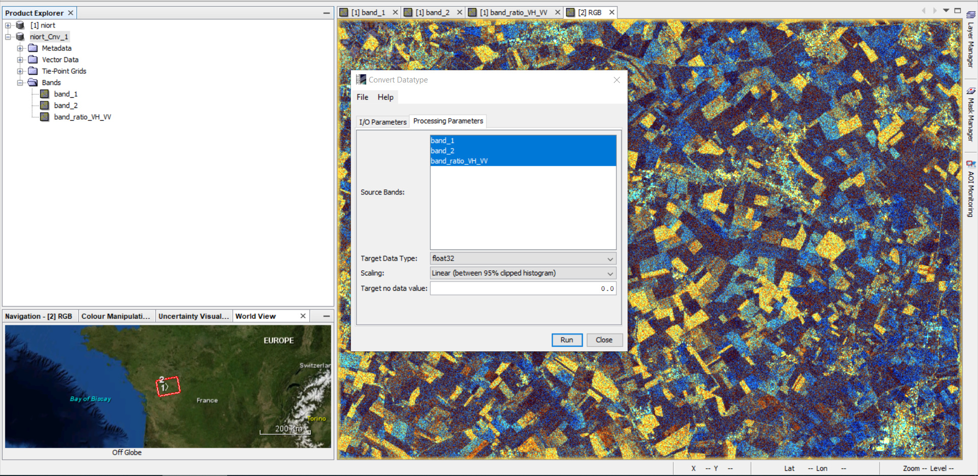
Ok so it ran for 10 min but unfortunately, the output in a Tiff format only contained 1 band and not the 3 expected…
ABraun
June 10, 2020, 2:55pm
18
I think you have to add Convert Band after each band maths and then use the Create Stack operator to merge them into one product before you write.
Thank you,
ABraun
June 10, 2020, 3:38pm
20
sorry, I thought you had overcome the expression error. My suggestion was simply addressing the one-band-output.
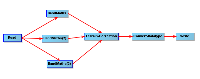
But, when I put the Terrain Correction at the end, as it is usually done for SAR data, the graph works
Here is my suggestion: Pol_RGB2.xml (5.6 KB)