I have a similar issue to the posts below but since the last update on this was in 2019 I wonder if I can ask again. Sorry in advance in case I have missed an update.
I’m aware the imagery belong to different orbits, and I can see the shift, the problem is identifying the reference tile meaning the one with little to no shift.
After these I will be using even more tiles from 2016 and 2020 so I would like to ask if the shift is always North-to-South? If not where can I find more information about the accuracy?
And if the imagery that seems to have the shift, in this case, are 2020 ones.
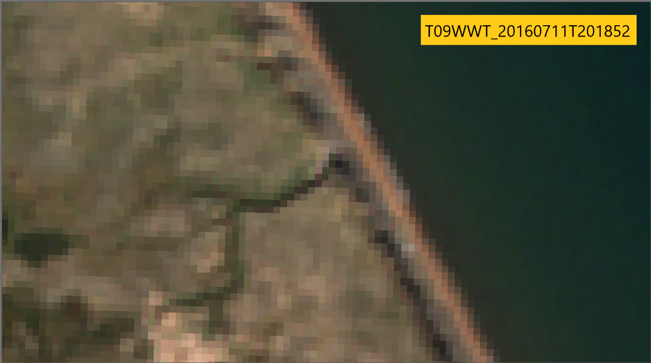
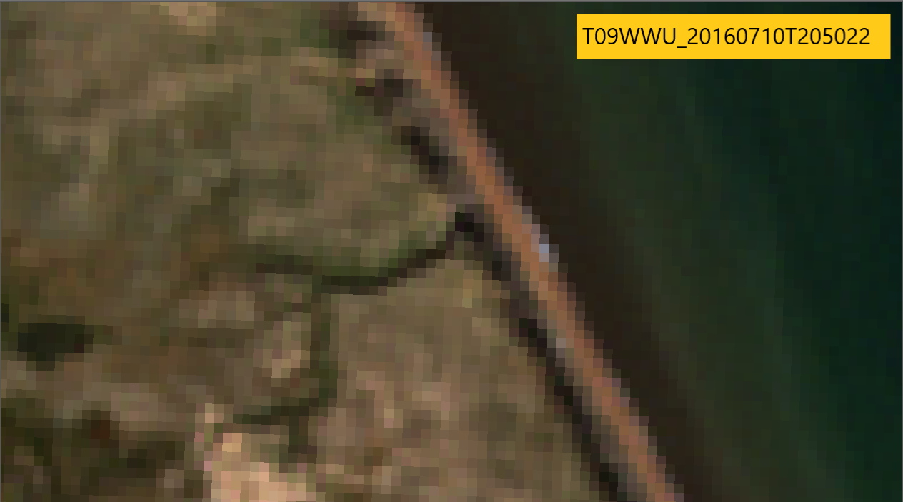
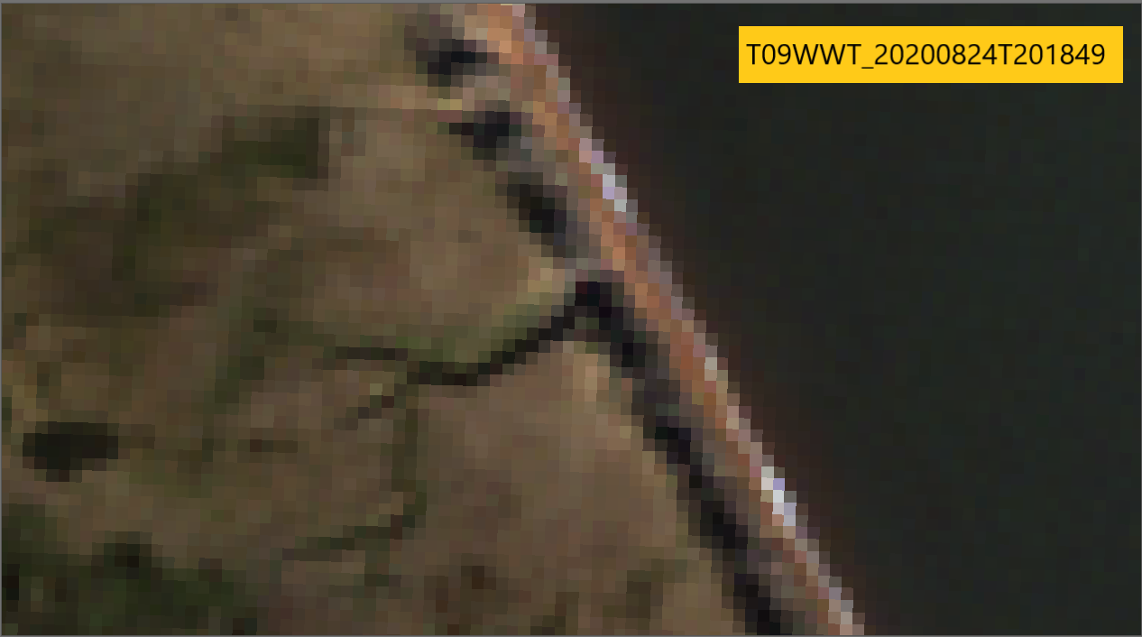
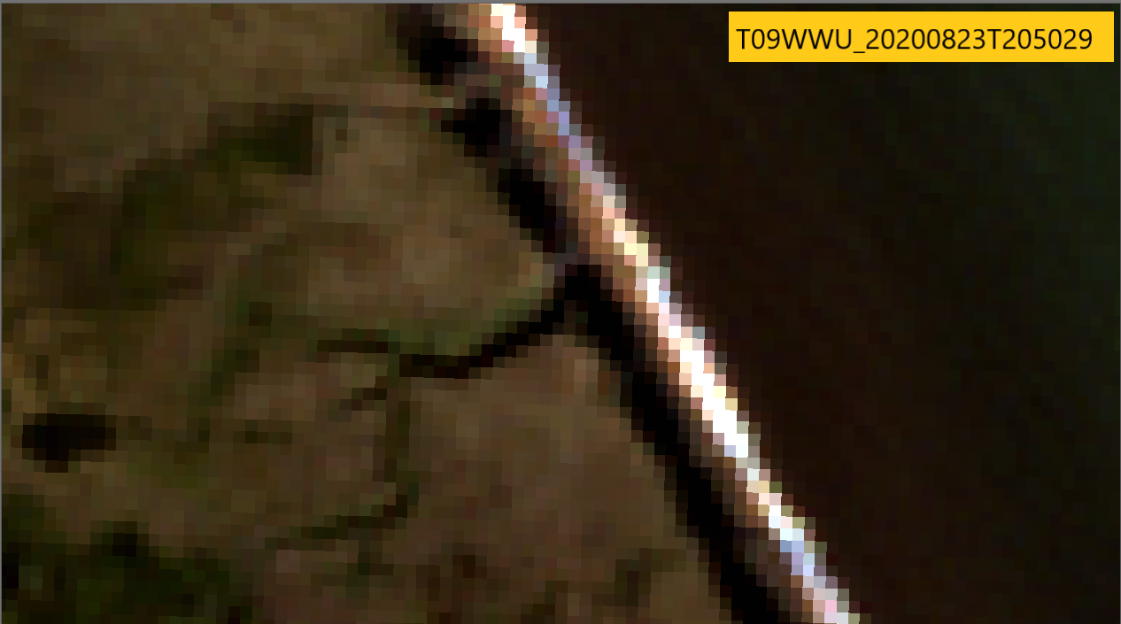
some examples of a sector where the 5 tiles overlap
(except T09WWT_20160806T204022 due to cloud cover).
Between the two examples from 2016 there seemed to be a 10m shift from west to east due to different orbits (R057 and R071) and same thing between the imagery from 2020. But by comparing the example from 2016 (R057) to 2020 (R071) it seems that actually there was no misalignment West-East wise. Maybe it’s related with the sensing angle? Sorry I am no expert.
And the imagery that seem to have the North-to-South shift are actually 2020 ones
Here was proposed a gdal batch code to correct a 10m shift North to South by @gbrelstaff Here was discussed that the shift seemed to be mostly in S2B and recent comments ask an update
@Jan said in one of the threads you have referenced that the Mission key performance specification is less than 20m. So, a shift at 10m can always be expected.
Maybe @Jan can update on this issue.
@marpet is correct in saying that the Operations Concept Document [OCD] demands an accuracy of image location at 2 sigma of 20m without GCPs. However, the operational geolocation of both S2A and S2B is routinely monitored and reported upon by expertise, and - as highlighted in Section 2.2.3 and Figure 1 (page 10) of the L1C Data Quality Report (https://sentinel.esa.int/documents/247904/4578605/Sentinel-2-L1C-Data-Quality-Report-January-2021.pdf) the long-term geolocation performance is close to 11 metres at 95% for both satellites.
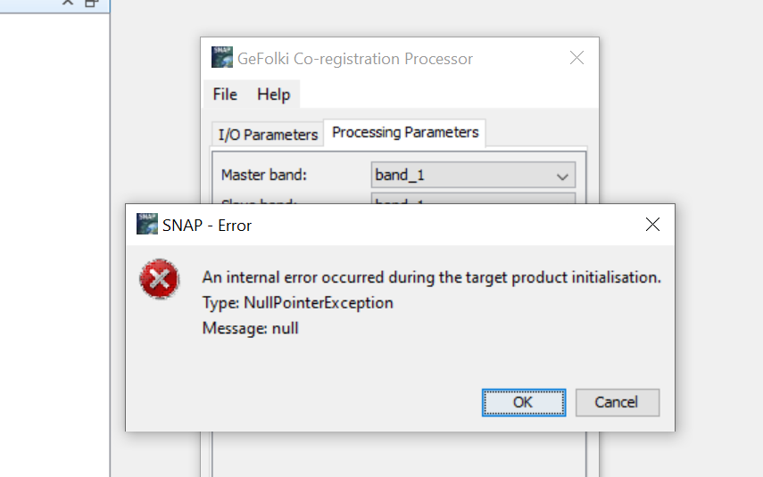
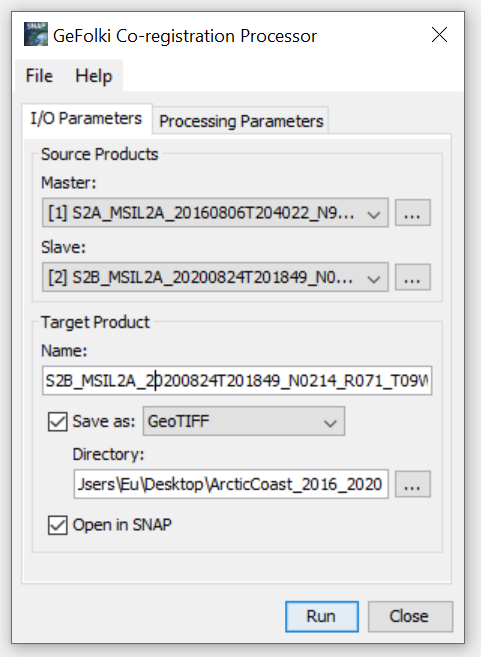
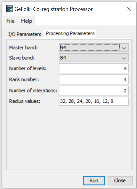
Hello @ABraun I am trying your suggestion. First issue is that one of the processed (Sen2cor) granules doesn’t load in SNAP, simply doesn’t open. And the second is that an error shows every time I try to run GeFolki. Is it common? I’m reading past posts regarding co-registration but can’t find a solution.
Sorry and thank you again.
File > Open Product > folder in question > tci band or other band
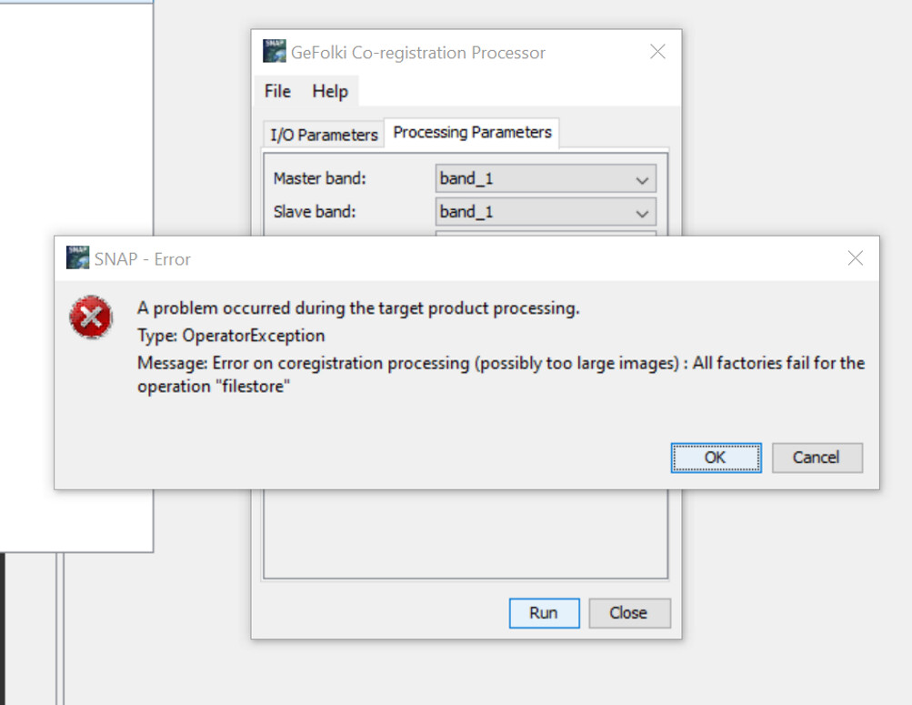
L2A product is 957mb already used it for other purposes and the algorithms didn’t report error so I think the folder is not damaged.
Please stick to the BEAM DIMAP format for the processing. I just tested two L2A products and it worked. Once the coregistration was successful you can still convert to GeoTiff.